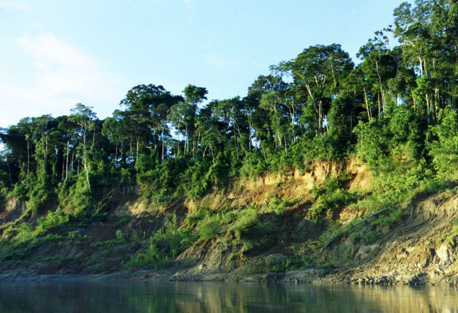
Manú River

Manú River
Manú

View of riverbank in Manu National Park
Basin countries Peru
Length 356 kilometres (221 mi)

The Manú is a river in southeastern Peru. It runs down the eastern slopes of the Andes Mountains into the Amazon Basin. It runs through the Manú National Park, a vast Biosphere Reserve, home to arguably the highest concentration of biodiversity on Earth. Few people live along its length. Much of the park is off-limits to all but permitted scientists and the indigenous groups of Amazonian Indians, mostly of the Machiguenga tribe. The Manú is a tributary to the Madre de Dios River.

Coordinates: 12°16′S 70°51′W / 12.267°S 70.85°W / -12.267; -70.85


Wikimedia Foundation. 2010.

Игры ⚽ Поможем решить контрольную работу

Look at other dictionaries:

  • Manu River, Tripura — The Manu River rises in the mountains of Tripura (India). After its initial rapid passage through mountainous terrain it slows and meanders during its course, which includes the Sylhet plains. It joins the Kushiyara River at Manumukh in the… …   Wikipedia

  • Manú National Park — Manu National Park IUCN Category II (National Park) View of a riverbank in Manu National Park …   Wikipedia

  • Manu Parrotlet — Conservation status Near Threatened (IUCN 3.1) Scientific classification King …   Wikipedia

  • Manú Province — Manu   Province   [[File: |250px|none|alt=|Location of Manu in the Madre de Dios Region]]Locatio …   Wikipedia

  • Manu — Contents 1 Geography 2 People 3 Religion 4 Other …   Wikipedia

  • Manu Dibango — in London in 2007 Background information Birth name Emmanuel N Djoké Dibango Born 12 December …   Wikipedia

  • Manu (Hinduism) — For other uses, see Manu (disambiguation). In various Hindu traditions, Manu is a title accorded to the progenitor of mankind, and also the very first brahman king to rule this earth, who saved mankind from the universal flood. He was absolutely… …   Wikipedia

  • Manu Learning Centre — Fundo Mascoitania Reserve Location Manu Province, Madre de Dios Region, Peru Nearest city Cusco Coor …   Wikipedia

  • River Churni — Diagram of River Churni s evolution River Churni is a river in the Nadia district, West Bengal …   Wikipedia

  • Marginea River (Ciban) — Coordinates: 45°35′55″N 23°29′40″E / 45.59861°N 23.49444°E / 45.59861; 23.49444 …   Wikipedia

Share the article and excerpts

Direct link
Do a right-click on the link above
and select “Copy Link”