- New Longton
-
Coordinates: 53°43′37″N 2°44′47″W / 53.726932°N 2.7464479°W
New Longton 
Harrison's Farm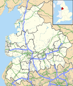
 New Longton
New Longton shown within LancashirePopulation 2,228 OS grid reference SD5084825873 District South Ribble Shire county Lancashire Region North West Country England Sovereign state United Kingdom Post town PRESTON Postcode district PR4 Dialling code 01772 Police Lancashire Fire Lancashire Ambulance North West EU Parliament North West England UK Parliament South Ribble List of places: UK • England • Lancashire New Longton is a village located to the south west of Preston, in the district of South Ribble, in the county of Lancashire, North West of England.[1] It is in the parish of Longton, which is the name of the older village located 2 miles (3.2 km) to the west of New Longton.
Contents
History
The development of New Longton was prompted by the building of the West Lancashire Railway between Preston and Southport in Victorian times. A station called "Hutton and Howick", later renamed "New Longton and Hutton" was built at the junction of what is now Station Road and Chapel Lane, where there was a level crossing.
Since the 1940s housing estate development has taken place south of Hugh Barn Lane and Wham Lane. Other small estates, including the council estate in Dickson Hey, were built on both sides of Station Road. The village lost its railway service in the 1960s, but remains a commuter village with a regular bus service into Longton and Preston. Longer distance commuting to Manchester, Merseyside and Lancaster is afforded by the proximity of the M6, M61 and M65 motorways.
Community
In 2004, New Longton was a runner up in Lancashire's Best Kept Village competition.[2]
New Longton has two churches - All Saints' Church of England and New Longton Methodist church. Regular services are held on Sundays and on a few evenings each week.
It also has a school - New Longton All Saints' C of E Primary School. There are several village shops, a local Sports and Social Club, a village hall and a children's playground. The old post office building has recently been converted into a men's hairdressers 'The Men's Lounge' and a cafe/shop 'Stickyweeds'.
Sports teams
There are two main sports teams, football and cricket. In New Longton JFC (junior football club) the age groups starts at under 6 and up to under 16s. There are also three senior teams from 1st's to 3rd team. The cricket has under 11's, 13's, 15s under 17s in the 'junior' category. There are also 1st, 2nd and 3rd teams in the cricket. As well as these two sports, there is a bowling green for bowls and various indoor sports inside New Longton village hall.
People
The actor and television presenter Peter Purves, known for his time on Blue Peter, was born in New Longton.[citation needed]
References
External links
 Media related to New Longton at Wikimedia CommonsCategories:
- Geography of South Ribble
- Villages in Lancashire


Wikimedia Foundation. 2010.