- Cowlam
-
Coordinates: 54°04′35″N 0°31′36″W / 54.076395°N 0.526616°W
Cowlam
 Cowlam shown within the East Riding of Yorkshire
OS grid reference SE965655 Parish Cottam Unitary authority East Riding of Yorkshire Ceremonial county East Riding of Yorkshire Region Yorkshire and the Humber Country England Sovereign state United Kingdom Post town DRIFFIELD Postcode district YO25 Dialling code 01377 Police Humberside Fire Humberside Ambulance Yorkshire EU Parliament Yorkshire and the Humber UK Parliament East Yorkshire List of places: UK • England • Yorkshire Cowlam is a hamlet in the East Riding of Yorkshire, England. It is situated on the Yorkshire Wolds approximately 2 miles (3.2 km) east of the village of Sledmere. It lies south of the B1253 road.
It forms part of the civil parish of Cottam.
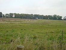
Cowlam was previously a medieval village that was deserted after the Black Death. The church of St Mary, Cowlam is one of the churches on the Sykes Churches Trail. It is a small medieval church restored in 1852 to a design by Mary E Sykes, daughter of the 4th Baronet.
References
- Gazetteer — A–Z of Towns Villages and Hamlets. East Riding of Yorkshire Council. 2006. p. 4.
External links
Categories:- Villages in the East Riding of Yorkshire
- Deserted medieval villages in England
- History of the East Riding of Yorkshire
- East Riding of Yorkshire geography stubs
Wikimedia Foundation. 2010.


