- Elkhart Municipal Airport
Infobox Airport
name = Elkhart Municipal Airport

image-width = 250
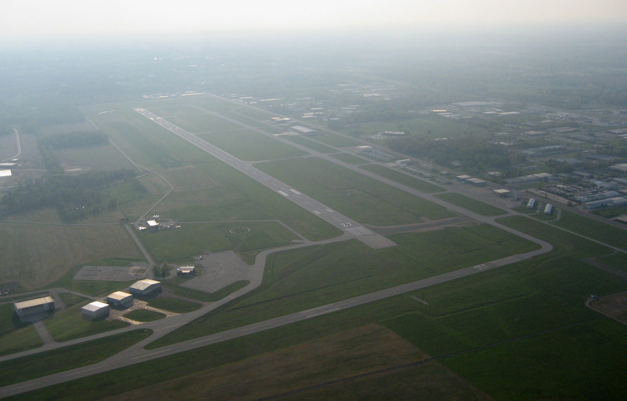
caption = Aerial view of Elkhart Municipal Airport, facing Northwest
IATA = EKI
ICAO = KEKM
FAA = EKM
type = Public
owner = City of Elkhart
operator =
city-served =
location =Elkhart, Indiana
elevation-f = 778
elevation-m = 237
coordinates = coord|41|43|10|N|086|00|12|W|type:airport|display=inline
website =
r1-number = 9/27
r1-length-f = 6,500
r1-length-m = 1,981
r1-surface =Asphalt
r2-number = 18/36
r2-length-f = 4,000
r2-length-m = 1,220
r2-surface = Asphalt
r3-number = 8/26
r3-length-f = 2,500
r3-length-m = 762
r3-surface = Turf
footnotes = Source:Federal Aviation Administration FAA-airport|ID=EKM|use=PU|own=PU|site=05248.*A]Elkhart Municipal Airport Airport codes|EKI|KEKM|EKM is a public
airport located three miles (5 km) northwest of thecentral business district of Elkhart, a city in Elkhart County,Indiana ,United States . This airport is publicly owned by City of Elkhart.Although most U.S. airports use the same three-letter
location identifier for the FAA and IATA, Elkhart Municipal Airport is assigned EKM by the FAA and EKI by the IATA. The airport's ICAO identifier is KEKM. [ [http://gc.kls2.com/airport/EKI Great Circle Mapper: EKI / KEKM - Elkhart, Indiana] ]Facilities
Elkhart Municipal Airport covers an area of 640
acre s (259 ha) which contains threerunway s:
* Runway 9/27: 6,500 x 120 ft (1,981 x 37 m), Surface:Asphalt
* Runway 18/36: 4,000 x convert|75|ft|m|abbr=on. (1,220 x 23 m), Surface: Asphalt
* Runway 8/26: 2,500 x 100 ft (762 x 30 m), Surface: TurfFormer airlines and destinations
*
Air Wisconsin - Operated in the 1970s through the 1980s. (Battle Creek, Chicago-O'Hare, Fort Wayne)cite news
last =
first =
coauthors =
title =Air Wisconsin
work =Archive.com: The Museum of Commercial Aviation
pages =
date =
url = http://airchive.com/Timetables%20and%20Maps/Various%202005/**AWmap7904.jpg
accessdate =2008-02-19]References
External links
* [http://www.in.gov/dot/modetrans/airports/images/dp20001.jpgAerial photo 1] from
Indiana Department of Transportation
* [http://www.in.gov/dot/div/multimodal/airports/ElkhartMunicipal.jpgAerial photo 2] from Indiana Department of Transportation
*FAA-diagram|05287
Wikimedia Foundation. 2010.
