- New Jersey Route 13
-
Route 13
Bridge Avenue Route information Maintained by NJDOT Length: 0.56 mi[1] (0.90 km) Existed: 1953 – present Major junctions West end:  CR 632 in Point Pleasant
East end: CR 632 in Bay HeadHighway system New Jersey State Highway Routes
Interstate and US←  Route 12
Route 14  →
→Route 13 is a short state highway in the communities of Point Pleasant and Bay Head, New Jersey, both of which are in Ocean County. The route consists of the Lovelandtown Bridge, and a distinct part of Bridge Avenue, which is mostly maintained by the county as County Route 632. The route is unsigned, designated in the 1953 New Jersey state highway renumbering as a re-designation of Route 13E from Hollywood Boulevard to Bay Avenue.
The route was first assigned in 1938, when the state took over maintenance of the fifth segment of Ocean County Route 13 built in 1929, intending it for reaching New Jersey Route 37 in Bay Head from Beaver Dam Road, a distance of 1.76 miles (2.83 km). The takeover did not reach that point, and the bridge and its approaches count for 0.56 miles (0.90 km) of the intended length. Route 13 received several reconstructions since 1929, including a replacement in 1971 and rehabilitation in 2005.
Contents
Route description
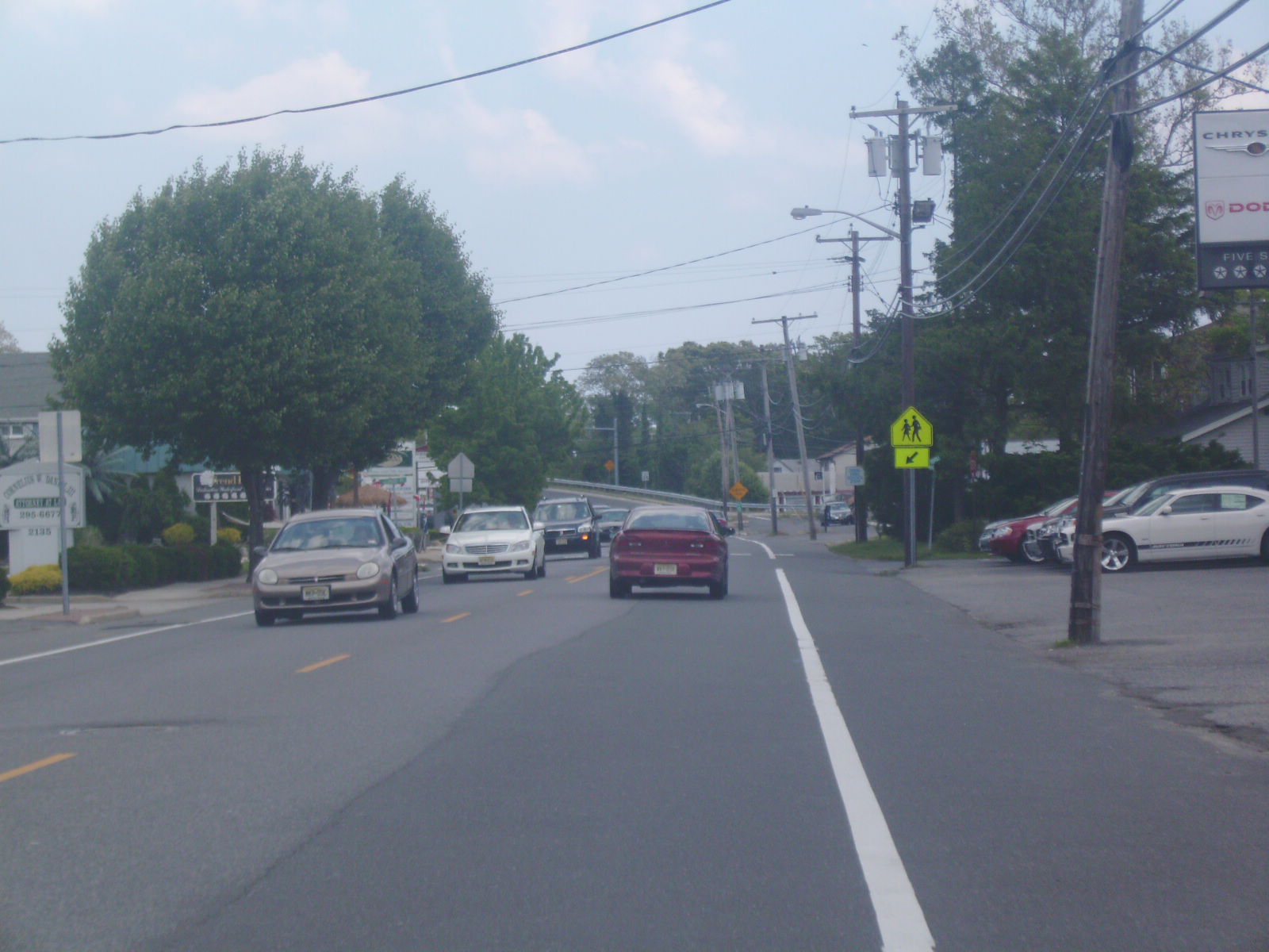
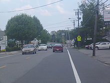 NJ 13 heading westward along Bridge Avenue. Signs denonating state-maintenance are visible in the distance
Route 13 begins at an intersection where Ocean County Route 632 meets Hollywood Place in Point Pleasant. There, the state-maintenance begins. The route heads eastward along Bridge Avenue, passing to the south of local businesses and to the north of local residences. There, Route 13 begins a curve to the northeast onto the Lovelandtown Bridge approach, crossing some dead-end local roads and a marina before reaching the Point Pleasant Canal and onto the lift bridge. The bridge soon re-enters land, where it parallels Elm Avenue for a short distance before turning away to the southeast. The route heads into downtown Bay Head, where it reaches an intersection with Bay Avenue, which denonates its eastern terminus. County Route 632 continues eastward to New Jersey Route 35.[2]
History
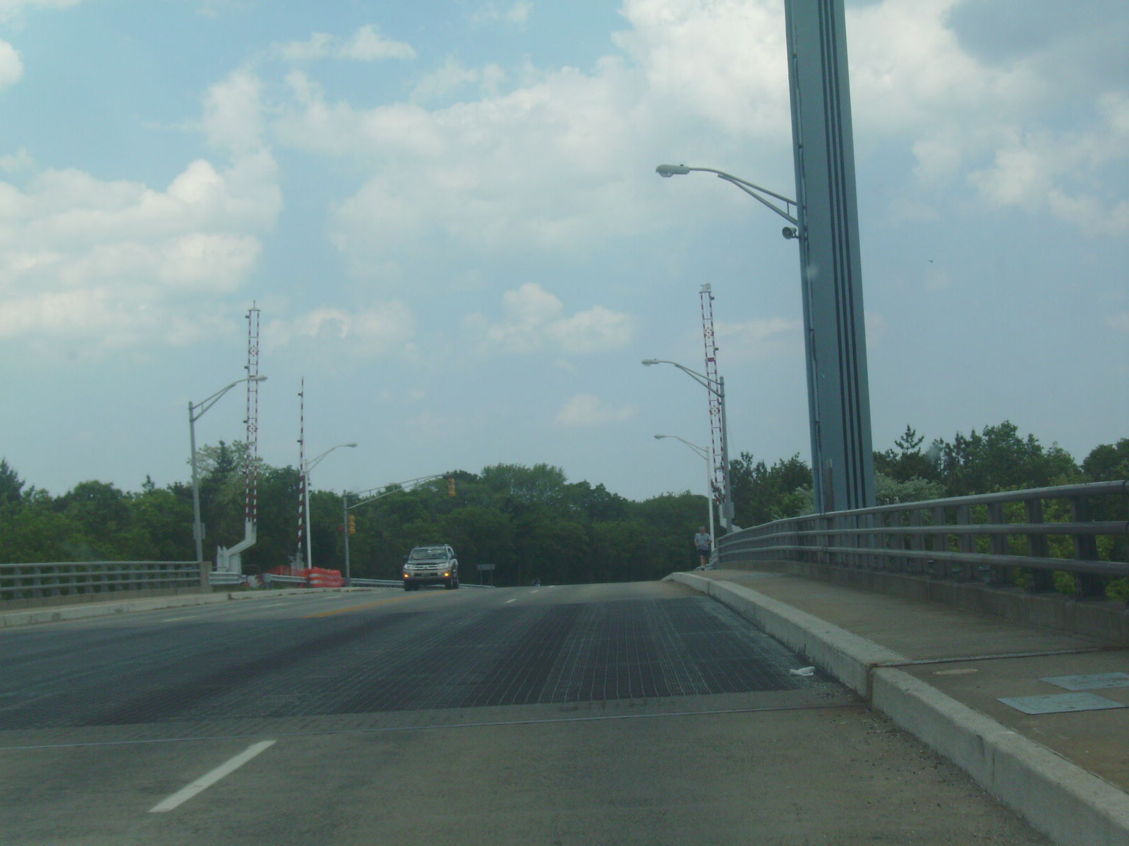
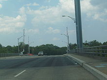 Heading eastbound on the Lovelandtown Bridge, which is most of NJ 13's alignment
 Route 13E (1938-1953)
Originally, the bridge over the Point Pleasant Canal, the Lovelandtown Bridge, was constructed in 1929 for a continuous route above Bridge Avenue.[3] The designation of Route 13 originated as an alignment of Ocean County Route 13-E, a highway maintained by the county In 1938, the state legislated a takeover of the fifth segment of the county route, a portion of highway from New Jersey Route 37 at Bay Head to an intersection with Beaver Dam Road, including the Lovelandtown Bridge. The route was to be 1.76 miles (2.83 km) long,[4] but the extension was never produced. In the 1953 renumbering, the state dropped the suffix and renumbered the bridge and its approaches to Route 13.[5]
During a storm in 1962, the bridge built in 1929 was swept away in a storm and rebuilt.[6] The bridge was then replaced in 1971[6] with a 291.01 feet (88.70 m) long steel lift bridge.[7] The bridge has remained virtually intact since.[8][9] Structurally, Route 13 was a rehabilitation on the bridge and its approaches in October 2004. The bridge construction was completed by Carr & Duff Inc., which had received the project in June of that year. The Department of Transportation and Governor James E. McGreevey forwarded $2.4 million (2005 USD) to the company for construction.[10]
Major intersections
The entire route is in Ocean County.
Location Mile[1] Destinations Notes Point Pleasant 0.00 CR 632 westBay Head 0.56 CR 632 east1.000 mi = 1.609 km; 1.000 km = 0.621 mi See also
 U.S. Roads portal
 New Jersey portal
- List of state highways in the United States shorter than one mile
References
- ^ a b "Route 13 Straight Line Diagram". New Jersey Department of Transportation. 2009. pp. 1. http://www.state.nj.us/transportation/refdata/sldiag/00000013__-.pdf. Retrieved September 10, 2009.
- ^ Microsoft Inc. (2009). Bing Maps - Overview map of NJ Route 13 (Map). Cartography by NAVTEQ Incorporated. http://www.maps.bing.com/maps/?FORM=Z9LH8#JnJ0cD1wb3MucXBicWRzOHR2Nzk2XzIxMDErQnJpZGdlK0F2ZSUyYytQb2ludCtQbGVhc2FudCtCb3JvJTJjK05KKzA4NzQyLTQ5MTVfX19lXyU3ZXBvcy5xcGJzOWc4dHZ3cjhfbmVhcisxNjk3K1MrQmF5K0F2ZSUyYytQb2ludCtQbGVhc2FudCtCZWFjaCUyYytOZXcrSmVyc2V5KzA4NzQyJTJjK1VuaXRlZCtTdGF0ZXNfX19lXyZydG9wPTAlN2Uw. Retrieved September 10, 2009.
- ^ "The Point Pleasant Canal". Point Pleasant Historical Society. 2009. http://mysite.verizon.net/ppbhistory/time_canal.htm. Retrieved September 10, 2009.
- ^ General Assembly, New Jersey (1938). "238". OCEAN COUNTY ROUTE 13-E. Beginning at highway Route 37 at Bay Head and continuing one and seventy-six one-hundredth (1.76) miles to the Beaver Dam road, in the boroughs of Point Pleasant and Bay Head, county of Ocean, and to include the Lovelandtown bridge across the Manasquan canal now under the jurisdiction of the Board of Commerce and Navigation, passing all right and title therein to the State Highway Commissioner.. New Jersey State Legislature. pp. 541–1.
- ^ 1953 renumbering. New Jersey Department of Highways. http://en.wikisource.org/wiki/1953_New_Jersey_state_highway_renumbering. Retrieved July 31, 2009.
- ^ a b "He's Ready When Boaters Need A Lift". Asbury Park Press. pp. 1.
- ^ Structure Number: ++++++++1505150 (2008 ed.). Washington D.C.: United States Department of Transportation. 2008.
- ^ New Jersey Department of Transportation (1988). New Jersey Official Road Map (Map). Cartography by New Jersey Department of Transportation.
- ^ New Jersey Department of Transportation (2007). New Jersey Official Road Map (Map). Cartography by New Jersey Department of Transportation.
- ^ "NJDOT begins construction on the Route 13 Inland Waterway Canal Bridge in Point Pleasant Boro". New Jersey Department of Transportation. October 27, 2004. pp. 1. http://www.nj.gov/transportation/about/press/2004/102704.shtm. Retrieved September 10, 2009.
External links
Categories:- Intracoastal Waterway
- State highways in New Jersey
- Transportation in Ocean County, New Jersey


Wikimedia Foundation. 2010.