- Dilton Marsh
-
Coordinates: 51°14′56″N 2°12′50″W / 51.249°N 2.214°W
Dilton Marsh 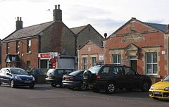
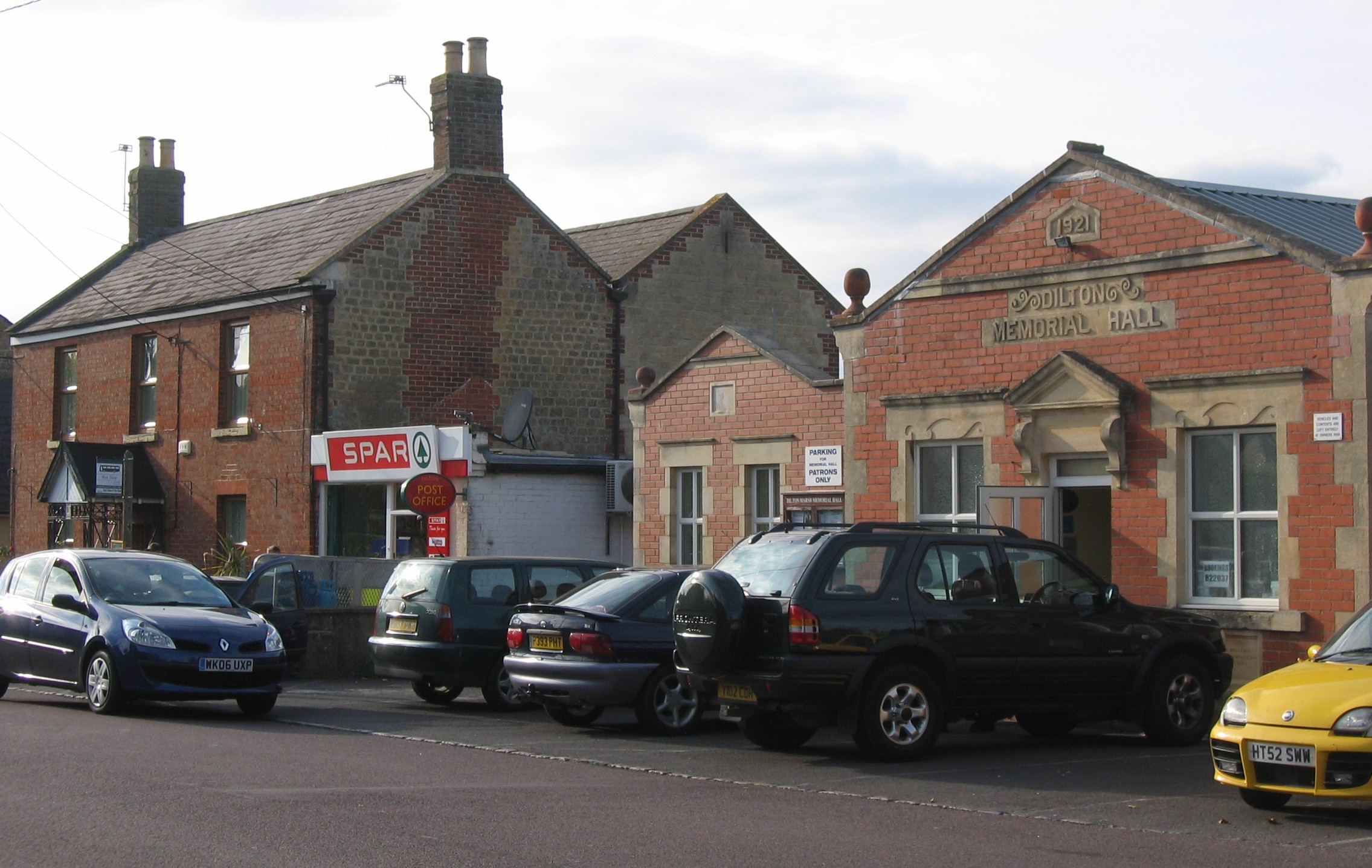
Village centre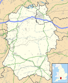
 Dilton Marsh
Dilton Marsh shown within WiltshirePopulation 1,870 (as of 2001) OS grid reference ST842498 Unitary authority Wiltshire Ceremonial county Wiltshire Region South West Country England Sovereign state United Kingdom Post town WESTBURY Postcode district BA13 Dialling code 01373 Police Wiltshire Fire Wiltshire Ambulance Great Western EU Parliament South West England List of places: UK • England • Wiltshire Dilton Marsh is a village and parish in the County of Wiltshire, in the south west of England.
Contents
Location
Its closest town is Westbury, which lies due east of the village. To the west is the Somerset town of Frome; Warminster is to the south, and Trowbridge (the county town) is just to the north (these last two are both in Wiltshire).
Features
 Holy Trinity Church, Dilton Marsh
The village High Street is 2 km (2187 yd) long. In the centre of the village is Holy Trinity Church. This Anglican church was built in 1844 in a rather unusual neo-Romanesque style by Thomas Henry Wyatt. The village also has a primary school, a public house (the Prince of Wales), a post office, grocery shop and Chinese takeaway.
Transport links
At the eastern end of the village is Dilton Marsh Halt, a simple railway platform on the regional line. It is the subject of the John Betjeman poem Dilton Marsh Halt. Dilton Marsh is a request stop which means you have to tell the conductor to stop there, when you want to get on a train there you hold you hand like you are yelling for a taxi - you will have to pay on board as you there are no facilities to pay at the platform.
History
The original settlement, Old Dilton, some 2.5 km (1.6 mi) south of the present village centre at grid reference ST860490, now consists of a couple of farm houses and the beautiful St Mary's Church (with a triple-decker pulpit and box pews). As fewer workers were needed in the local woollen industry, with the introduction of greater mechanisation, many moved to the common land of the drained marsh on the northern side of the ridge. By the early nineteenth century, Dilton Marsh had outgrown the older settlement.
At the end of the 19th century, it was noticed that the Westbury Sheep Fair in September caused low attendance at local schools, including that at Dilton Marsh.[1]
Notes
- ^ Wiltshire Community History: County School, Dilton Marsh at kennet.gov.uk, accessed 29 May 2010
External links
Categories:- Villages in Wiltshire

Wikimedia Foundation. 2010.