- Snaith and Cowick
-
Snaith and Cowick 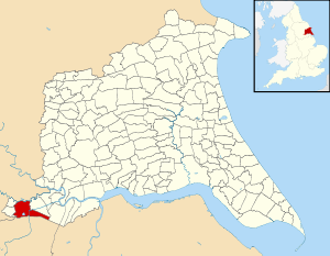
Civil parish Status: Town Governance: Town Council Population: 3,028 (2001 census)[1] Administration Primary council: East Riding of Yorkshire Region: Yorkshire and the Humber Coordinates: 53°41′N 1°01′W / 53.683°N 1.017°WCoordinates: 53°41′N 1°01′W / 53.683°N 1.017°W Politics UK Parliament: Brigg and Goole European Parliament: Yorkshire and the Humber Snaith and Cowick is a civil parish in the East Riding of Yorkshire, England. It is situated approximately 6 miles (9.7 km) west of the town of Goole and covering an area of 2,406.612 hectares (5,946.87 acres).[2]
The civil parish is formed by the town of Snaith and the villages of East Cowick and West Cowick. According to the 2001 UK census, Snaith and Cowick parish had a population of 3,028.[1]
The parish was part of the Goole Rural District in the West Riding of Yorkshire from 1894 to 1974, then in Boothferry district of Humberside until 1996.
References
- ^ a b "2001 Census: Key Statistics: Parish Headcounts: Area: Snaith and Cowick CP (Parish)". Neighbourhood Statistics. Office for National Statistics. http://neighbourhood.statistics.gov.uk/dissemination/LeadTableView.do?a=3&b=791041&c=snaith&d=16&e=15&g=391228&i=1001x1003x1004&m=0&r=1&s=1205358589935&enc=1&dsFamilyId=779. Retrieved 12 March 2008.
- ^ "2001 Census Area Profile" (PDF). East Riding of Yorkshire County Council. 2004. http://www.eastriding.gov.uk/corp-docs/researchgroup/parishprofiles/SNAITH+AND+COWICK.pdf. Retrieved 21 March 2011.
- Gazetteer — A–Z of Towns Villages and Hamlets. East Riding of Yorkshire Council. 2006. pp. 4, 10.
Categories:- Civil parishes in the East Riding of Yorkshire
- East Riding of Yorkshire geography stubs

Wikimedia Foundation. 2010.