- Brentwood (LIRR station)
-
This article is about a Long Island Rail Road station in Brentwood, New York. For the Vancouver SkyTrain station in Burnaby, British Columbia, see Brentwood Town Centre Station.
Brentwood 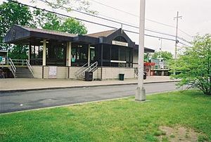
Brentwood's current LIRR station.Station statistics Address Brentwood Road and Suffolk Avenue
Brentwood, New YorkCoordinates 40°46′51″N 73°14′37″W / 40.780826°N 73.243607°WCoordinates: 40°46′51″N 73°14′37″W / 40.780826°N 73.243607°W Lines Connections Suffolk County Transit: S27, S41, S45, 3A, 3C, 3D
Lindy's TaxiPlatforms 2 side platforms Tracks 2 Parking Yes Other information Opened 1987 Electrified January 18, 1988
750V (DC) third railAccessible 
Owned by MTA Fare zone 10 Formerly Modern Times Traffic Passengers (2006) 2,750[1] Services Ticket vending machines Preceding station LIRR Following station toward New York terminalsMain Line
(Ronkonkoma Branch)toward GreenportBrentwood is a station along the Main Line (Ronkonkoma Branch) of the Long Island Rail Road. It is officially located at Suffolk County Road 100 (Suffolk Avenue) and Brentwood Road in Brentwood, New York. However, it has parking facilities and other amenities that are extended far beyond its given location. The actual station is located across the tracks from the dead end of Eighth Street near Leroy Avenue. The parking lot entrance is on Suffolk Avenue 1/2 mile east of Brentwood Road/Washington Avenue.
Contents
History
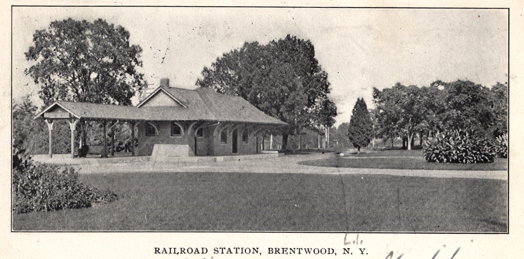
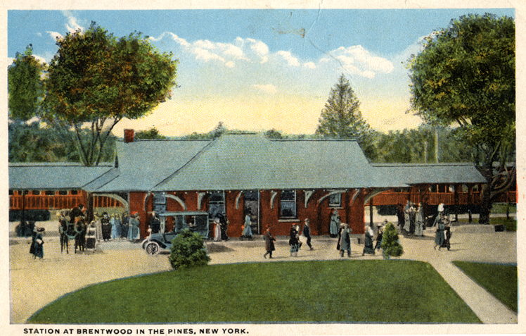
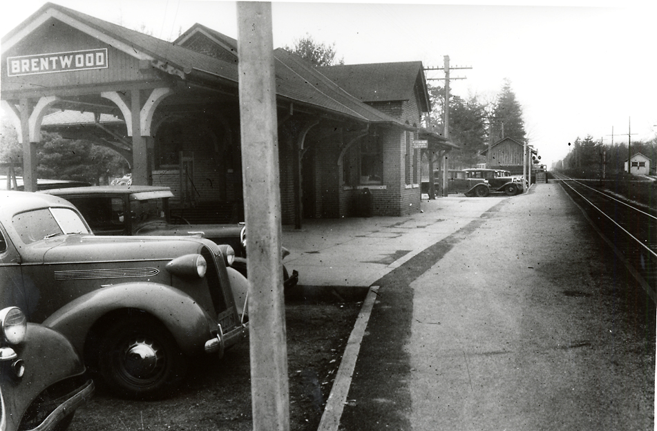
The first station, originally known as "Modern Times Station", was built in 1870, then burned in April 1903 and was replaced on November 10, 1903. Until 1987, Brentwood Station was located on First Avenue between 4th Street and Brentwood Road. It was moved as part of a major electrification and reconstruction project of the line in Ronkonkoma, Central Islip, Brentwood, Deer Park, and Wyandanch. Originally, the LIRR had planned to merge Deer Park, Pineaire, and Brentwood stations into a single station, but residential opposition blocked that proposal, and only Deer Park and Pineaire were merged.[2] The current station was built close to the former Brentwood Station, which was converted into a restaurant shortly after it was abandoned. All grade crossings in the Brentwood area remain unchanged after the station was moved.[3]
Thompson's Station
Prior to the construction of Brentwood Station, another station existed in Brentwood where the Sagtikos State Parkway now crosses over the Main Line of the Long Island Rail Road. This was known as Thompson's Station or Thompson's Siding, and served as a private home, a station, an Inn, and a general store. It was opened as a station on June 24, 1842, with the arrival of the railroad, and closed in December 1869, before Brentwood Station was built further east. The site was replaced with the former Pineaire (LIRR station) in 1915, until it was closed in 1986 and combined into the new Deer Park (LIRR station) west of Sagtikos State Parkway.
Platforms and tracks
This station has two high-level side platforms, each 12 cars long. The north platform, next to Track 1, is generally used by westbound or New York City-bound trains. The south platform, next to Track 2, is generally used by eastbound trains.
The Main Line has two tracks here.
Gallery
-

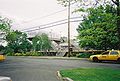
Former station house, now a restaurant.
-
Old station is now the Solar Cafe.
-
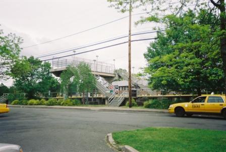
Pedestrian bridge near the current station house.
Reference
- ^ Average weekday, 2006 LIRR Origin and Destination Study
- ^ Station on the Ronkonkoma Line during electrification (Railroad.net Forums; Long Island Rail Road)
- ^ LIRR station History (TrainsAreFun.com)
External links
- Official LIRR station information page for Brentwood
- Station timetable for Brentwood
- Unofficial LIRR History Website
- Brentwood History Collection
- Station 1905 and Station 1908 and Station 1910
- Ron Ziel Collection
- Unofficial LIRR Photography Site (lirrpics.com)
- Brentwood Station and "SG" Cabin History (TrainsAreFun.com)
- Station from Brentwood Road from Google Maps Street View
Categories:- Long Island Rail Road stations
- Transportation in Suffolk County, New York
- Islip (town), New York
-


Wikimedia Foundation. 2010.