- Delaware Route 36
-
Delaware Route 36
Route information Maintained by DelDOT Length: 23.28 mi[1] (37.47 km) Major junctions West end:  DE 404 in Scotts Corner
 DE 16 in Greenwood
 US 13 in Greenwood
 US 113 in Milford
 DE 1 east of Milford
East end: Slaughter Beach Highway system ←  DE 34
DE 34DE 37  →
→Delaware Route 36 (DE 36) is a state highway in Sussex County, Delaware. It runs in a generally northeast-southwest direction from Delaware Route 404 in Scotts Corner to Slaughter Beach, a town along the Delaware Bay. The road runs through the northern portion of Sussex County, passing through Greenwood and Milford. DE 36 was built as a state highway in stages during the 1920s and 1930s. The road was designated by 1938 from Delaware Route 16 east of Greenwood to Fort Saulsbury (present-day Slaughter Beach) and was extended west to DE 404 by 1994.
Contents
Route description
Delaware Route 36 heads to the northeast from DE 404 on Scotts Store Road. West of Greenwood, Delaware Route 16 merges onto DE 36 and it assumes the name Hickman Road. The two routes continue into Greenwood, passing through the town on Market Street. On the eastern edge of Greenwood, it intersects U.S. Route 13 and it becomes the Beach Highway.[1][2]
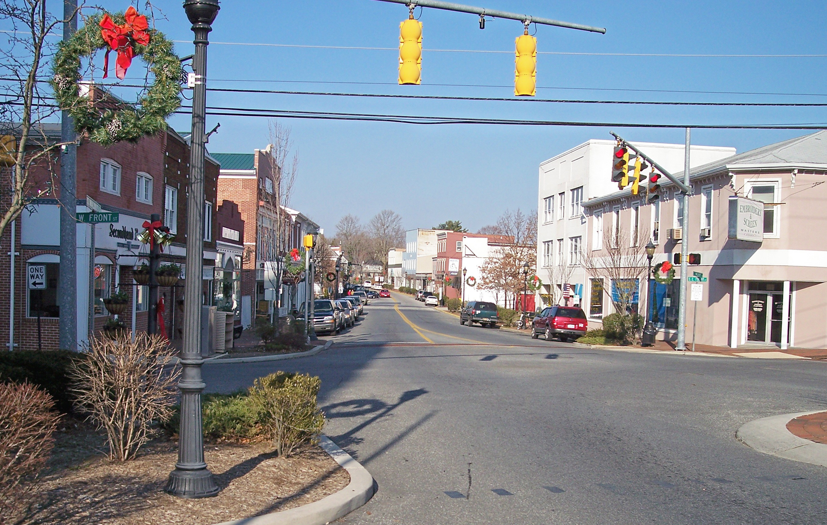
 DE 36 eastbound in Milford, where it turns from Walnut Street onto SE Front Street
In Saint Johnstown, Delaware Route 36 splits from DE 16 by heading to the northeast on Shawnee Road. It heads through countryside, and eventually reaches the city of Milford. Upon reaching Milford, the road becomes Lakeview Avenue and intersects U.S. Route 113. It heads northeast toward Silver Lake, a lake along the Mispillion River, and DE 36 continues to the east on Causey Avenue. It then heads north on Walnut Street briefly before heading east on SE Front Street. It heads toward the eastern part of Milford where it intersects Delaware Route 1 Business (Rehoboth Boulevard).[1][2]
DE 36 then heads to the northeast on Cedar Beach Road before angling to the east. It then intersects the Delaware Route 1 Milford Bypass at a diamond interchange. DE 36 continues to the northeast on Cedar Beach Road toward Slaughter Beach, where Delaware Route 36 ends at a drawbridge over the Cedar Creek. The road continues past the drawbridge into Slaughter Beach where it becomes Bay Avenue and turns south and runs along the Delaware Bay.[1][2]
History
By 1920, a section of present-day DE 36 southwest of Milford was completed as a state highway while a portion leading further northeast into Milford was under contract as one; the remainder of the route existed as an unimproved county road.[3] The portion leading into Milford was completed by 1924, in addition to the segment of the road through Greenwood.[4] By 1925, the state highway was under proposal between Greenwood and southwest of Milford.[5] All of current DE 36 was completed by 1931 except for the easternmost part of the road.[6] By 1938, DE 36 was designated to follow its current alignment between DE 16 east of Greenwood and Fort Saulsbury (now Slaughter Beach), with the entire route being paved except for the part near Fort Saulsbury.[7] The unpaved portion was paved by 1939.[8] By 1988, the portion of the current route west of Greenwood designated as Road 32.[9] DE 36 was extended westward to its current terminus at DE 404 by 1994.[10]
Major intersections
The entire route is in Sussex County.
Location Mile[1] Road Notes Scotts Corner 0.00 DE 404 (Seashore Highway)Western terminus Greenwood 3.60 DE 16 west (Hickman Road)West end of DE 16 overlap 5.08 US 13 (Sussex Highway)5.58 DE 16 east (Beach Highway)East end of DE 16 overlap Milford 15.85 US 113 (Dupont Boulevard)17.56 
DE 1 Bus. (Rehoboth Boulevard) DE 1 (Coastal Highway)Interchange Slaughter Beach 23.28 Cedar Creek bridge Eastern terminus 1.000 mi = 1.609 km; 1.000 km = 0.621 mi See also
 U.S. Roads portal
 Delaware portal
References
- ^ a b c d e http://www.deldot.gov/information/pubs_forms/manuals/traffic_counts/2006/pdf/rpt_pgs1_38_rev.pdf DelDOT 2006 Traffic Count and Mileage Report
- ^ a b c Google, Inc. Google Maps – overview of Delaware Route 36 (Map). Cartography by Google, Inc. http://maps.google.com/maps?f=d&source=s_d&saddr=delaware+36+and+delaware+404&daddr=38.8433875,-75.5281871+to:delaware+36+and+marina+lane&geocode=FXy_TwIdIGd9-ymdIltZ34q4iTGu1GEMxy_tYg%3BFfuzUAIdBYh_-ykjjc2eHY64iTFlnAkvy4mWKg%3BFZ0YUgIdsKqC-ymvmDkTZqK4iTEroL7Ry0TGBg&hl=en&mra=dpe&mrcr=0&mrsp=1&sz=11&via=1&sll=38.8586,-75.49519&sspn=0.229917,0.676346&ie=UTF8&t=h&z=11. Retrieved 2010-08-31.
- ^ Delaware Department of Transportation (PDF). Delaware Official Highway Map (Map) (1920 ed.). http://www.deldot.gov/archaeology/historic_pres/historic_highway_maps/pdf/cd_002.pdf. Retrieved 2010-04-15.
- ^ Delaware Department of Transportation (PDF). Delaware Official Highway Map (Map) (1924 ed.). http://www.deldot.gov/archaeology/historic_pres/historic_highway_maps/pdf/cd_003.pdf. Retrieved 2010-08-01.
- ^ Delaware Department of Transportation (PDF). Delaware Official Highway Map (Map) (1925 ed.). http://www.deldot.gov/archaeology/historic_pres/historic_highway_maps/pdf/cd_004.pdf. Retrieved 2010-08-19.
- ^ Delaware Department of Transportation (PDF). Delaware Official Highway Map (Map) (1931 ed.). http://www.deldot.gov/archaeology/historic_pres/historic_highway_maps/pdf/cd_005.pdf. Retrieved 2010-08-19.
- ^ Delaware Department of Transportation (PDF). Delaware Official Highway Map (Map) (1938 ed.). http://www.deldot.gov/archaeology/historic_pres/historic_highway_maps/pdf/cd_010.pdf. Retrieved 2010-04-29.
- ^ Delaware Department of Transportation (PDF). Delaware Official Highway Map (Map) (1939 ed.). http://www.deldot.gov/archaeology/historic_pres/historic_highway_maps/pdf/cd_012.pdf. Retrieved 2010-08-26.
- ^ Delaware Department of Transportation (PDF). Delaware Official Highway Map (Map) (1988 ed.). http://www.deldot.gov/archaeology/historic_pres/historic_highway_maps/pdf/cd_066.pdf. Retrieved 2010-04-15.
- ^ Delaware Department of Transportation (PDF). Delaware Official Highway Map (Map) (1994 ed.). http://www.deldot.gov/archaeology/historic_pres/historic_highway_maps/pdf/cd_068.pdf. Retrieved 2010-04-29.
Categories:- State highways in Delaware
- Transportation in Sussex County, Delaware

Wikimedia Foundation. 2010.