- Scaife Mountains
-
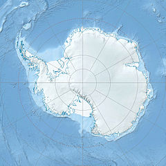
The Scaife Mountains (75°06′S 065°08′W / 75.1°S 65.133°W) is a group of mountains rising west of Prehn Peninsula and between the Ketchum and Ueda glaciers, in Palmer Land, at the base of Antarctic Peninsula.[1]
Discovered by the Ronne Antarctic Research Expedition (RARE) under Finn Ronne, 1947-48, who named these mountains for Alan M. Scaife of Pittsburgh, Pennsylvania, a contributor to the expedition.[1]
List of mountains
- Mount Brundage (75°16′S 65°28′W / 75.267°S 65.467°W) is a mountain located 12 nautical miles (22 km) west-southwest of Mount Terwileger in the south part of the Scaife Mountains. Discovered by RARE who named it for Burr Brundage, United States Department of State, who assisted in making arrangements for the expedition.[2]
- Mount Terwileger (75°13′S 64°44′W / 75.217°S 64.733°W) is a mountain on the northern side of Ueda Glacier, standing at the SE extremity of the Scaife Mountains. Mapped by U.S. Geological Survey (USGS) from surveys and U.S. Navy air photos, 1961-67. Named by Advisory Committee on Antarctic Names (US-ACAN) for Stephen E. Terwileger, hospital corpsman at South Pole Station in 1967.[3]
References
- ^ a b "Scaife Mountains". Geographic Names Information System, U.S. Geological Survey. http://geonames.usgs.gov/pls/gnispublic/f?p=gnispq:5:::NO::P5_ANTAR_ID:13343. Retrieved 2004-11-13.
- ^ "Mount Brundage". Geographic Names Information System, U.S. Geological Survey. http://geonames.usgs.gov/pls/gnispublic/f?p=gnispq:5:::NO::P5_ANTAR_ID:15156. Retrieved 2010-10-24.
- ^ "Mount Terwileger". Geographic Names Information System, U.S. Geological Survey. http://geonames.usgs.gov/pls/gnispublic/f?p=gnispq:5:::NO::P5_ANTAR_ID:15156. Retrieved 2010-11-07.
 This article incorporates public domain material from websites or documents of the United States Geological Survey.
This Palmer Land location article is a stub. You can help Wikipedia by expanding it.

