- Mount Iwahara
-
Mount Iwahara 岩原山 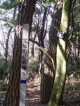
Top of the Mt. IwaharaElevation 573.0 m (1,880 ft) Pronunciation Japanese: [iwahaɽajama] Location Location Takarazuka, Hyōgo, Japan Range Rokko Mountains Coordinates 34°48′N 135°18′E / 34.8°N 135.3°E Mount Iwahara (岩原山 Iwaharayama) is a 573.0 metre high Japanese mountain in Takarazuka, Hyōgo, Japan.
Outline
Mount Iwahara is a part of Setonaikai National Park. The mountain is a peak on the East Ridge of the Rokko Mountains. The mountain is the highest mountain in Takarazuka City.
Access
- Eden no Sono Bus Stop of Hankyu Bus
- Shirubeiwa Bus Stop of Hankyu Bus
References
- Shozo Tamaki, Rokkosan Hakubutsushi, Kobe Shimbun Shuppan Center
- Official Home Page of Setonaikai National Park
- Official Home Page of the Geographical Survey Institute in Japan
Categories:- Mountains of Hyōgo Prefecture
- Visitor attractions in Hyōgo Prefecture

Wikimedia Foundation. 2010.