- Mir Bacha Kot
-
Mir Bacha Kot Location in Afghanistan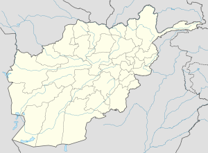
 Mir Bacha Kot
Coordinates: 34°44′48″N 69°6′59″E / 34.74667°N 69.11639°ECoordinates: 34°44′48″N 69°6′59″E / 34.74667°N 69.11639°E Country  Afghanistan
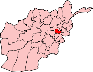
Province Kabul Province District Mir Bacha Kot District Elevation 5,545 ft (1,690 m) Population (2007) - Total 5,659 Time zone UTC+4:30 Mir Bacha Kot is a village and the center of Mir Bacha Kot District, Kabul Province, Afghanistan. It is located at 34°44′48″N 69°06′59″E / 34.7467°N 69.1164°E at 1690 m altitude, 25 km North of Kabul. The village infrastructure was destroyed during the war. The population is 5,659 (2007 calculation).
Capital 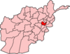
Districts Bagrami · Chahar Asyab · Deh Sabz · Farza · Guldara · Istalif · Kabul · Kalakan · Khaki Jabbar · Mir Bacha Kot · Mussahi · Paghman · Qarabagh · Shakardara · SurobiCities Bagrami · Qalai Naeem · Tarakhel · Dehnawe Farza · Guldara · Istalif · Kabul · Kalakan · Khak-i Jabbar · Mir Bacha Kot · Mussahi · Paghman · Qara Bagh · Shakar Dara · SurobiLandmarks Darul Aman Palace · Abdul Rahman Mosque · Bala Hissar · Gurdwara Karte Parwan · InterContinental Hotel · Kabul's Irish Pub · Kabul Library · National Museum of Afghanistan · Pul-e Khishti Mosque · Safi Landmark Hotel · Shah-Do Shamshira MosqueCategories:- Populated places in Kabul Province
- Afghanistan geography stubs

Wikimedia Foundation. 2010.