- May Township, Christian County, Illinois
-
May Township — Township — Location in Christian County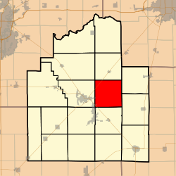 Christian County's location in Illinois
Coordinates: 39°33′54″N 89°11′35″W / 39.565°N 89.19306°WCoordinates: 39°33′54″N 89°11′35″W / 39.565°N 89.19306°W Country  United States
State  Illinois
County Christian Established November 7, 1865 Area - Total 36.47 sq mi (94.47 km2) - Land 36.39 sq mi (94.26 km2) - Water 0.08 sq mi (0.21 km2) 0.22% Elevation 607 ft (185 m) Population (2000) - Total 1,436 - Density 39.5/sq mi (15.2/km2) Time zone CST (UTC-6) - Summer (DST) CDT (UTC-5) ZIP codes 62510, 62567, 62568 GNIS feature ID 0429342 May Township is one of seventeen townships in Christian County, Illinois, USA. As of the 2000 census, its population was 1,436[1].
Contents
History
May Township was established November 7, 1865[2], as Smith Township, but was later changed to Howard, then Penn, and finally to May. References as to when the name changes happened have been lost.[3] It was named in honor of Colonel Charles May, of the artillery arm of the service in the Mexican-American War.[4]
Geography
According to the United States Census Bureau, May Township covers an area of 36.47 square miles (94.5 km2); of this, 36.39 square miles (94.2 km2) (99.78 percent) is land and 0.08 square miles (0.21 km2) (0.22 percent) is water.
The highest point in May Township is located approximately 20 feet south of the centerline of County Road 1600 North, at roughly 1816 East (.16 miles East of 1800 North Road, a/k/a Christian County Highway #7).
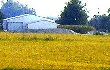 The May Township Road Department Office
Cities, towns, villages
- Taylorville (east edge)
Unincorporated towns
- Hewittville at 39°32′10″N 89°13′00″W / 39.5361554°N 89.2167533°W
- Old Stonington at 39°36′41″N 89°08′52″W / 39.6114309°N 89.1478606°W
- Willey Station at 39°35′49″N 89°14′00″W / 39.5969883°N 89.2334185°W
Cemeteries
The township contains these four cemeteries: Fraley, Harris Number 2, Long and Tanner.
Major highways
Airports and landing strips
- Anselm Landing Strip
School districts
- Central A & M Community Unit School District 21
- Taylorville Community Unit School District 3
Political districts
- State House District 87
- State House District 98
- State Senate District 44
- State Senate District 49
References
- "May Township, Christian County, Illinois". Geographic Names Information System, U.S. Geological Survey. http://geonames.usgs.gov/pls/gnispublic/f?p=gnispq:3:::NO::P3_FID:0429342. Retrieved 2010-01-04.
- United States Census Bureau 2009 TIGER/Line Shapefiles
- United States National Atlas
- Illinois Atlas & Gazetteer; Third Edition, Second Printing; Copyright 2000 DeLorme; ISBN 0-89933-321-4; pp 62
- ^ United States Census Bureau American FactFinder
- ^ http://www.ilsos.gov/GenealogyMWeb/NameIndexLocalGovernmentsServlet
- ^ Christian County Fact Sheet
- ^ May Township history
External links

Buckhart Township Stonington Township Taylorville Township 
Prairieton Township  May Township

Johnson Township Locust Township Assumption Township Municipalities and communities of Christian County, Illinois County seat: Taylorville Cities 
Villages Bulpitt | Edinburg | Harvel‡ | Jeisyville | Kincaid | Morrisonville | Mount Auburn | Moweaqua‡ | Owaneco | Palmer | Stonington | Tovey
Townships Assumption | Bear Creek | Buckhart | Greenwood | Johnson | King | Locust | May | Mosquito | Mount Auburn | Pana | Prairieton | Ricks | Rosamond | South Fork | Stonington | Taylorville
Unincorporated
communitiesBolivia | Clarksdale | Dunkel | Ellis | Grove City | Hewittsville | Langleyville | Midway | Millersville | Old Stonington | Osbernville | Radford | Roby | Rosamond | Sharpsburg | Sicily | Vanderville | Velma | Willey Station | Zenobia‡
Footnotes ‡This populated place also has portions in an adjacent county or counties
Categories:- Townships in Christian County, Illinois


Wikimedia Foundation. 2010.