- Alaska Route 7
-
Alaska Route 7
Haines Highway and other roads Route information Maintained by Alaska DOT&PF Length: 144.622 mi[1] (232.747 km)
(in four sections)Highway system ←  AK-6
AK-6AK-8  →
→Alaska Route 7 (AK-7) is a state highway in the Alaska Panhandle of the U.S. state of Alaska. It consists of four unconnected pieces, serving some of the Panhandle communities that the Alaska Marine Highway ferries stop at, and connecting to the Alaska Highway in Yukon via the Haines Highway.
Route description
Main articles: Egan Drive, Glacier Highway, and Haines HighwayAccording to Alaska's supplement to the Federal Manual on Uniform Traffic Control Devices, AK-7 follows[2]
Major highways in Southeast, including:
- South Tongass Hwy, North Tongass Hwy (Ketchikan)
- Nordic Drive, Mitkoff Hwy (Petersburg)
- Glacier Hwy, Egan Drive (Juneau)
- Haines Hwy, Haines to Border
No other segments are shown on maps.[3][4][5][6][7]
The southernmost piece of AK-7 is known as the Tongass Highway, and heads both ways from Ketchikan on Revillagigedo Island.
Next is the Mitkoff Highway, south from Petersburg to the southeast point of Mitkof Island. AK-7 also includes the short Nordic Drive, connecting the Mitkoff Highway to the north point of the island.
Egan Drive, part of AK-7, is the main road through Juneau, replacing the Glacier Highway from downtown Juneau to near the Juneau International Airport. Beyond the airport, AK-7 continues along the Glacier Highway past Auke Bay to near Berner's Bay.
The final piece of AK-7 begins in downtown Haines, and follows the Haines Highway northwest to the border with British Columbia. There it connects with Yukon Highway 3, which passes through British Columbia and ends at the Alaska Highway at Haines Junction.
Major intersections
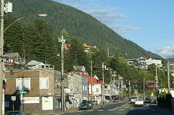 North Tongass Highway, looking roughly easterly as it passes through a neighborhood just beyond downtown Ketchikan.
Borough Location Mile[1] Road(s) Ketchikan Gateway 0.000 Beaver Falls access Ketchikan 15.503 Ferry Terminal Road - Ketchikan Ferry Terminal 31.700 Dead end Unorganized 0.000 Dead end Petersburg 32.211 Ferry Terminal Road - Petersburg Ferry Terminal 34.210 Sandy Beach Road Juneau 0.000 Main Street, Thane Road 0.679 Juneau-Douglas Bridge 13.151 Auke Bay Ferry Terminal 39.009 Dead end (just beyond Echo Cove access) Haines Haines 0.000 Main Street, 2nd Avenue - Haines Ferry Terminal British Columbia border 39.703  Hwy 3 north (Haines Road)
References
- ^ a b Alaska Department of Transportation and Public Facilities, Southern Region General Log, April 25, 2006 (Routes 291400 (South Tongass Highway), 291500 (North Tongass Highway), 294000 (Mitkof Highway), 294020 (Nordic Drive), 296000 (Glacier Highway/Egan Drive), and 298000 (Haines Highway))
- ^ Alaska Department of Transportation and Public Facilities, Alaska Traffic Manual Supplement, January 17, 2003
- ^ Google Maps street maps, accessed August 2007
- ^ American Automobile Association Road Atlas: United States, Canada, Mexico, 1995
- ^ Gousha Road Atlas: United States, Canada, Mexico, 1996
- ^ Rand McNally Road Atlas: United States, Canada, Mexico, 1998
- ^ MapQuest.com, Inc., National Geographic Road Atlas: United States, Canada, Mexico, 2001
Categories:- Transportation in Haines Borough, Alaska
- Transportation in Juneau City and Borough, Alaska
- Transportation in Ketchikan Gateway Borough, Alaska
- State highways in Alaska
- Petersburg Census Area, Alaska
- Transportation in Unorganized Borough, Alaska


Wikimedia Foundation. 2010.