Nail Pond, Prince Edward Island
- Nail Pond, Prince Edward Island
-
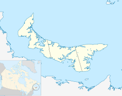
Nail Pond (2006 population: ~250) is a Canadian rural community in Prince County, Prince Edward Island.
It is located north of Tignish, near the communities of Skinner's Pond, Ascension, and Peterville.
History
It was founded by a cattle farmer by the name of Glenn Joseph Ellsworth in the early 19th century, and was reformed as an official locality in 2000. Glenn Joseph Ellsworth a 18th century cattle farmer, discovered Nail Pond in the early 19th century while making his way north from Tignish. He then settled there with his wife and several family members from England who emigrated to the area.
In November 1987 a blue whale washed ashore Nail Pond beach. The whale was consequently buried, only to later be dug up. The whale was dug up in 2008. The skeleton of the whale was sent to the University of British Columbia, where it is now on display. [1]
Roads in Nail Pond locality
- Route 160 (Ascension Road)
- Back Settlement Road
- Josie Shang Road
- Nail Pond Shore Road
- Route 156 (Palmer Road)
- Pebble Beach Avenue
- Route 14
- Sunset Beach Road
See also
References
Coordinates: 46°58′56.2″N 64°4′1.5″W / 46.982278°N 64.067083°W / 46.982278; -64.067083 (Nail Pond)
Categories: - Communities in Prince County, Prince Edward Island
- Prince Edward Island geography stubs
Wikimedia Foundation.
2010.
Look at other dictionaries:
Route 156 (Prince Edward Island) — Palmer Road, labeled Route 156, is a 2 lane collector highway in western Prince County, Prince Edward Island, Canada. It is between the communities of Tignish and Miminegash. Its maximum speed limit is 80 km/h. The road is considered part of two… … Wikipedia
Route 160 (Prince Edward Island) — Ascension Road, labeled Route 160, is a 2 lane collector highway in western Prince County, Prince Edward Island, Canada. It is located 2 miles NW of the community of Tignish. Its maximum speed limit is 80 km/h.The highway runs from Route 14… … Wikipedia
Lot 1, Prince Edward Island — Infobox Settlement official name = Pagename other name = native name = nickname = settlement type = Township motto = imagesize = image caption = flag size = image seal size = image shield = shield size = city logo = citylogo size = mapsize = map… … Wikipedia
Tignish, Prince Edward Island — Village Primary Tignish welcome sign, located on Western road (Phillip street) … Wikipedia
List of communities in Prince Edward Island — Contents 1 A 2 B 3 C 4 D … Wikipedia
Ascension, Prince Edward Island — Ascension (also known as Pigbrook) is a small community located mainly on Route 160 from 3 miles NE of Tignish. Ascension is within the Canadian province of Prince Edward Island, in Eastern Canada. The community is home to Harper s Brook , a… … Wikipedia
Liste des localités de l'Île-du-Prince-Édouard — Voici une liste des villes, villages et hameaux de la province canadienne de l Île du Prince Édouard. Voir aussi la liste des municipalités de l Île du Prince Édouard. Sommaire 1 Liste 1.1 1, 2, ... 1.2 A 1.3 … Wikipédia en Français
Tignish-Palmer Road — Legislative Assembly of Prince Edward Island provincial electoral district … Wikipedia
Tignish — Lage in Prince Edward Island … Deutsch Wikipedia
Glenn Joseph Ellsworth — (February 6 1769 – January 4 1883) was a cattle farmer. He discovered Nail Pond in the early 1800s while making his way north of Tignish, Prince Edward Island. He then settled there with his wife Mrs. Glenn Ellsworth. Glenns ancestors originally… … Wikipedia

 Subdivisions of Prince Edward Island