- Coldbackie
-
Coordinates: 58°30′17″N 4°21′02″W / 58.50477°N 4.35059°W
Coldbackie Scottish Gaelic: Callbacaidh 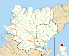
 Coldbackie
Coldbackie shown within the Sutherland areaOS grid reference NC631597 Council area Highland Country Scotland Sovereign state United Kingdom Post town Lairg Postcode district IV27 4 Police Northern Fire Highlands and Islands Ambulance Scottish EU Parliament Scotland List of places: UK • Scotland • Coldbackie (Scottish Gaelic: Callbacaidh) is a crofting township in Sutherland and is in the Scottish council area of Highland Scotland.
Geography
Coldbackie lies at the head of the Kyle of Tongue, two miles north east of Tongue. It sits under the Watch Hill, looking north over a spectacular beach to the Rabbit Islands. It is one of a series of crofting townships, running from Tongue, through Coldbackie, StrathTongue, Dalharn, Blandy and Scullomie to the deserted township of Slettel that sit on the eastern fringes of the Kyle of Tongue. South of here lies the area known as Braetongue.
Cnoc an Fhreiceadain is modest in height at 1008 feet, but offers dramatic Old Red Sandstone conglomorate cliffs, and impressive views along the north coast of Scotland, from Durness to Orkney.
Etymology
Back, the old Norse (ON) word for a hill or ridge is a quite straightforward translation (Gaelic (G) bac a bank, ON Old Icelandic (OI) bakki a ridge, Danish (D), bakke Swedish (Sw) backe a hill, hillock). There is a Back in Lewis, and a Backie in East Sutherland near Golspie. The Cold in Coldbackie is somewhat more problematical. A number of Scottish place name commentators have translated it as the G coil or cuil, meaning a nook or corner. Cuille G a wood is also mentioned. This would give us the nook or corner under the ridge or woody ridge, both accurate and descriptive.
There is a problem with this approach however, in that it clearly combines a Gaelic and Norse root to form a word. This is not impossible, as there is ample evidence of place names combining words from the two languages, with Dalharn mixing the Norse word dale for field, with the Gaelic word for stones or cairn. However it is important to remember that Dal in Gaelic is a borrow word from Norse, and is therefore part of the Gaelic language. The other key issue that the place name Coldbackie is not unique to the Kyle of Tongue, with there being two Coldbacks in Shetland (in Unst and Delting) and one in NW Iceland, there is also a Culleybackey in Aintrim, north of Belfast. As there is no evidence at all of any Gaelic influence in Shetland, or Iceland, (and a very strong Norse presence in Ulster) it makes a Gaelic Norse word combination very unlikely.
As the pattern of Norse colonisation of the Shetland, Orkney, Caithness, Sutherland, Faeroes and Iceland was from Norway, through Shetland and thence North to Faeroe and Iceland (and Greenland), and from Shetland south to Orkney, Caithness and Sutherland, i.e. through Shetland rather than direct from Norway, it would seem that there is an argument for the Sutherland Coldbackie to be the same word combination as those in Shetland and Iceland.
There are a number of possibilities as to its meaning. Two obvious possibilities occur in Old Norse, Kald - Cold (the same root word for English and Scots) or Kol - Charcoal, Coal or Peat. This could give us Cold Ridge, or Peaty Ridge, both accurate descriptions. There is a problem with using Kol for peat, as there is no evidence that this Norse word was ever used in Scotland, with peat being called Turf - ON torf in Scotland. Omand, in The Sutherland book, translates Coldbackie as kula-bakki bank with the bump, whilst Stewart, in his seminal work Place names of Shetland says that Coldbacks is Cold Hill.
External links
Categories:- Populated places in Sutherland

Wikimedia Foundation. 2010.