Ohau (skifield)

Ohau (skifield)

Ohau is a small commercial skifield in the foothills of New Zealand's Southern Alps, near the boundary between the Otago and Canterbury regions, and close to the southwestern shore of the lake of the same name.

Details

In 2004, a new two seater chairlift was installed on the slopes. This chairlift opened up the snowfield a lot more and increased the lift-accessible terrain. The next year, the longest snowmat in New Zealand was installed in place of the ropetow. The skifield now has 3 lifts (1 chairlift, 1 platter lift and 1 snowmat).

The base altitude is 1400 m and the highest altitude is 1825 m. The access road is an unsealed alpine road but is usually kept in good condition with buses leaving from the lodge daily.

Historically, the season has run from mid-July to early October. As of 2008, a new 23-cannon, fully automated snowmaking system is being installed. This will allow the skifield to open earlier, capturing lucrative July school holiday business.

Scenery

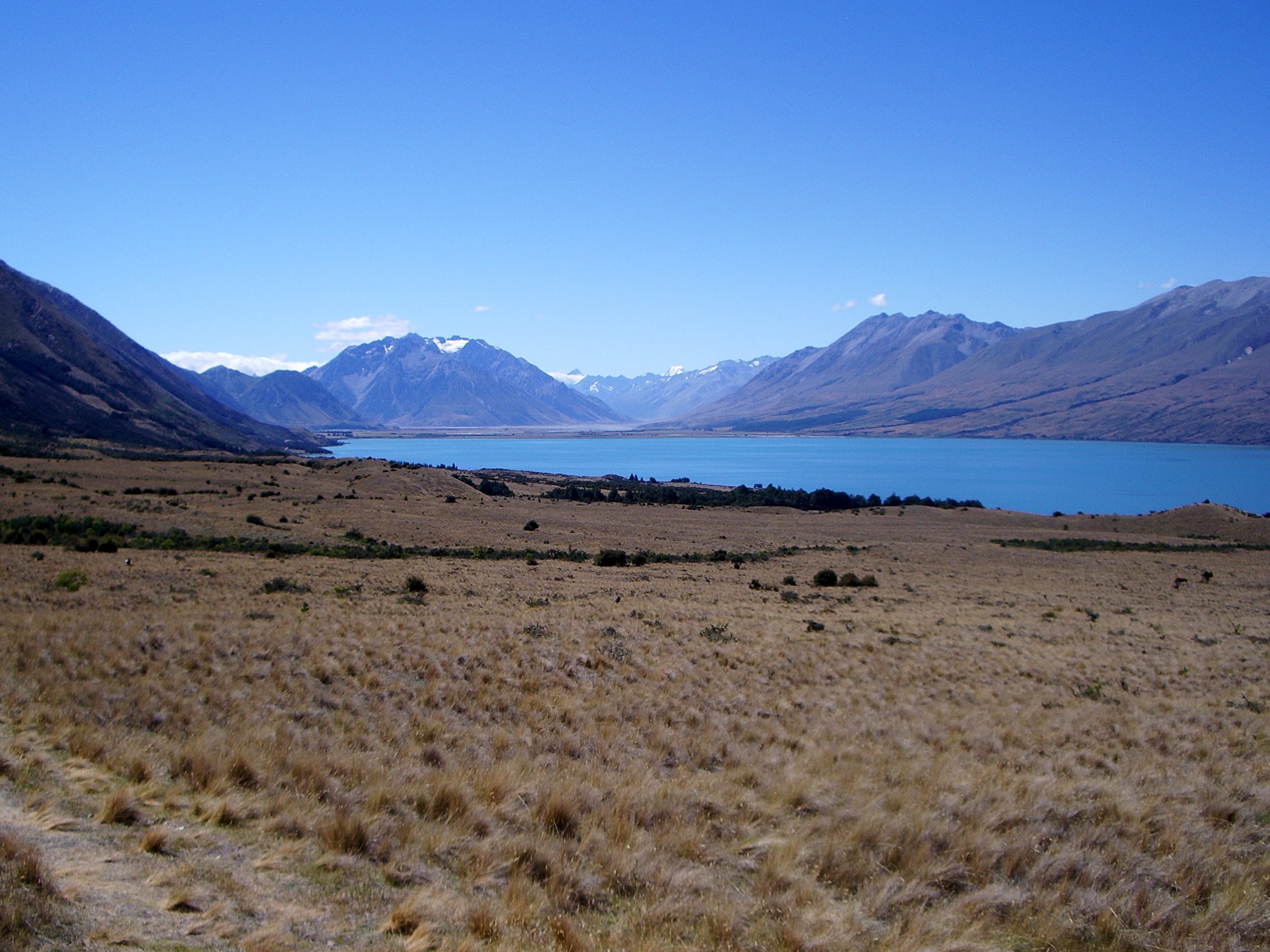
Ohau has some of the most spectacular mountain views in New Zealand. From the summit of the skifield a view of the Southern Alps can be seen. From the skifield runs, Lake Ohau and the Mackenzie Basin can be seen spread out below in the valley floor. There are good views across the lake to Ben Ohau.

View of Lake Ohau

External links

Coordinates: 44°13′29″S 169°46′43″E / 44.224634°S 169.778670°E / -44.224634; 169.778670


Wikimedia Foundation. 2010.

Игры ⚽ Нужно решить контрольную?

Look at other dictionaries:

  • Ohau — may refer to: Lake Ohau Ohau River Ohau (skifield) Ohau A power station Ohau B power station Ohau C power station This disambiguation page lists articles associated with the same title. If an …   Wikipedia

  • Mackenzie Basin — For the basin of the Canadian river, see Mackenzie River. The Mackenzie Country s typical autumn colouration. The Mackenzie Basin (popularly and traditionally known as the Mackenzie Country), is an elliptical intermontane basin, located in the… …   Wikipedia

  • Twizel — TwizelUrban AreaPopulation:1,000Extent:Territorial AuthorityName:Mackenzie District CouncilPopulation:Mayor:Website …   Wikipedia

  • List of ski areas and resorts in New Zealand — This is a list of ski areas and resorts in New Zealand where the public can pay to ski.North IslandMount Ruapehu*Whakapapa *Tukino (club skifield) *TuroaTaranaki*Manganui (club skifield)outh IslandNelson Lakes*Rainbow *Mount RobertCanterbury*Fox… …   Wikipedia

  • South Island — Infobox Islands name = South Island Māori: Te Wai Pounamu image caption = Satellite view of the South Island image size = locator Location map|New Zealand|lat= 43.983333|long=170.45|marksize=16 map custom = yes native name = native name link =… …   Wikipedia

  • Coronet Peak — Looking west from Coronet Peak Coronet Peak is a commercial skifield in Otago, New Zealand located 18 kilometres to the northeast of the town of Queenstown and seven kilometres west of Arrowtown, on the southern slopes of the 1,649 metre peak… …   Wikipedia

  • Mount Robert — 1421m high mountain, in the Nelson area of New Zealand s South Island. It is within the Nelson Lakes National Park. Access to the mountain is via the town of Saint Arnaud on a partially unsealed road followed by a two hour walk. On its northern… …   Wikipedia

  • Mount Olympus Ski Area — Mt Olympus, on the LHS Location Canterbury NZ …   Wikipedia

  • Mount Hutt (New Zealand) — Mount Hutt Mount Hutt rises to the west of the Canterbury Plains in the South Island of New Zealand, above the braided upper reaches of the Rakaia River, and 80 kilometres west of Christchurch. Its summit is 2190 metres above sea level. Skifield… …   Wikipedia

  • Omarama — Motto: The Place of Light …   Wikipedia

Share the article and excerpts

Direct link
Do a right-click on the link above
and select “Copy Link”