Dalrigh

Dalrigh

Coordinates: 56°25′25″N 4°41′16″W / 56.42361°N 4.68778°W / 56.42361; -4.68778

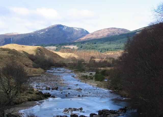
River Fillan at Dalrigh. Photographer: Richard Webb

Dalrigh is a hamlet in Scotland near Tyndrum. The name means "The King's Field" in the Scottish Gaelic language. grid reference NN342291

The origin of the name stems specifically from the Battle of Dalrigh which was fought there in 1306, when King Robert I of Scotland (Bruce) was defeated by the Clan MacDougall.


Wikimedia Foundation. 2010.

Игры ⚽ Поможем написать реферат

Look at other dictionaries:

  • Battle of Dalrigh — Infobox Military Conflict conflict=Battle of Dalrigh partof=Wars of Scottish Independence caption= date=1306 place=Dalrigh, Lorne, Scotland result=Victory for the MacDougalls, the domestic enemies of Robert Bruce combatant1=Scottish Royal Army… …   Wikipedia

  • Ben Oss — Infobox Mountain Name = Ben Oss Photo = Ben Oss 2.jpg Caption = Ben Oss seen from the high ground to the north of Tyndrum. Elevation = 1029 m (3376 ft) Location = Stirlingshire, SCO Range = Grampians Prominence = 342 m Parent peak = Ben Lui… …   Wikipedia

  • James Douglas, Lord of Douglas — See also: James Douglas (disambiguation) Sir James Douglas Tomb of Sir James, St Bride s Kirk, Douglas. Born c.1286 Douglas, Lanarkshire …   Wikipedia

  • Dalry — is the name of several places in Scotland: Dalry, North Ayrshire Dalry, Edinburgh St. John s Town of Dalry (Kirkcudbrightshire) You may also be looking for Dalrigh or the Battle of Dalrigh This disambiguation page lists articles associated with… …   Wikipedia

  • James Douglas el Bueno — James Douglas el Bueno, II señor de Douglas Saltar a navegación, búsqueda Sir James Douglas Tumba de Sir James, St Bride s Kirk, Douglas …   Wikipedia Español

  • Sir James Douglas — Tumba de Sir James, St Bride s Kirk, Douglas. General A …   Wikipedia Español

  • Declaration of Arbroath — v · First B …   Wikipedia

  • List of battles (geographic) — This list of battles is organized geographically, by country in its present territory. For other lists of battles, see List of battles. Angola* Battle of Mbwila 1665 * Battle of Quifangondo 1975 * Battle of Cassinga 1978 * Battle of Cuito… …   Wikipedia

  • Dunblane — Coordinates: 56°11′02″N 3°58′03″W / 56.183827°N 3.967410°W / 56.183827; 3.967410 …   Wikipedia

  • Doune — Castle seen from the arch bridge over the River Teith. The town of Doune is situated to the left, out of the shot. Doune (Gaelic: An Dùn, the fort ) is a burgh in the district of Stirling, Scotland, on the River Teith. Doune s postal address… …   Wikipedia

Share the article and excerpts

Direct link
Do a right-click on the link above
and select “Copy Link”