- Granary Burying Ground
-
Granary Burying Ground 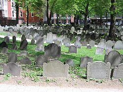
Granary Burying GroundDetails Year established 1660 Country United States Location Boston, Massachusetts Type Historical Owned by City of Boston Number of graves 2,345 Website Granary Burying Ground Founded in 1660, the Granary Burying Ground in Massachusetts is the city of Boston's third-oldest cemetery. Located on Tremont Street, it is the final resting place for many notable Revolutionary War-era patriots, including three signers of the Declaration of Independence, Paul Revere and the five victims of the Boston Massacre. The cemetery has 2,345 graves, but historians estimate as many as 5,000 people are buried in it. [1] The cemetery is adjacent to Park Street Church and immediately across from Suffolk University Law School.
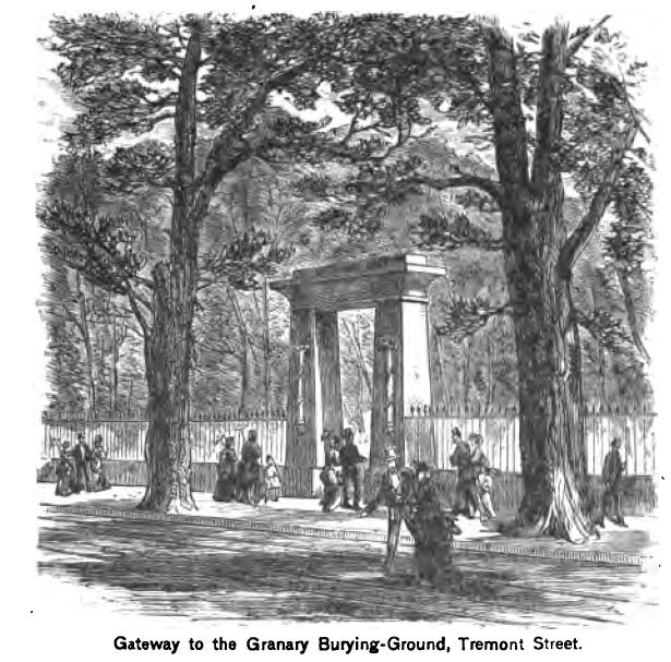
The cemetery's Egyptian revival gate and fence were designed by Boston architect Isaiah Rogers (1810-1849), who designed an identical gate for Newport's Touro Cemetery.[2]
Contents
History
The Burying Ground was the third cemetery established in the city of Boston and dates to the year 1660.[3] The need for the site arose because the land set aside for the city's first cemetery, King's Chapel Burying Ground located a block east was insufficient to meet the city's growing population. Early in its existence the area was known as the South Burying Ground until 1737 at which point it took on the name of the granary building which formerly stood on the site of what is now the Park Street Church. In May 1830 trees were planted in the area and an attempt was made to change the name to “Franklin Cemetery” to honor the family of Benjamin Franklin, but the effort failed.
 Entrance to the Granary Burying Ground as it appeared circa 1881 with the now missing European Elms present
The Burying Ground was originally part of the Boston Common which then encompassed the entire block, but two years after the cemetery was established the southwest portion of the block was taken for public buildings, which included the Granary and a house of correction[4] and the north portion of the block was used for housing.
Tombs were initially placed near the back of the property and on 15 May 1717 a vote was passed by the town to enlarge the Burying Ground by taking part of the highway on the eastern side, (now Tremont Street). The enlargement was carried out in 1720 when 15 tombs were created and assigned to a number of Boston families.
One of the most striking features of the Burying Ground was the row of eleven large European elms, (now gone) that fronted it on Tremont Street.[5] The elms were planted in 1762 by Major Adino Paddock and John Ballard, and by 1856 reached ten feet in circumference. The walk under the elms was known as "Paddock's Mall." Ironically while the entrance was shaded by the large elms, the grounds itself were devoid of any trees at all until the first major improvement was undertaken in 1830 when a number of trees were planted around the grounds. The property was improved again in 1840 by the construction of an iron fence on Tremont Street designed by Boston architect Isaiah Rogers at a cost of $5,000, half paid by the city and half by public subscription.[6] Rogers designed an identical Egyptian revival gateway for Newport's Touro Cemetery.[7]
In January 2009 a previously unknown crypt was discovered when a tourist on a self-guided tour through the cemetery fell through the ground into what appeared to be a stairway leading to a crypt. The stairway had been covered with a piece of slate which eventually gave way due to advanced age. The tourist was not hurt nor did she come into contact with any human remains. The crypt is reported to be 8 by 12 feet in size and is structurally intact. The crypt is possibly the resting place of Jonathan Armitage, a Boston selectman from 1732 to 1733.[8] Officials from the City of Boston announced in May, 2011 a $300,000 refurbishment project designed to repair and restore the historic site, including widening paths in the cemetery and providing new observation sites. $125,000 will be provided by the Freedom Trail Foundation and the city will pay the rest. [9]
Memorials and monuments
Prominently displayed in the Burying Ground is an obelisk erected in 1827 to the parents and relatives of Benjamin Franklin who was born in Boston and is buried in Philadelphia. Franklin's father was Josiah Franklin, originally from Ecton, Northamptonshire, England, and his mother was Abiah, who was born in Nantucket and was Josiah's second wife. Constructed of granite from the Bunker Hill Monument quarry, the obelisk was constructed to replace the original Franklin family gravestones which had been in poor condition. The new memorial was dedicated on 15 June 1827.
The oldest memorial in the yard lies near the Franklin monument memorializing John Wakefield, aged 52 who died 18 June 1667. Why there is a seven-year gap between the establishment of the burying ground and the oldest memorial is unknown.[10]
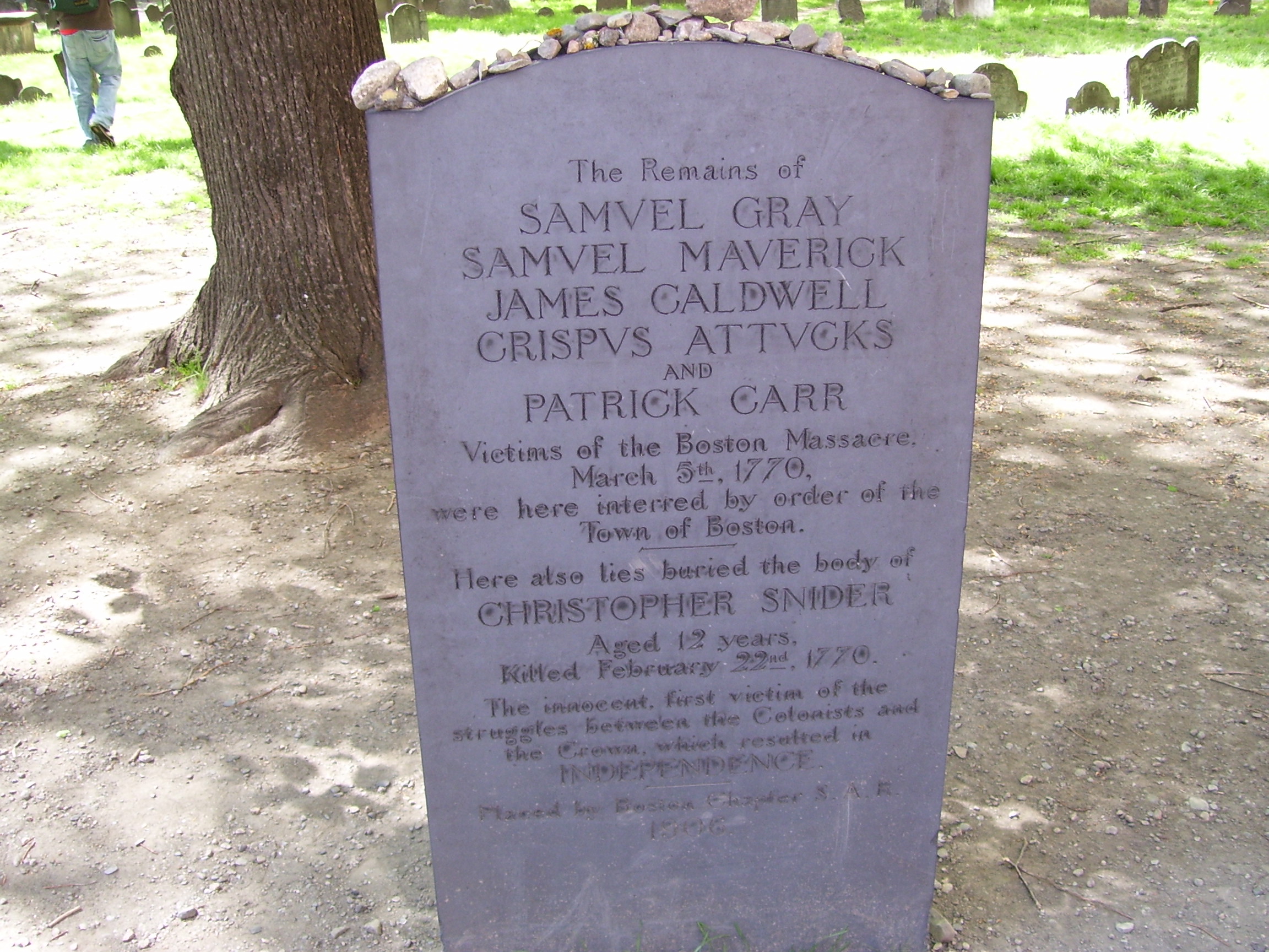
Near the Tremont Street entrance are the ashes of the American casualties in the Boston Massacre which occurred 5 March, 1770.
The grave markers were moved during the 1800s to be in nice straight lines to conform to nineteenth century ideas of order, as well as to allow for the modern lawn mower.[11]
Notable burials
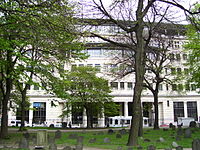 Granary Burying Ground with Suffolk Law School across the street
- John Phillips (1770 – 1823), first mayor of the city of Boston
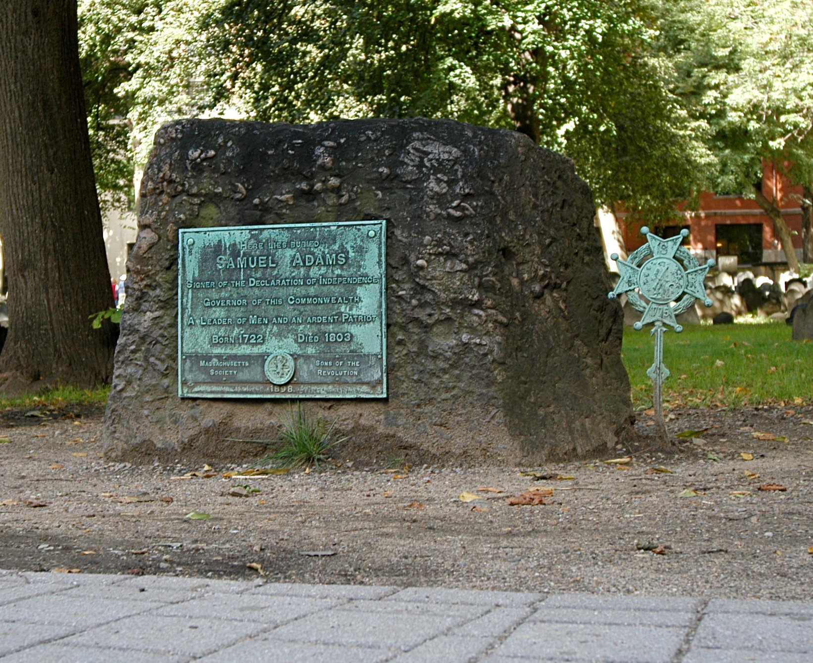
- Samuel Adams (1722-1803), statesman, signer of the Declaration of Independence
- Crispus Attucks (1723-1770), African-American victim of the Boston Massacre, in a common grave with the other 4 victims and a boy killed 11 days before
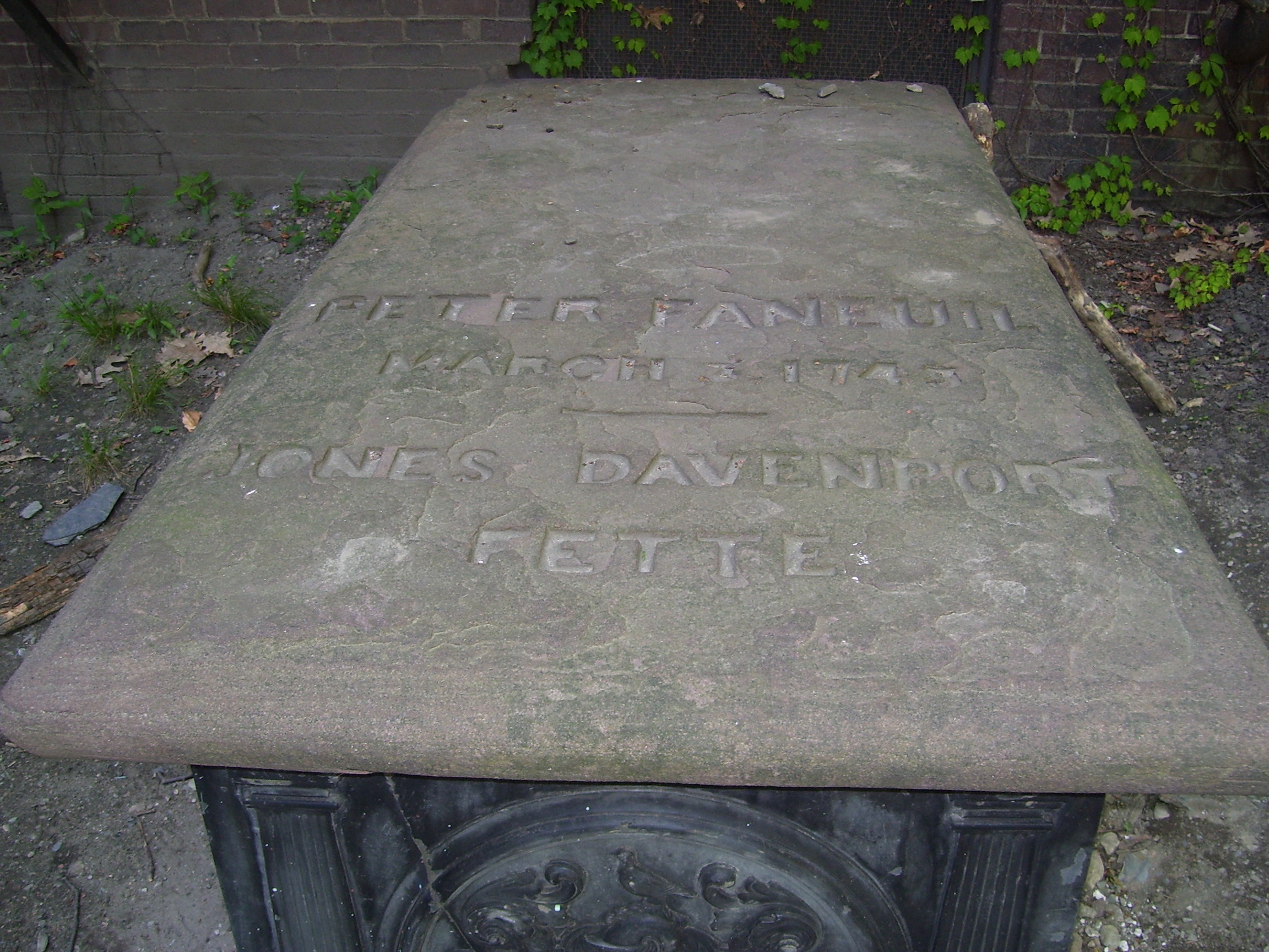
- Peter Faneuil (1700-1743), benefactor of Faneuil Hall
- Members of Benjamin Franklin's family, but not Franklin himself, who is buried in Philadelphia, Pennsylvania.
- Mary Goose (1665-1758), unlikely[12] claim familiar to locals as being the original Mother Goose, (some Mother Goose stories long predate the 17th century, the name Mother Goose was already familiar in France in 1650,[13] and the first public appearance of Mother Goose stories in the New World was in 1786.[14])
- Jeremiah Gridley (1702-1767), lawyer, defender of writs of assistance in 1761
- John Hancock (1737-1793), statesman, signer of the Declaration of Independence
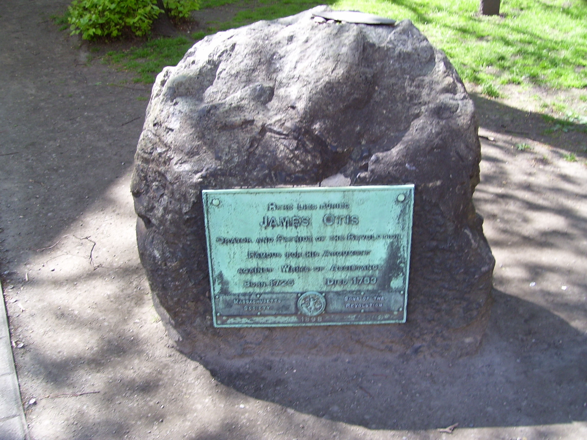
- James Otis (1725-1783), lawyer, Revolutionary War Patriot
- Robert Treat Paine (1731-1814), signer of the Declaration of Independence
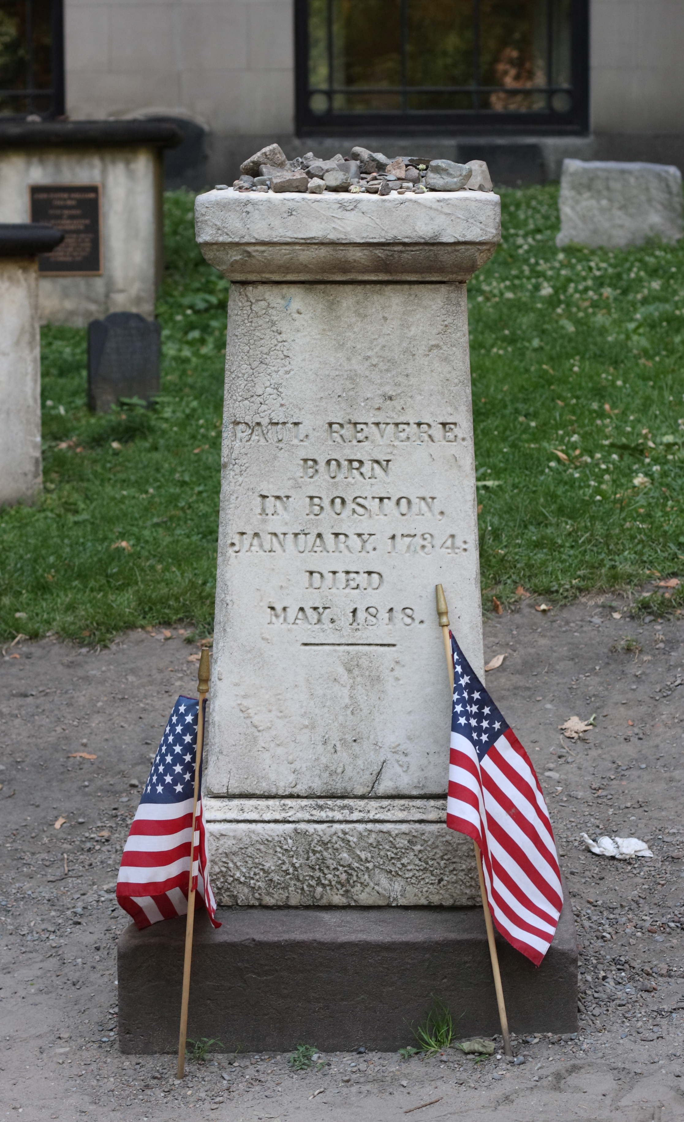
- Paul Revere (1735-1818), silversmith, Revolutionary War Patriot
- Increase Sumner (1746-1799), third Governor of Massachusetts
- Nathan Webb , (1705-1772), pastored the first new Congregational Church in Massachusetts started during the Great Awakening period for over 41 years
- Benjamin Woodbridge (1708-1728), victim of the first duel fought in Boston[15]
- Samuel Sewall (1652-1730) Salem Witch trials judge
- John Smibert (1688 - 1751) Scottish-American artist
- John Endecott (c. 1588 – March 15, 1665), first Governor of Massachusetts (His grave stone has been destroyed and for many years it was thought - erroneously - that he was buried in the King’s Chapel Burying Ground. But recent evidence has proven conclusively that he was buried in tomb 189 of the Granary Burying Ground)
Image gallery
-

Grave of Samuel Adams.
-

Grave of Crispus Attucks, Christopher Sider, and other victims of the Boston Massacre
-

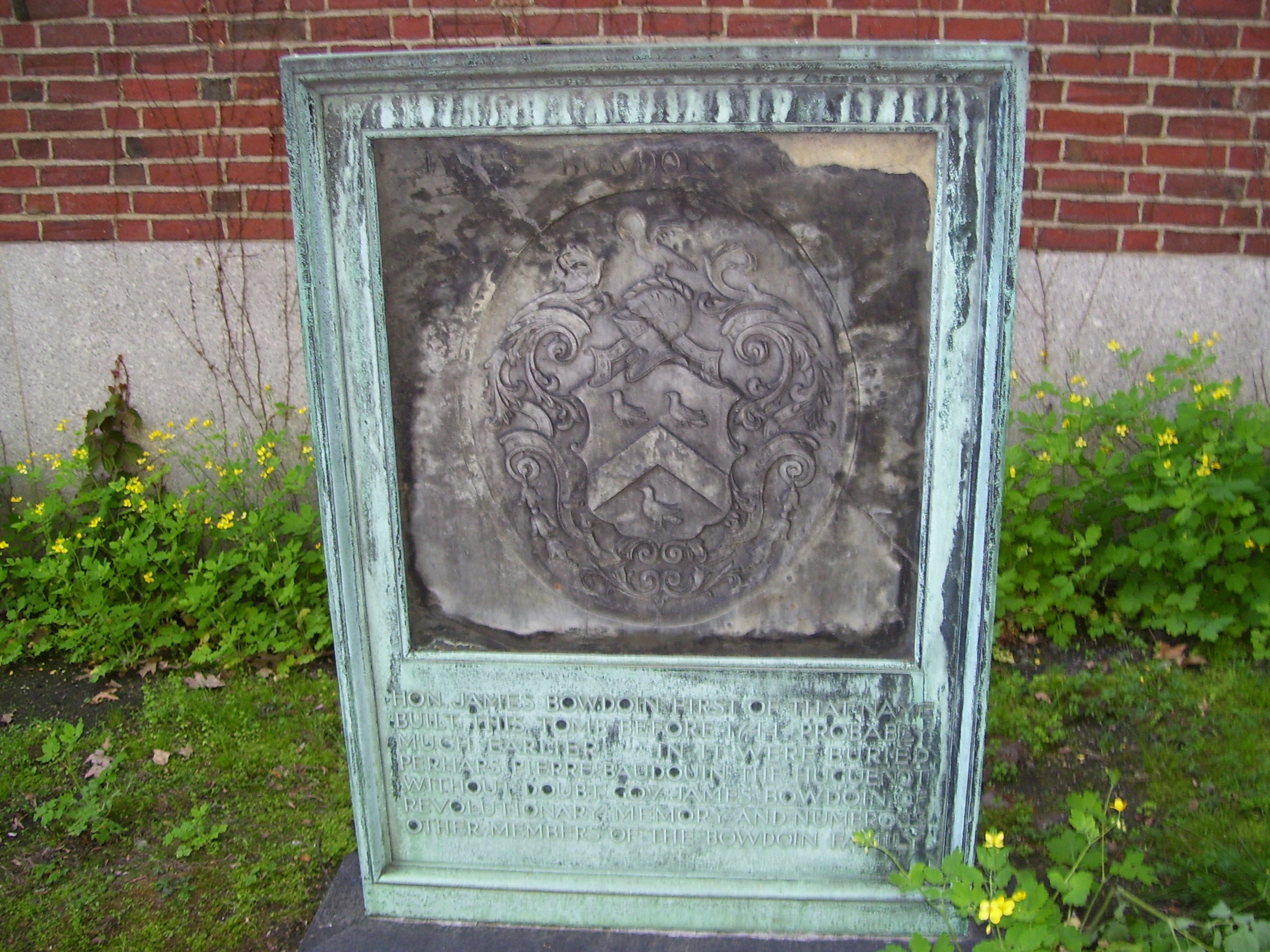
James Bowdoin's tomb.
-
Peter Faneuil's tomb.
-
Mary Goose's grave.
-

John Hancock memorial.
-

James Otis' grave.
-

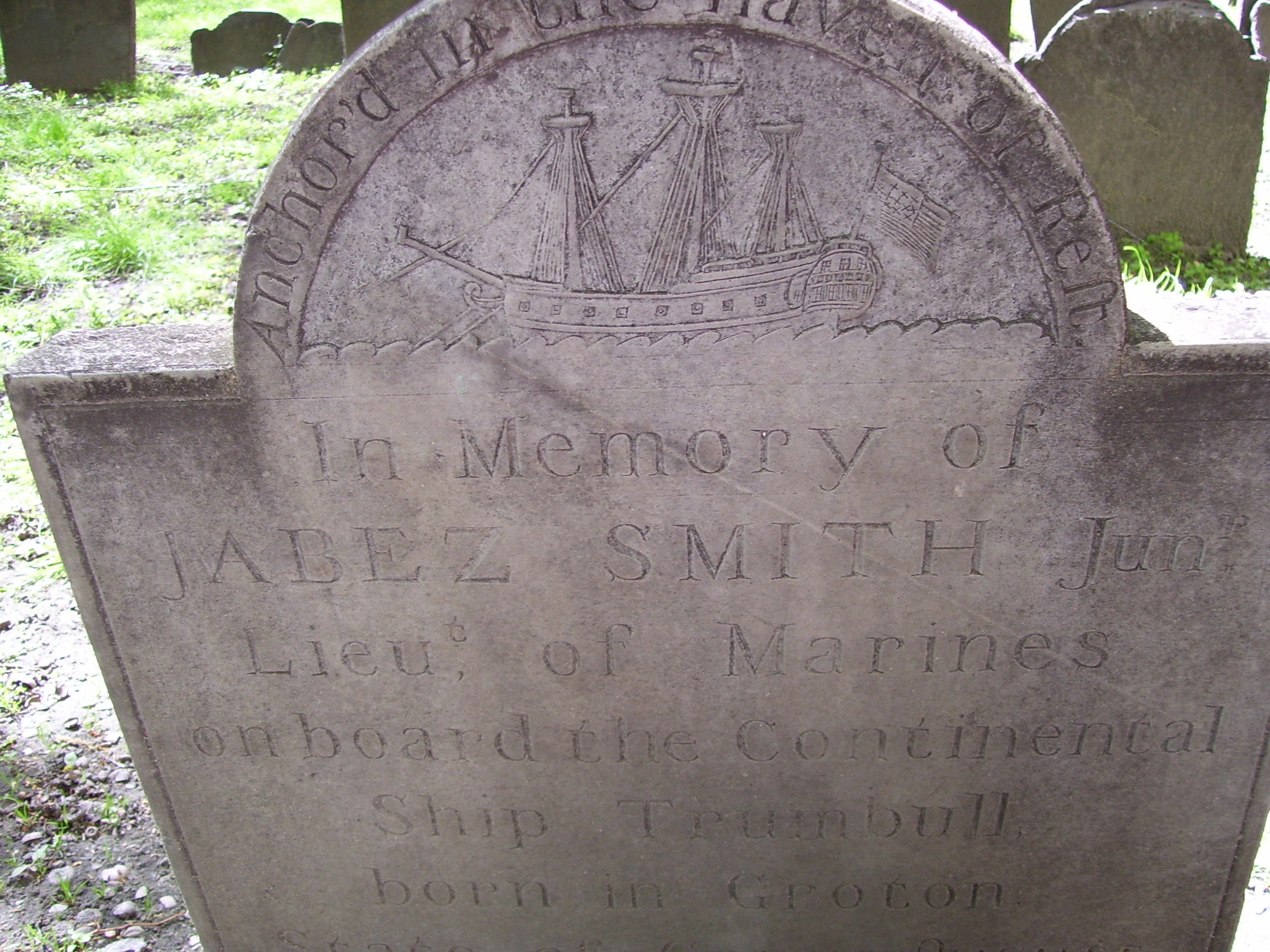
USS Trumbull (1776) depicted on the 1780 grave of Lt. Jabez Smith, killed aboard the ship
-

Grave of Increase Sumner fifth Governor of Massachusetts
-

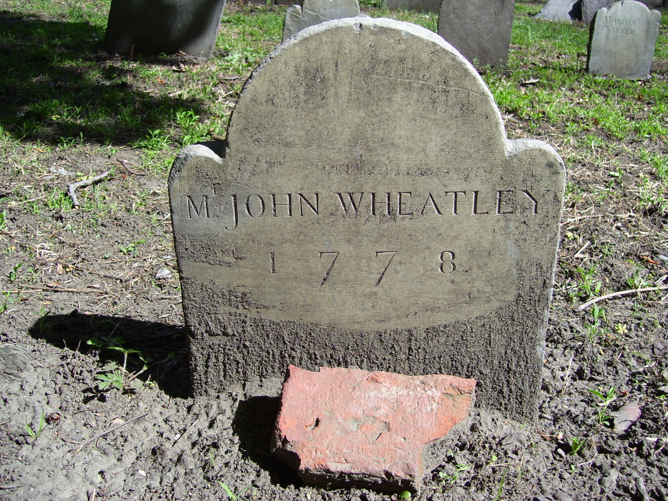
Grave of John Wheatley, owner of Phillis Wheatley.
See also
- Central burying ground
- Copp's Hill Burying Ground
- King's Chapel burying ground
- List of cemeteries in Boston, Massachusetts
References
- ^ Abel, David (16 May, 2011). "Colonial Resting Place Slated for Upgrade". Boston Globe. http://articles.boston.com/2011-05-16/news/29549185_1_granary-tombs-grave-markers. Retrieved 2 June, 2011.
- ^ James Stevens Curl, The Egyptian Revival, Routledge, 2005, p, 300
- ^ D. Brenton Simons (New England Historic Genealogical Society) Boston beheld: antique town and country views University Press of New England, 2008
- ^ Shurtleff p 211
- ^ Bridgeman, Thomas (1856). The Pilgrims of Boston and their Descendants. New York: D. Appleton and Company. http://books.google.com/books?id=oPQWAAAAYAAJ&printsec=frontcover&dq=the+pilgrims+of+boston. Retrieved 29 April, 2009.
- ^ Shurtleff p 216
- ^ James Stevens Curl, The Egyptian Revival, Routledge, 2005, p, 300
- ^ Ryan, Andrew; John R. Ellement (12 February, 2009). "Burying ground yields a secret". Boston Globe. http://www.boston.com/news/local/massachusetts/articles/2009/02/12/burying_ground_yields_a_secret/. Retrieved May 1, 2009.
- ^ Abel, David (16 May, 2011). "Colonial Resting Place slated for Upgrade". Boston Globe. http://articles.boston.com/2011-05-16/news/29549185_1_granary-tombs-grave-markers. Retrieved 6 June, 2011.
- ^ Shurtleff p 219
- ^ "Granary - City of Boston". Boston, Massachusetts: City of Boston. http://www.cityofboston.gov/parks/HBGI/hbginfo.asp?ID=16. Retrieved 4 August 2011. "The gravestones� original haphazard configuration was rearranged into straighter rows over to the years to accommodate both nineteenth-century aesthetics and the modern lawnmower."
- ^ "Mother Goose; Longevity of the Boston Myth— The Facts of History in this Matter, The New York Times, 4 February 1899 (on-line text).
- ^ Collected editions were published in 1650, 1660 and 1665; the 1650 reference to "ma mère l"Oye" was noted by William Bracy in Encyclopedia Americana, s.v. "Mother Goose" 1965:512),
- ^ Charles Francis Potter, "Mother Goose", Standard Dictionary of Folklore, Mythology, and Legends II (1950), p. 751f. "Isaiah Thomas reprinted Robert Samber's Histories or Tales of Past Times, Told by Mother Goose (London, 1729), under the same title, in 1786".
- ^ Shurtleff p 222
Sources
Shurtleff, Nathaniel Bradstreetl (1871). A Topographical and Historical Description of Boston. Boston: Boston City Council. pp. 210–226. http://books.google.com/books?id=UWkUAAAAYAAJ&pg=PA210&dq=granary+burying+ground&as_brr=1#PPA226,M1.
Coordinates: 42°21′27″N 71°03′42″W / 42.357367°N 71.061641°W
External links
Preceded by
Park Street ChurchLocations along Boston's Freedom Trail
Granary Burying GroundSucceeded by
King's ChapelCategories:- Cemeteries in Boston, Massachusetts
- Cemeteries in Massachusetts
- Freedom Trail
- 1660 establishments
- Financial District, Boston


Wikimedia Foundation. 2010.