Milborne St Andrew

Milborne St Andrew

Coordinates: 50°47′N 2°17′W / 50.78°N 2.28°W / 50.78; -2.28

Milborne St Andrew
Milborne St Andrew.jpg
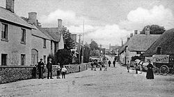
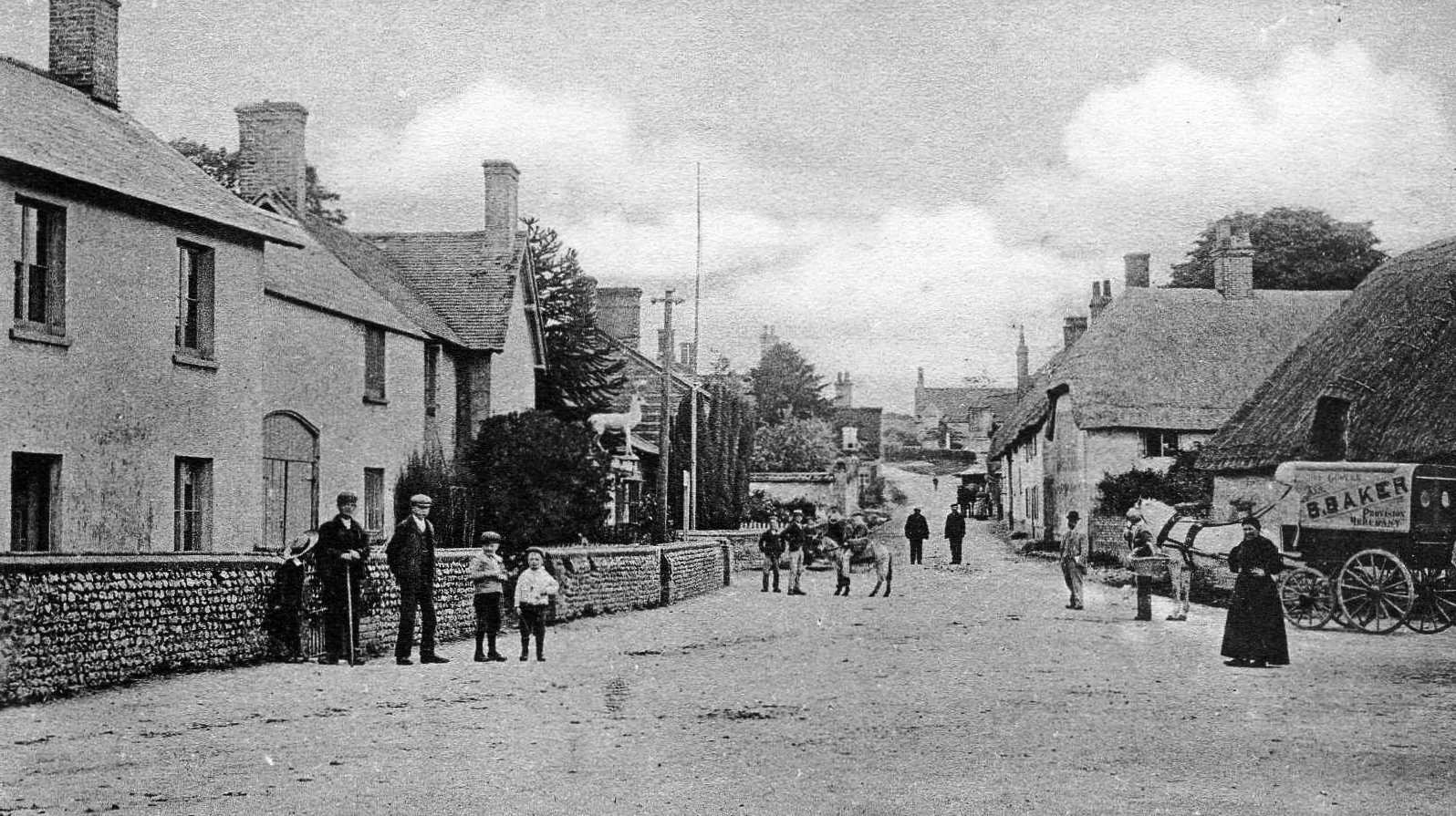
Milborne St Andrew circa 1900
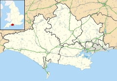
Milborne St Andrew is located in Dorset
Milborne St Andrew

 Milborne St Andrew shown within Dorset
Population 1,042 
OS grid reference SY805975
Shire county Dorset
Region South West
Country England
Sovereign state United Kingdom
Post town DORCHESTER
Postcode district DT11
Police Dorset
Fire Dorset
Ambulance South Western
EU Parliament South West England
List of places: UK • England • Dorset

Milborne St Andrew is a village in central Dorset, England, situated in a winterbourne valley on the dip slope of the Dorset Downs, straddling the A354 road nine miles north east of Dorchester. The village has a population of 1,042 (2001). A mile south of the village is Weatherby Castle hill fort, the 'tower' of Thomas Hardy's novel Two on a Tower.

There is an infants' school, Milbourne St Andrew First School [1], rated 'Outstanding' by Ofsted in 2009. The village also has a pub, the Royal Oak, a church, St Andrew's (Church of England) founded in 1069, and other community facilities, most notably the sports club and pavilion, home of the Milborne Sports Football Club which was nominated Dorset FA Charter Club of the Year in 2008.

External links


Wikimedia Foundation. 2010.

Игры ⚽ Поможем сделать НИР

Look at other dictionaries:

  • List of schools in the South West of England — The following is a partial list of currently operating schools in the South West region of England. You may also find of use to find a particular school. See also the List of the oldest schools in the United Kingdom.Listed by local education… …   Wikipedia

  • Thomas Hardy — This article is about the novelist and poet. For other uses, see Thomas Hardy (disambiguation). Thomas Hardy Born 2 June 1840(1840 06 02) Stinsford, Dorchester, Dorset, England …   Wikipedia

  • Orphanage — For other uses, see Orphanage (disambiguation). Former Berlin Pankow orphanage …   Wikipedia

  • List of hundreds in Dorset — This is a list of hundreds (i.e., administrative subdivisions) in the county of Dorset, England. Between the Anglo Saxon period and the Poor Law Amendment Act 1834, the county of Dorset was divided into hundreds and boroughs (and from the… …   Wikipedia

  • List of unions in Dorset — List of Dorset Poor Law UnionsThe Poor Law Amendment Act 1834 and its administration entailed the creation of entirely new administrative areas throughout the United Kingdom: groups of parishes known as Poor Law Unions or simply Unions .( Parish… …   Wikipedia

  • List of sanitary districts in Dorset — Under the Public Health Acts 1873 and 1875 the Poor Law Unions were used as the basis for sanitary districts. All municipal boroughs and areas with bodies such as improvement commissioners became Urban Sanitary Districts. (Any area which acquired …   Wikipedia

  • List of poor law unions in Dorset — The Poor Law Amendment Act 1834 and its administration entailed the creation of entirely new administrative areas throughout the United Kingdom: groups of parishes known as Poor Law Unions or simply Unions. (Parish here = civil parish, defined as …   Wikipedia

  • North Dorset — For the constituency, see North Dorset (UK Parliament constituency). North Dorset District   Non metropolitan district   …   Wikipedia

  • Dewlish — is a village in Dorset, England, seven miles north east of Dorchester in the Dorset Area of Outstanding Natural Beauty (AONB). The village has a population of 254 (2001). The village pub, The Oak at Dewlish, runs darts, pool and cribbage teams.… …   Wikipedia

  • List of places in Dorset — This is a list of settlements and other places in Dorset, England. Settlements with a population over 3,000 are in bold. For a list of districts see the main Dorset article. See List of places in England for settlements in other… …   Wikipedia

Share the article and excerpts

Direct link
Do a right-click on the link above
and select “Copy Link”