- LaBelle, Florida
Infobox Settlement
official_name = LaBelle, Florida
other_name =
native_name =
nickname =
settlement_type =City
motto =
imagesize = 229x172
image_caption = City of LaBelle - "Under the Oaks Since 1925"
flag_size =
image_
seal_size =
image_shield =
shield_size =
image_blank_emblem =
blank_emblem_type =
blank_emblem_size =
imagesize = 229x172
image_caption = City of LaBelle - "Under the Oaks Since 1925"
flag_size =
image_
seal_size =
image_shield =
shield_size =
image_blank_emblem =
blank_emblem_type =
blank_emblem_size =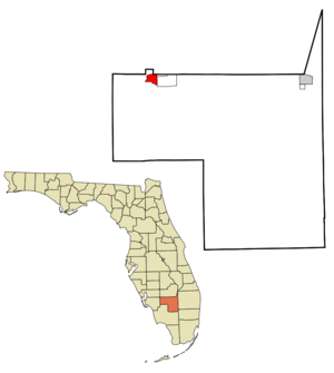
mapsize = 250x200px
map_caption = Location in Hendry County and the state ofFlorida
mapsize1 =
map_caption1 =
image_dot_
dot_mapsize =
dot_map_caption =
dot_x =
dot_y =
pushpin_
pushpin_label_position =
pushpin_map_caption =
pushpin_mapsize =
subdivision_type = Country
subdivision_name = flag|United States
subdivision_type1 = State
subdivision_name1 = flag|Florida
subdivision_type2 = County
subdivision_name2 = noflag|Hendry
subdivision_type3 =
subdivision_name3 =
subdivision_type4 =
subdivision_name4 =
government_footnotes =
government_type =
leader_title =
leader_name =
leader_title1 =
leader_name1 =
leader_title2 =
leader_name2 =
leader_title3 =
leader_name3 =
leader_title4 =
leader_name4 =
established_title =
established_date =
established_title2 =
established_date2 =
established_title3 =
established_date3 =
area_magnitude =
unit_pref = Imperial
area_footnotes =
area_total_km2 = 9.2
area_land_km2 = 9
area_water_km2 = 0.2
area_total_sq_mi = 3.6
area_land_sq_mi = 3.5
area_water_sq_mi = 0.1
area_water_percent =
area_urban_km2 =
area_urban_sq_mi =
area_metro_km2 =
area_metro_sq_mi =
area_blank1_title =
area_blank1_km2 =
area_blank1_sq_mi =
population_as_of = 2000
population_footnotes =
population_note =
population_total = 4210
population_density_km2 = 457.6
population_density_sq_mi = 1169.4
population_metro =
population_density_metro_km2 =
population_density_metro_sq_mi =
population_urban =
population_density_urban_km2 =
population_density_urban_sq_mi =
population_blank1_title =
population_blank1 =
population_density_blank1_km2 =
population_density_blank1_sq_mi =
timezone = Eastern (EST)
utc_offset = -5
timezone_DST = EDT
utc_offset_DST = -4
latd = 26 |latm = 45 |lats = 38 |latNS = N
longd = 81 |longm = 26 |longs = 21 |longEW = W
elevation_footnotes =
elevation_m = 4
elevation_ft = 13
postal_code_type =ZIP code s
postal_code = 33935, 33975
area_code = 863
blank_name = FIPS code
blank_info = 12-37225GR|2
blank1_name = GNIS feature ID
blank1_info = 0285188GR|3
website =
footnotes =LaBelle is a city in and the county seat of Hendry County,
Florida ,United States . The population was 4,210 at the 2000 census. As of 2004, the population recorded by theU.S. Census Bureau is 4,480 [http://www.census.gov/popest/cities/tables/SUB-EST2004-04-12.xls] . It was named for Laura and Belle Hendry, daughters of pioneer cattlemanFrancis A. Hendry .LaBelle hosts the annual Swamp Cabbage Festival, which is held in honor of the Florida state tree during the last full weekend of February.
The city is somewhat unique in that the low population of the county makes Clewiston the center of economic activity for the county, but LaBelle is the county seat. For example the only hospital in the county is in
Clewiston and all the larger retailers and motels are there too. The governmental departments enable LaBelle to compete somewhat with Clewiston.LaBelle is known to be a cattle town, with more cows than people in the city.
Geography
LaBelle is located at coor dms|26|45|38|N|81|26|21|W|city (26.760591, -81.439104)GR|1.
According to the
United States Census Bureau , the city has a total area of 3.5square mile s (9.2km² ), of which, 3.5 square miles (9.0 km²) of it is land and 0.1 square miles (0.2 km²) of it (2.54%) is water.Demographics
As of the
census GR|2 of 2000, there were 4,210 people, 1,440 households, and 995 families residing in the city. Thepopulation density was 1,214.0 people per square mile (468.4/km²). There were 1,739 housing units at an average density of 501.4/sq mi (193.5/km²). The racial makeup of the city was 73.28% White, 11.26% African American, 0.62% Native American, 0.33% Asian, 12.47% from other races, and 2.04% from two or more races. Hispanic or Latino of any race were 31.35% of the population.There were 1,440 households out of which 32.2% had children under the age of 18 living with them, 55.2% were married couples living together, 10.2% had a female householder with no husband present, and 30.9% were non-families. 25.9% of all households were made up of individuals and 14.1% had someone living alone who was 65 years of age or older. The average household size was 2.71 and the average family size was 3.26.
In the city the population was spread out with 26.8% under the age of 18, 8.5% from 18 to 24, 25.5% from 25 to 44, 18.3% from 45 to 64, and 20.9% who were 65 years of age or older. The median age was 36 years. For every 100 females there were 102.7 males. For every 100 females age 18 and over, there were 99.8 males.
The median income for a household in the city was $31,642, and the median income for a family was $39,550. Males had a median income of $26,327 versus $21,979 for females. The
per capita income for the city was $15,652. About 12.9% of families and 18.0% of the population were below thepoverty line , including 21.1% of those under age 18 and 15.4% of those age 65 or over.Notable people
*
Martín Gramática -NFL place kicker
*Bill Gramática -NFL place kickerReferences
External links
* [http://www.citylabelle.com City of LaBelle Web site]
* [http://www.swampcabbagefestival.org/ Swamp Cabbage Festival Web site]
* [http://www.uflib.ufl.edu/UFDC/?c=fdnl1&b=UF00027799 "Caloosa Belle"] newspaper that serves LaBelle, Florida is available archived in full-text with images in [http://www.uflib.ufl.edu/UFDC/?c=fdnl1 Florida Digital Newspaper Library]
Wikimedia Foundation. 2010.