- Collingbourne Kingston
-
Coordinates: 51°18′04″N 1°39′25″W / 51.301°N 1.657°W
Collingbourne Kingston 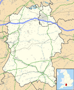
 Collingbourne Kingston
Collingbourne Kingston shown within WiltshirePopulation 456 (2001 Census)[1] OS grid reference SU2455 Parish Collingbourne Kingston Unitary authority Wiltshire Ceremonial county Wiltshire Region South West Country England Sovereign state United Kingdom Post town Marlborough Postcode district SN8 Dialling code 01264 Police Wiltshire Fire Wiltshire Ambulance Great Western EU Parliament South West England UK Parliament Devizes List of places: UK • England • Wiltshire Collingbourne Kingston is a village and civil parish about 8 miles (13 km) south of the market town of Marlborough in Wiltshire, England. It is one of several villages on the River Bourne, which is a seasonal river usually dry in summer.
The toponym Collingbourne meanes the Bourne as the stream of Cola's people. Collingbourne Kingston was so named to distinguish it from its southerly neighbour Collingbourne Ducis. Until the 14th century Collingbourne Kingston was called Collingbourne Abbot's: with reference to Hyde Abbey, Winchester, the owner of the principal manor. The change to Kingston was a reference to the appearance of Collingbourne in the Domesday Book.[2]
Contents
Local government
The civil parish originally contained Collingbourne Kingston, Aughton, Brunton, and Sunton, and part of Cadley hamlet. In 1934 Sunton and the part of Cadley were transferred to Collingbourne Ducis and in 1987 it was further reduced when its south-east and south-west parts were also transferred to Collingbourne Ducis.[2]
Collingbourne Kingston is part of the Tidworth Community Area.[clarification needed]
Location
Position: grid reference SU240558
The A338 trunk road runs through Collingbourne Kingston.
Population
No. Year Collingbourne Kingston Wiltshire 1 1801 731 185,107 2 1811 746 193,828 3 1821 817 222,157 4 1831 913 240,156 5 1841 933 258,733 6 1851 922 254,221 7 1861 903 249,311 8 1871 841 257,177 9 1881 696 258,965 10 1891 739 264,997 11 1901 744 271,394 12 1911 748 286,822 13 1921 669 292,208 14 1931 585 303,373 15 1951 440 386,692 16 1961 397 422,950 17 1971 410 486,747 18 1981 441 518,545 19 1991 454 564,471 20 2001 456 613,024 Amenities
The village has a petrol station with garage and small shop open Monday to Saturday. There is no post office in the village. The nearest post offices are in Collingbourne Ducis and Burbage. The nearest supermarkets are in Ludgershall, Tidworth and Pewsey.
The village has a public house.[4] It is now called the Barleycorn Inn but was previously the Kingston Hotel and The Cleaver. A former public house called the Windmill Inn is now a private house.
Education
The original school, now a bed and breakfast establishment called "The Old School House" was opened in 1845 and served the children of the local farmworkers and craftsmen. It was ahead of its time as universal education was not introduced until thirty years later.[5] The village school closed in 1978 and the primary age children now attend the newly-built school in neighbouring Collingbourne Ducis.
Children of secondary school age are able to attend Pewsey Vale School, Castledown School in Ludgershall and St John's School and Community College in Marlborough.
Church and chapel
The Church of England parish church of Saint Mary is in the centre of the village. In 1344 its dedicatee was Saint John the Baptist but by 1763 it was dedicated to St. Mary. In 1862 it was altered and extensively restored by John Colson. It is an 11th century Norman building and there is a possibility that it stands on the site of an earlier Saxon church. The oldest features of the church are the round Norman pillars in the nave. Each has a different capital, one with a lady facing the south door. There are four arches to the southern arcade, but only three to the northern one.
The 13th and 14th centuries gave the Church its ornate chancel arch, with four depths of moulded spandrels and foliage capitals set on Purbeck marble piers. An engraving of the church in 1806 shows the original lower ridge of the nave roof, giving a better proportion to its relationship with the fine tower with its carved pinnacles and strange gargoyles. At that time there were only four round clerestory windows on each side of the north and south walls of the nave. In the 1860s the roof was raised and the clerestory windows increased to six on each side.
The Conacher two manual, 1210 pipe organ came from the parish church of Lavenham, Suffolk in 1997. It was blessed by the Bishop of Salisbury who then played a piece by Bach on it.
Two recent windows are the Wilson Memorial window on the north side of the chancel, and the tiny Ruth Fisher window in the vestry. The huge canopied Pile family tomb stands to the right of the altar, and therein lie Gabriel Pile who died in 1626, and his wife Anne.
St. Mary’s ring of six bells is amongst the finest in England[citation needed] and is played regularly by the local team of bellringers. The old second bell stands in retirement in the south aisle.[6]
Further south in the village is a Methodist chapel built in 1914 to replace an earlier chapel built in 1819. The chapel was sold as a private home in 1987.
Twinning Association
 Collingbourne and District are twinned with Le Merlerault, Normandy in France. The twinning agreement was made on 18 April 1992.
Air crash and railway
In 1943 a female pilot apparently crashed into the roof of No 54 The High Street taking off its thatched roof.[7] This house also served as the ticket office for the Collingbourne Kingston Halt railway station on the Midland and South Western Junction Railway.[8] The station opened in 1932 on a line that had been open since 1882 and closed to passengers in 1961.[9]
See also
References
- ^ "Area selected: Kennet (Non-Metropolitan District)". Neighbourhood Statistics: Full Dataset View. Office for National Statistics. http://neighbourhood.statistics.gov.uk/dissemination/viewFullDataset.do;jsessionid=ac1f930b30d8251a33137b414aacb8d5d1a9029f24bf?instanceSelection=03070&productId=779&$ph=60_61&datasetInstanceId=3070&startColumn=1&numberOfColumns=4&containerAreaId=790549. Retrieved 16 June 2010.
- ^ a b Collingbourne Kingston | British History Online
- ^ Wiltshire Council - Wiltshire Community History Get Population/Census Information
- ^ The Barleycorn Inn
- ^ The Old School House, http://www.wiltshirebedandbreakfast.co.uk/index.htm
- ^ Savernake Team - The Parishes
- ^ History
- ^ Swindon's Other Railway
- ^ Mike Oakley. Wiltshire Railway Stations (2004 ed.). Wimborne: Dovecote Press. pp. 43–44. ISBN 1 904349 33 1.
Sources
- Wiltshire County Council Website page on Collingbourne Kingston, retrieved 20:00 Oct 12, 2004 (UTC)
External links
Categories:- Villages in Wiltshire

Wikimedia Foundation. 2010.