- Channel Country
-
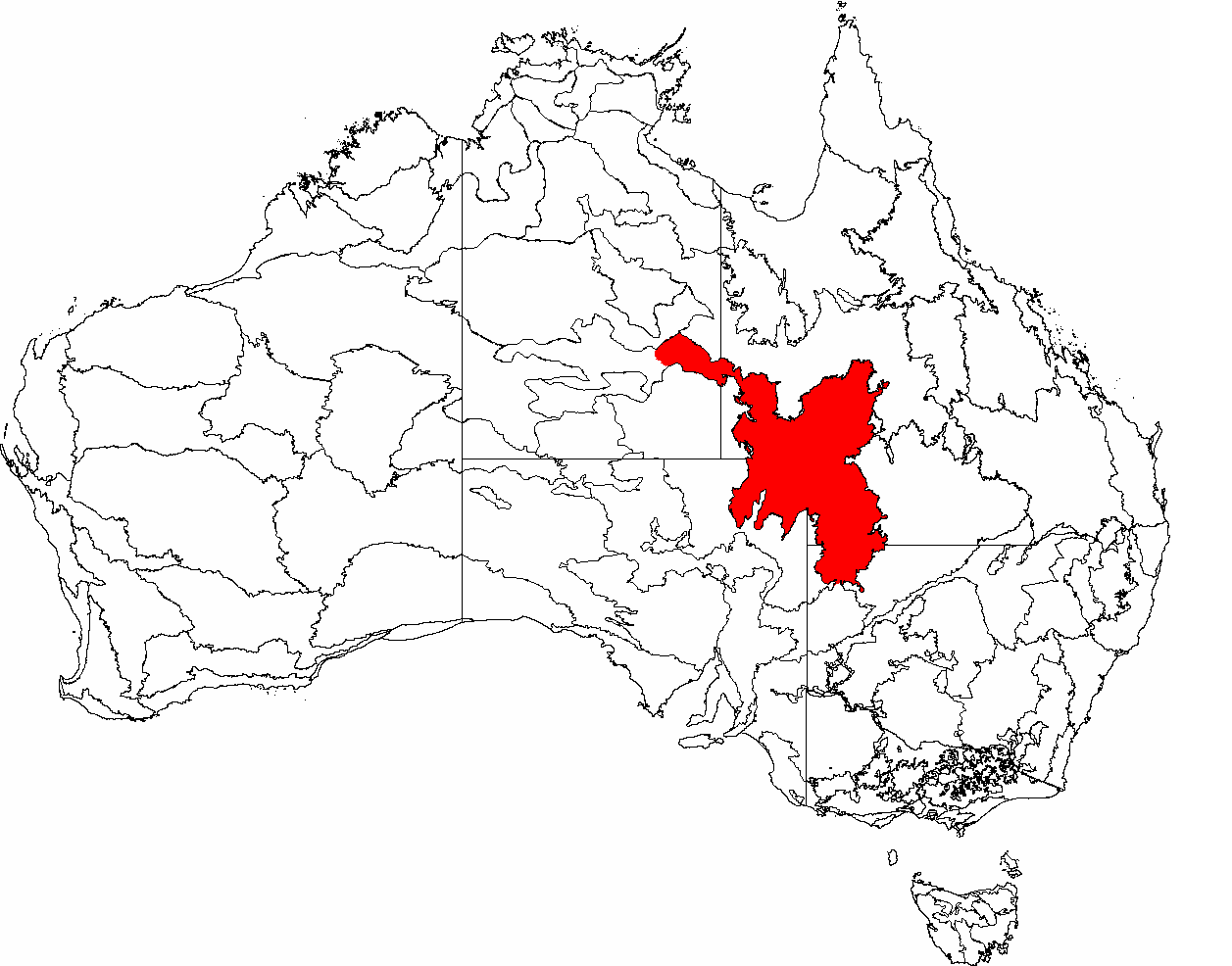
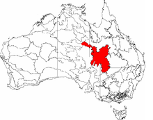 The IBRA regions of Australia, with Channel Country in red
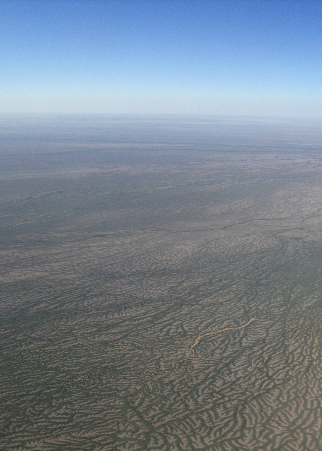
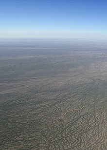 Overhead Channel Country / Cooper Creek
The Channel Country is region of outback Australia located mostly in the state of Queensland but also in portions of South Australia, Northern Territory and New South Wales.[1][2] The name comes from the numerous intertwined rivulets that cross the region, which cover 150,000 km².[3] The Channel Country is situated over the Cooper and Eromanga geological basins and the Lake Eyre Basin drainage basin. Further to the east is the less arid Maranoa district.
Birdsville and Windorah are the most prominent towns in the area. Other settlements include Betoota and Bedourie. Haddon Corner is also located in the Channel Country.
The Channel Country features an arid landscape with a series of ancient flood plains from rivers which only flow intermittently. The principal rivers are Georgina River, Cooper Creek and the Diamantina River. When there is sufficient rainfall in their catchment area these rivers flow into Lake Eyre, South Australia. In most years the flood waters are absorbed into the earth or evaporate, however. One of the most significant rainfall events occurred in 2010 when a monsoonal low from ex-Cyclone Olga created a period of exceptional rainfall.[4]
The primary land use is cattle grazing which has replaced sheep grazing.[5] It is estimated that in the Queensland section alone there are between half to one million head of cattle.[6] The area's towns and cattle stations are serviced by a mail run that is operated by West Wing Aviation which delivers goods and passengers as well as mail.[7]
The Channel Country is the location for a majority of Min Min light sightings. It is also home to at least two important bird areas, Lake Yamma Yamma and the Lake Machattie Area.
Bioregion
The Interim Biogeographic Regionalisation for Australia Channel Country Bioregion covers a larger area, extending into South Australia, the Northern Territory and New South Wales and includes the town of Innamincka.[2]
See also
References
- ^ Channel Country Bioregion New South Wales Department of Environment, Climate Change and Water.
- ^ a b "Rangelands - Overview - Channel Country". Australian Natural Resources Atlas. Department of the Environment, Water, Heritage and the Arts. http://www.anra.gov.au/topics/rangelands/overview/qld/ibra-chc.html. Retrieved 2009-09-11.
- ^ Reardon, Mitch (1995). The Australian Geographic Book of Corner Country. Terrey Hills, New South Wales: Australian Geographic. pp. 93. ISBN 1862760128.
- ^ "Channel Country rain will boost cattle feed". ABC Rural (Australian Broadcasting Corporation). 3 February 2010. http://www.abc.net.au/rural/news/content/201002/s2808740.htm. Retrieved 18 May 2010.
- ^ "Boulia: Capital of the Channel Country". Boulia Shire Council. http://www.boulia.qld.gov.au/. Retrieved 18 May 2010.
- ^ Ben Lynes (August 2007). "Focus on the Channel Country". The State of Queensland. http://www.dpi.qld.gov.au/30_7211.htm. Retrieved 18 May 2010.
- ^ "West Wing Aviation Mail Runs". http://www.westwing.com.au/mail-runs.html. Retrieved 2008-09-12.
Coordinates: 25°59′47.04″S 140°59′57.52″E / 25.9964°S 140.9993111°E
Categories:- Regions of Queensland
- IBRA regions
- Lake Eyre basin
Wikimedia Foundation. 2010.