- Debel, Lebanon
-
Debel/Dibil
دبل— City — Location within Lebanon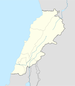
 Debel/Dibil
Coordinates: 33°07′N 35°22′E / 33.117°N 35.367°ECoordinates: 33°07′N 35°22′E / 33.117°N 35.367°E Country  Lebanon
Governorate Nabatieh Governorate District Bint Jbeil District Highest elevation 650 m (2,133 ft) Lowest elevation 560 m (1,837 ft) Time zone EET (UTC+2) – Summer (DST) EEST (UTC+3) Postal code Dialing code +961 Debel (also spelled Dibil, Arabic: دبل) is a Lebanese village located in the caza of Bint Jbeil in the Nabatiye Governorate in Lebanon.
Geography
Debel occupies several hills with elevation ranging from 560 to 650 meters above sea level. The main agricultural products of Debel are olives and tobacco.
Demography
The people of Debel are Lebanese and are followers of the Maronite Catholic Church.
References
Capital: Bint JbeilTowns and villages · Aynata · Ain Ebel · Aitaroun · Ayta al-Jabal · Ayta ash Shab · Bayt Lif · Bayt Yahoun · Bint Jbeil · Brashit · Burj Qallawiyah · Chakra we Doubiyah · Dayr Antar · Debel · Frun · Ghanduriyah · Haddatha · Hanin · Haris · Jumayjimah · Kafra · Kafr Dunin · Khirbet Selm · Kunin · Maroun al-Ras · Qalouet · Qaouzah · Rachaf · Ramyah · Rmaich · Safad al-Battikh · as-Sultaniyah · Sribbin · Tebnine · Tiri · Yaroun · Yater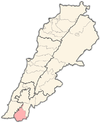
Notable landmarks ·Notable people ·Categories:- Lebanon geography stubs
- Bint Jbeil District
- Populated places in the Nabatieh Governorate


Wikimedia Foundation. 2010.