- Nafferton
-
Coordinates: 54°01′10″N 0°23′25″W / 54.019429°N 0.390216°W
Nafferton 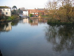
Nafferton Mere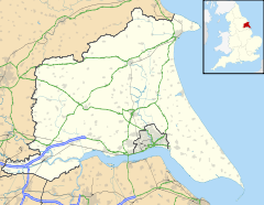
 Nafferton
Nafferton shown within the East Riding of YorkshirePopulation 2,184 (2001 census)[1] OS grid reference TA055593 Parish Nafferton Unitary authority East Riding of Yorkshire Ceremonial county East Riding of Yorkshire Region Yorkshire and the Humber Country England Sovereign state United Kingdom Post town DRIFFIELD Postcode district YO25 Dialling code 01377 Police Humberside Fire Humberside Ambulance Yorkshire EU Parliament Yorkshire and the Humber UK Parliament East Yorkshire List of places: UK • England • Yorkshire Nafferton is a village and civil parish in the East Riding of Yorkshire, England. It is situated approximately 2 miles (3.2 km) north east of Driffield town centre and lies just south of the A614 road. It is served by Nafferton railway station on the Yorkshire Coast Line from Hull to Scarborough. According to the 2001 UK census, Nafferton parish had a population of 2,184.[1]
Contents
Toponomy
The name Nafferton derives from Old Scandinavian: -
Nattfari: a personal name
ton: farm
hence, Nattfari's farm.Nafferton is listed in the Domesday Book as "Nadfartone".[2][3] The present name came into use in the thirteenth century.[citation needed]
History
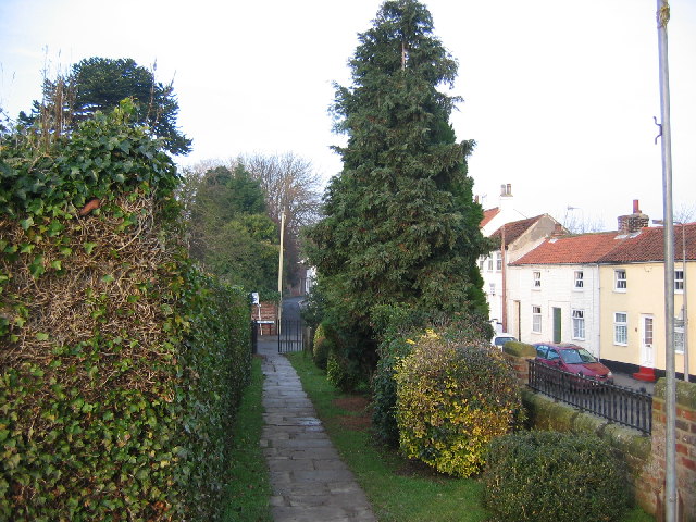
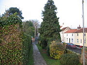 Nafferton, looking north from the churchyard
Archaeological evidence for settlement in the area dates back to the mesolithic. Early hunter-gatherers established temporary camp sites throughout the area, subsisting from woodlands foraging, deer, boars, bears, and wild cattle. The nearby Yorkshire Wolds were later the site of substantial human activity during the neolithic and the area features burial mounds, with frequent finds of lithic technology.
The oldest surviving building in the village is the church, parts of which date from the 13th century. The mere, a large expanse of water fed by natural springs was formerly a mill pond.[4]
References
- ^ a b "2001 Census: Key Statistics: Parish Headcounts: Area: Nafferton CP (Parish)". Neighbourhood Statistics. Office for National Statistics. http://neighbourhood.statistics.gov.uk/dissemination/LeadTableView.do?a=3&b=791005&c=Nafferton&d=16&e=15&g=390779&i=1001x1003x1004&m=0&r=1&s=1211194920059&enc=1&dsFamilyId=779. Retrieved 19 May 2008.
- ^ "Nafferton", Domesdaymap.co.uk. Retrieved 19 November 2011
- ^ "Documents Online: Nafferton", Folios: 301r, 322v, 382r, Great Domesday Book; The National Archives. Retrieved 19 November 2011
- ^ East Yorkshire Federation of Women's Institutes (1991). The East Yorkshire Village Book. The Villages of Britain. Newbury: Countryside Books. pp. 147–148. ISBN 1853061387.
- Harrison, Stephen, ed (2000). Nafferton: A Living Past. Hull: Nafferton Millennium Committee.
- Gazetteer — A–Z of Towns Villages and Hamlets. East Riding of Yorkshire Council. 2006. p. 8.
External links
- The Villages of the Yorkshire Wolds : Nafferton
- Nafferton village parish council web site
- Local News - Nafferton Today
Categories:- Villages in the East Riding of Yorkshire
- Civil parishes in the East Riding of Yorkshire
- East Riding of Yorkshire geography stubs


Wikimedia Foundation. 2010.