- Drybrook
-
Coordinates: 51°43′43″N 2°31′43″W / 51.7286°N 2.5285°W
Drybrook 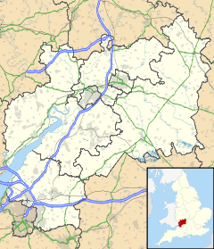
 Drybrook
Drybrook shown within GloucestershirePopulation 2,855 (2001 Census) OS grid reference SO6303 District Forest of Dean Shire county Gloucestershire Region South West Country England Sovereign state United Kingdom Police Gloucestershire Fire Gloucestershire Ambulance Great Western EU Parliament South West England List of places: UK • England • Gloucestershire Drybrook is a village and civil parish in the Forest of Dean in west Gloucestershire, England.
Contents
Location
It lies near the middle of the Royal Forest, about three miles from Cinderford, and about two miles from Mitcheldean.
Population
In the 2001 census, Drybrook had a population of 2,855.[1] This includes 1,391 men and 1,464 women. There are 1,146 households in the village.
Amenities
The village has a range of amenities, including a butcher, chemist, general stores, hairdresser, post office, fish and chips shop, builder's merchant, doctor's surgery, nursery school, primary school, two garages, public house, off-licence, and a bus service to Gloucester and surrounding areas.
The nearest secondary school is Dene Magna School, which is in Mitcheldean. Drybrook is also renowned for its rugby club, which is at the top of the High Street, and it also has a football club up Harrow Hill. Among the villages in the Forest of Dean, Drybrook has been voted one of the best villages to live in, for its scenery and leisure. There are about 3,000 people living in Drybrook.
Drybrook School and Dene Magna
Drybrook School, which is the village's only school, is a primary school for students of ages 4 years through 11 years. The nearest secondary school is Dene Magna Community School, which is in Abenhall, by Mitcheldean. Dene Magna Community School is about 1 mile from Drybrook.
Drybrook
Drybrook is also known as a royal hunting ground, where the so-called legend of the black panther and the white deer roamed. Unfortunately, the white deer was killed after being hit down and then trophy hunters cut off its head, but the police have not caught the person responsible. Drybrook also had a good supply of coal and stone. As Drybrook grew, so did its boundary, and it grew to include a small village called Harrow Hill (or as most locals call it, Harry Hill). The village's first modern church, The Holy Trinity Church, was built on Harrow Hill in 1817. The church's location is on the way to Mitcheldean.
Mechanical Organ Museum
The Mechanical Organ Museum is situated at the north end of the village, on the road to Lea and Ross-on-Wye. It has been called "a unique collection of mechanical music spanning the last 150 years, hidden away on the edge of the Forest of Dean. Mechanical organs, polyphons, pianola, automatic piano, electric organs & musical boxes".
Weather and Climate
The Forest of Dean has been known for warm summers and cold winters. Some of the extremes that have been recorded in Drybrook are 36.6°C in August 2005 and -14°C in January 2010. Snow and rain have also been a problem in the village: for example, in the winter of 2005, six inches of snow fell in a few hours, causing horrific traffic problems. And the Gloucestershire Floods of 2007 were also a major problem for the village too. The averages are pretty much normal for Drybrook as they would be for most of the south of England, but in the winter it may change as Drybrook is on higher ground than other towns and cities surrounding the area. For example, in January, the average low temperature in Drybrook is 3°C but in Gloucester the average low temperature is 7°C.
References
- ^ "2001 Census: Key Statistics: Parish Headcounts: Area: Drybrook CP (Parish)". Neighbourhood Statistics. Office for National Statistics. http://neighbourhood.statistics.gov.uk/dissemination/LeadTableView.do?a=7&b=794846&c=drybrook&d=16&e=15&g=448130&i=1001x1003x1004&m=0&r=1&s=1232138068383&enc=1&dsFamilyId=779. Retrieved 2009-01-16.
External links
Categories:- Forest of Dean
- Villages in Gloucestershire

Wikimedia Foundation. 2010.