Banda Pir Khan

Banda Pir Khan

Union Councils
name = Banda Pir Khan


caption = Banda Pir Khan is located in Abbottabad District
province = NWFP
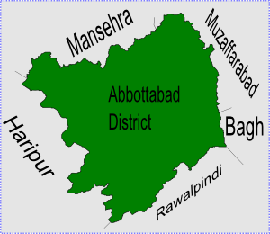
district = Abbottabad
tehsil = Abbottabad
nazim = Muhammad Azam Khan [http://www.abbottabad.gov.pk/Union-council/UCDetailPage.asp?name=Banda%20Pir%20Khan Banda Pir Khan Union Council] ]
naib nazim = Jehandad Awan Khan
population = 25,385
coordinates =

Banda Pir Khan is one of the 51 Union Councils of Abbottabad District in North-West Frontier Province, Pakistan. [ [http://www.abbottabad.sdnpk.org/adminunit.htm Administrative Units of District Abbottabad] ]

It is located in the north of the district (to the north west of Abbottabad city) near the border with Mansehra District. The population of Banda Pir Khan is 25,385. [ [http://www.abbottabad.sdnpk.org/list_administrative.htm List of Union Councils District & Tehsil Abbottabad] ]

ubdivisions

The Union Council is subdivided into the following areas: Band Pir Khan, Bandi Dhundan and Tarnawal.

References


Wikimedia Foundation. 2010.

Игры ⚽ Поможем написать реферат

Look at other dictionaries:

  • Banda Pir Khan — est l une des 51 subdivisions du district d Abbottabad dans la province de la Frontière du Nord Ouest du Pakistan[1]. Références ↑ (en) …   Wikipédia en Français

  • Banda — Cette page d’homonymie répertorie les différents sujets et articles partageant un même nom. Banda peut faire référence à : Banda : un district de l État d Uttar Pradesh, au nord est de l Inde, Banda : une ville de l État d Uttar… …   Wikipédia en Français

  • Bandi Atti Khan — est l une des 51 subdivisions du district d Abbottabad dans la province du nord ouest de frontière du Pakistan[1]. Références ↑ (en) …   Wikipédia en Français

  • Pind Kargu Khan — est l une des 51 subdivisions du district d Abbottabad de la province de la Frontière du Nord Ouest, au Pakistan[1]. Références ↑ (en) …   Wikipédia en Français

  • Abbottabad District — Abottabad District   District   Map of Hazara, Pakistan with Abbottabad District highlighted Country …   Wikipedia

  • Dalola —   Union Council   Location of Dalola Union Council (highlighted in red) within Abbottabad district, the names of the neighbouring districts to Abbottabad are also shown …   Wikipedia

  • Dhamtour —   Union council   Dhamtore is located in Abbottabad District Coordinates …   Wikipedia

  • Nagri Totial — Nagri Tutial   Union council   Location of Nagri Tutial (highlighted in red) within Abbottabad district, the names of the neighbouring districts to Abbottabad are also shown …   Wikipedia

  • Malkot — is a village of Abbottabad District in Khyber Pakhtunkhwa province of Pakistan. Until the local government reforms of 2000 it was a Union Councils of the district.[1] There is also a very beautiful picnic spot at Knair (a stream) as well as… …   Wikipedia

  • Nambal, Khyber Pakhtunkhwa — Numbal نمبل   Union council   Numbal is located in Abbottabad District Country …   Wikipedia

Share the article and excerpts

Direct link
Do a right-click on the link above
and select “Copy Link”