Ramsar Airport

Ramsar Airport
Ramsar Airport
IATA: RZRICAO: OINR
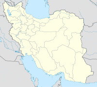
RZR is located in Iran
{{{alt}}}
RZR
Location of airport in Iran
Summary
Serves Tonekabon
Location Ramsar, Iran
Elevation AMSL -70 ft / -21 m
Coordinates 36°54′35.67″N 050°40′46.52″E / 36.9099083°N 50.6795889°E / 36.9099083; 50.6795889
Runways
Direction Length Surface
ft m
13/31 4,920 1,500 Asphalt
Source: World Aero Data[1]

Ramsar Airport (IATA: RZRICAO: OINR) is an airport in Ramsar/Tonekabon, Iran.

Ramsar was one of the popular cities of northern Iran during Pahlavi era and the airport was constructed to serve the tourists visiting Ramsar. There were also some palaces of Mohammad Reza Shah and other pahlavi family members in Ramsar, therefore the airport was used as a way to serve the former royalty of Iran or foreign officials visitng Iran.

Nowadays the airport is used for private and sport flights along the Caspian Sea coasts. There are also a weekly flight to Tehran.

Airlines and destinations

Airlines Destinations
Iran Aseman Airlines Tehran-Mehrabad

Ramsar Airport Website Address  :

www.ramsarairport.ir

www.ramsarairport.com

References


Wikimedia Foundation. 2010.

Игры ⚽ Нужно сделать НИР?

Look at other dictionaries:

  • Moss Airport, Rygge — Moss lufthavn, Rygge IATA: RYG – ICAO: ENRY Summary Ai …   Wikipedia

  • Mehrabad International Airport — Mehrabad redirects here. For the city in Yazd Province formerly called Mehrabad, see Mehrdasht. Mehrabad Airport فرودگاه مهرآباد IATA: THR – ICAO: OIII …   Wikipedia

  • Mehrabad Airport — Infobox Airport name = Mehrabad Airport nativename a = فرودگاه مهرآباد IATA = THR ICAO = OIII type = Joint (Public/Military) owner = operator = city served = location = Tehran, Iran elevation f = 3,962 elevation m = 1,208 website = r1 number =… …   Wikipedia

  • Mazandaran Province — This article is about Māzandarān Province of Iran . For Historic Tabarestan region, see Tabaristan. Mâzandaran Province استان مازندران   Province   …   Wikipedia

  • List of Iranian Air Force Bases — This page lists bases and airports operated or used by the Islamic Republic of Iran Air Force (IRIAF). Categories include: (1) Tactical Air Bases (TAB), the 14 major IRIAF operational air bases, (2) Other Military Aviation Installations and joint …   Wikipedia

  • Māzandarān Province — Infobox Iran Province province name = Mâzandarân ostan name = مازندران مازرون loc capital = Sari latd = 36.5656 longd = 53.0588 pop = 2,920,657 [Iranian 2006 Census Website [http://www.sci.org.ir/portal/faces/public/census85/census85.natayej/censu… …   Wikipedia

  • Japan — This article is about the country. For other uses, see Japan (disambiguation) …   Wikipedia

  • Dipor Bil — or Deepor Beel A typical beel Location Guwahati, Kamrup district, Assam Coordinates …   Wikipedia

  • Diego Garcia — For other uses, see Diego Garcia (disambiguation). Diego Garcia IATA: NKW – ICAO: FJDG Summary …   Wikipedia

  • Sierra Leone River — The Sierra Leone River is a river estuary on the Atlantic Ocean in Western Sierra Leone. It is formed by the Port Loko Creek and Rokel River and is between 4 and 10 miles wide (6 16 km) and 25 miles (40 km) long. It holds the major ports of… …   Wikipedia

Share the article and excerpts

Direct link
Do a right-click on the link above
and select “Copy Link”