- Edinburgh City Bypass
-
A720 road
Route information Part of 
Length: 13 mi (21 km) Major junctions East end: Old Craighall  A1 road
 A68 road
 A6106 road
 A7 road
 A772 road
 A701 road
 A702 road
 A71 road


![]](/pictures/enwiki/52/4px-Motorway_Right.svg.png) M8 motorway
M8 motorway
 A8 road
West end: South Gyle Road network Roads in the United Kingdom
Motorways • A and B road zonesThe Edinburgh City Bypass, designated as A720, is one of the most important trunk roads in Scotland. Circling around the south of Edinburgh, as the equivalent of a ring road for the coastal city, it links together the A1 towards north-east England, the A702 towards north-west England, the M8 through the Central Belt towards Glasgow, the A7 through south-east Scotland and north-west England as well as the A8 leading to the M9 for Stirling and the Forth Road Bridge.
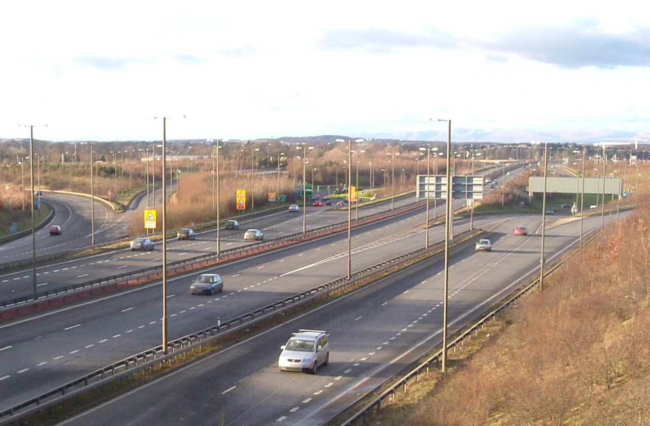
The road is dual carriageway standard throughout, including emergency laybys and hard shoulders in areas. The road is classed as a special road in legal terms. Every motorway in the UK is termed a special road in that specific regulations govern its use. Not every special road is signed as a motorway and this bypass is one of those roads.
Between Gogar and Sheriffhall junctions (see below) the A720 forms part of European route E15, which runs from Inverness, in northern Scotland, to Algeciras, in southern Spain. North of Gogar, the E15 runs towards the A90 and the Forth Road Bridge; and south of Sheriffhall along the A68.
Contents
Junctions
The A720 starts at the Old Craighall junction in the east where it meets the A1, from which traffic can approach Edinburgh city centre from the east, or run past Musselburgh and Haddington on the way to England.
Junction 1: Millerhill
This junction comes shortly after the eastern start of the A720, which was completed in 2008 as the Dalkeith Northern Bypass of the A68.[1] This is a crucial route for traffic to south-east Scotland.
Junction 2: Sheriffhall Roundabout
About 1.5 miles further is the most congested junction located on the bypass. Whereas all the other junctions on the bypass are grade separated, the Sheriffhall location was deemed unsuitable for a flyover due to extensive mine workings underneath.[2]
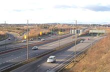 Hermiston Junction where the A720 meets the M8 and the A71.
The junction is hence a simple traffic-light controlled roundabout and the evident traffic problems of forcing all through A720 traffic to halt is evident, worsened by the importance of the roads which intersect here - the A7 which leads north to the city centre and south to Carlisle, the former A68 which now leads to the town of Dalkeith and also has access to the A68, and a minor A-road, the A6106. Traffic jams at the roundabout are common at most times of day.
Junction 3: Gilmerton
This is a small junction which is for the A772, that used to be the A7 until the mid 1990s. This road leads to Cameron Toll shopping centre as well as the A701 and the city centre. There is evidence that western slip-roads were considered at the roundabout to join the A772.
Junction 4: Lasswade
Just shortly after the Gilmerton junction, comes the Lasswade junction.
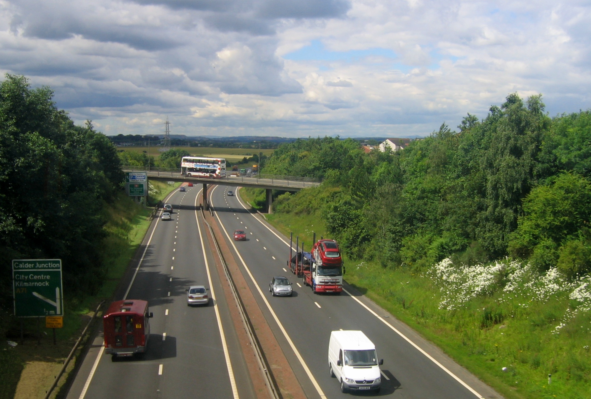
 South of Calder Junction
Junction 5: Straiton
This junction includes access to Straiton Retail Park, Costco and IKEA, this junction also provides access to the A701. This road is important for access to the southern suburbs.
Junction 6: Lothianburn
This junction was the original eastern terminus of the road. This is a major junction with the A702, which provides access to western England, via Abington and the A74(M) to Carlisle and the M6 as well as being a scenic route to Glasgow, avoiding the M8.
Junction 7: Dreghorn
This junction primarily provides access to the only services on the bypass. Local roads including the B701, and Dreghorn Barracks are also accessed from this junction.
Junction 8: Baberton
This junction was the original western terminus of the road. It provides direct access to the suburb of Baberton and indirect access to the A70, for Lanark, or the centre of Edinburgh.
Junction 9 & 10: Calder and Hermiston Gait
The centre of these junctions are within half a mile of each other, with a tangle of inter-weaving slips roads, flyovers, and underpasses between and either side of them. The A71 meets the bypass at a roundabout over the carriageway, and the M8 terminates at a roundabout under the carriageway, along with access to Hermiston Gait retail park. The slip roads to the separate roundabouts interweave with each other resulting in a tangle of curves and carriageways which is at one point 15 lanes wide.
The A71 provides one of the main routes into Edinburgh via Calder Road, and west to Livingston and Kilmarnock. The M8 runs to Glasgow and provides direct access to M9 for Stirling, and via the A90 to the Forth Road Bridge.
Junction 11: Gogar Junction
Finally the road swings north to finish on the A8 at Gogar Roundabout. The original junction was a simple roundabout connecting both roads, and access to South Gyle and Edinburgh Park. The roundabout now has an underpass for traffic on the A8. From this junction there, traffic can proceed into Edinburgh City Centre by an alternative route through Corstorphine, or can head west out to Edinburgh Airport and the M9 for Stirling, with connecting roads leading to all places north.
References
- ^ "CBRD - Futures - A68 Dalkeith Northern Bypass". http://www.cbrd.co.uk/futures/scheme.php?id=128. Retrieved 2009-02-21.
- ^ "SABRE - Road Lists - Roads by 10 - A720". http://www.sabre-roads.org.uk/roadlists/r10/notes.php?number=A720. Retrieved 2009-02-21.
A roads in Zone 7 of the Great Britain road numbering scheme - A701
- A702
- A720
- A727
- A749
- A772
Categories:- Roads in Scotland
- Transport in Edinburgh
- Transport in Midlothian
Wikimedia Foundation. 2010.