Changla Gali — 33°59′0″N 73°23′0″E / 33.98333, 73.38333 … Wikipédia en Français
Murree — This article is about the city. For the beer and brewery, see Murree Brewery. Murree مری … Wikipedia
Ayubia National Park — Ayubia is a National Park in NWFP, Pakistan. It is a small natural park located at 26 km from the Murree hill station. Ayubia was named after President Ayub Khan. It has been developed as a resort complex from a combination of four mini resorts… … Wikipedia
Galyat — The Galyat region is an area roughly 50 80km north east of Islamabad, Pakistan, on both sides of the NWFP Punjab border. The word Galyat is the plural of the Urdu word gali , which means an alley between two mountains on both sides of which there … Wikipedia
Ayubia — is small town in the North West Frontier Province of Pakistan. It is located near the Murree hills and Galyat and is home to Ayubia National Park.ee also* Patriata * Muree * Bhurban * Ayubia National Park * Circle Bakote * Mukeshpuri * Abbottabad … Wikipedia
Murree rebellion of 1857 — The Murree rebellion of 1857, sometimes termed a war of Independence, was part of the Indian Rebellion of 1857. It was a rebel skirmish between the tribes surrounding the hill station of Murree (modern day Pakistan) and the colonial government of … Wikipedia
Tajwal — Union Councils name = Tajwal caption = Tajwal is located in Abbottabad District province = NWFP district = Abbottabad tehsil = Havelian nazim = Sardar Muhammad Imtiaz [http://www.abbottabad.gov.pk/Union council/UCDetailPage.asp?name=Tajwal Tajwal … Wikipedia
Barian — is a town in northern Punjab, Pakistan. It is located at 33°57 0N 73°22 60E. [ [http://www.fallingrain.com/world/PK/4/Barian.html Location of Barian Falling Rain Genomics] ] . The town is linked to the city of Abbottabad by a 71km road via Nathia … Wikipedia
Seer Gharbi — 33°57′N 73°21′E / 33.95, 73.35 … Wikipédia en Français
Ville du Pakistan — Villes du Pakistan Carte du Pakistan … Wikipédia en Français
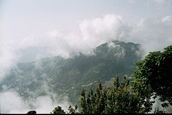
 Changla Gali
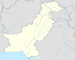
 Pakistan
