- Tajwal
Union Councils
name = Tajwal
caption = Tajwal is located in Abbottabad District
province =NWFP
district = Abbottabad
tehsil = Havelian
nazim = Sardar Muhammad Imtiaz [http://www.abbottabad.gov.pk/Union-council/UCDetailPage.asp?name=Tajwal Tajwal Union Council] ]
naib nazim = Sardar Gul Nawaz
population =
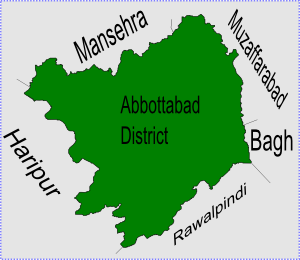
coordinates =Tajwal is one of the 51
Union Council s ofAbbottabad District in theNorth-West Frontier Province ofPakistan [ [http://www.abbottabad.sdnpk.org/adminunit.htm Administrative Units of District Abbottabad] ] .Location
Tajwal is located in the south of the district and is in the north western part of Havelian
tehsil , it is bounded by the following union councils,Nathia Gali to the north,Palak to the east,Seer Gharbi and Nara to the south, as well asDewal Manal and Nara to the west.Tajwal is a beautiful valley, near by
Changla Gali en-route fromMurree toAbbottabad . From Murree to Nathiagali a small stop of Changlagali with little shops and hotels. On this stop a link road lead to Tajwal, Jeeps and Toyota Hice for public transport, simple man and women travel by these transport. Some basic necessity that is water, electric, school and road has been established in this village. The Nadi Aro is a small river that divides this village from Bagan. Culture and religious factor are common element in these villages. Notable people from Tajwal include Sardar Muhammad Idreas Khan an Ex MPA of NWFP.Main tribe of this area iskarlal .ubdivisions
The Union Council of Tajwal is subdivided into the following areas: Nowshera, Pirkot, Tajwal and Topla.
References
Wikimedia Foundation. 2010.