Mbuji Mayi Airport

Mbuji Mayi Airport
Mbuji Mayi Airport
IATA: MJMICAO: FZWA
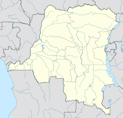
Mbuji MayiAirport is located in Democratic Republic of the Congo
{{{alt}}}
Mbuji Mayi
Airport
Location in the Democratic Republic of the Congo
Summary
Airport type Public
Operator Government
Location Mbuji Mayi, Democratic Republic of the Congo
Elevation AMSL 2,221 ft / 677 m
Coordinates 06°07′16″S 023°34′08″E / 6.12111°S 23.56889°E / -6.12111; 23.56889
Runways
Direction Length Surface
m ft
17/35 1,999 6,558 Asphalt
Source: DAFIF[1][2]

Mbuji Mayi Airport (IATA: MJMICAO: FZWA) is an airport serving Mbuji Mayi[1] (formerly Bakwanga), the capital of the Kasai-oriental Province in the Democratic Republic of the Congo.

Contents

Facilities

The airport resides at an elevation of 2,221 feet (677 m) above mean sea level. It has one runway designated 17/35 with an asphalt surface measuring 1,999 by 45 metres (6,558 × 148 ft).[1]

Airlines and destinations

Airlines Destinations
Compagnie Africaine d'Aviation Goma, Kinshasa, Lububashi
Hewa Bora Airways Kananga, Kinshasa, Lubumbashi

References

  1. ^ a b c Airport information for FZWA from DAFIF (effective October 2006)
  2. ^ Airport information for MJM at Great Circle Mapper. Source: DAFIF (effective Oct. 2006).

External links


Wikimedia Foundation. 2010.

Игры ⚽ Поможем сделать НИР

Look at other dictionaries:

  • Mbuji-Mayi — Coordinates …   Wikipedia

  • Kananga Airport — Infobox Airport name = Kananga Airport nativename = Aéroport de Kananga nativename a = nativename r = image width = caption = IATA = KGA ICAO = FZUA type = Public owner = operator = Civil Government city served = location = Kananga elevation f =… …   Wikipedia

  • Lubumbashi International Airport — Infobox Airport name = Lubumbashi International Airport nativename = nativename a = nativename r = image width = caption = IATA = FBM ICAO = FZQA type = Public owner = operator = city served = location = Lubumbashi elevation f = 4,295 elevation m …   Wikipedia

  • Kinshasa International Airport — Infobox Airport name = Kinshasa N Djili International Airport nativename = Aéroport international de Ndjili nativename a = nativename r = image width = caption = IATA = FIH ICAO = FZAA type = Public owner = operator = city served = location =… …   Wikipedia

  • N'djili Airport — Aéroport de N djili IATA: FIH – ICAO: FZAA …   Wikipedia

  • Goma International Airport — Infobox Airport name = Goma Airport nativename = IATA = GOM ICAO = FZNA type = Public owner = operator = Government city served = Goma, Democratic Republic of the Congo location = elevation f = 5,089 elevation m = 1,551 coordinates =… …   Wikipedia

  • Kindu Airport — is an airport in Kindu, Democratic Republic of the Congo airport codes|KND|FZOA.cheduled Services*Bravo Air Congo (Kinshasa, Mbuji Mayi) *Compagnie Africaine d Aviation (Kindu, Kinshasa) *Lignes Aeriennes Congolaises (Kisangani) *Wimbi Dira… …   Wikipedia

  • Compagnie Africaine d'Aviation — IATA ICAO FPY Callsign AFRICOMPANY …   Wikipedia

  • List of Democratic Republic of the Congo-related articles — The Democratic Republic of the Congo ( fr. République démocratique du Congo), often referred to as DR Congo, DRC or RDC, and formerly known or referred to as Congo Free State, Belgian Congo, Congo Léopoldville, Congo Kinshasa, and Zaire (or Zaïre …   Wikipedia

  • Compagnie Africaine d'Aviation — Compagnie Africaine d Aviation …   Wikipedia Español

Share the article and excerpts

Direct link
Do a right-click on the link above
and select “Copy Link”