- Bridge City, Texas
Infobox Settlement
official_name = Bridge City, Texas
settlement_type =City
nickname =
motto =
imagesize =
image_caption =
image_
mapsize = 250px
map_caption = Location of Bridge City, Texas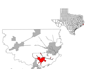
mapsize1 = 250px
map_caption1 =subdivision_type = Country
subdivision_name =United States
subdivision_type1 = State
subdivision_name1 =Texas
subdivision_type2 = County
subdivision_name2 = Orangegovernment_footnotes =
government_type =
leader_title =
leader_name =
leader_title1 =
leader_name1 =
established_title =
established_date =unit_pref = Imperial
area_footnotes =
area_magnitude =
area_total_km2 = 14.0
area_land_km2 = 13.3
area_water_km2 = 0.7
area_total_sq_mi = 5.4
area_land_sq_mi = 5.1
area_water_sq_mi = 0.3population_as_of = 2000
population_footnotes =
population_total = 8651
population_density_km2 = 649.4
population_density_sq_mi = 1682.0timezone = Central (CST)
utc_offset = -6
timezone_DST = CDT
utc_offset_DST = -5
elevation_footnotes =
elevation_m = 3
elevation_ft = 10
latd = 30 |latm = 2 |lats = 3 |latNS = N
longd = 93 |longm = 50 |longs = 34 |longEW = Wpostal_code_type =
ZIP code
postal_code = 77611
area_code = 409
blank_name = FIPS code
blank_info = 48-10252GR|2
blank1_name = GNIS feature ID
blank1_info = 1331256GR|3
website =
footnotes =Bridge City is a city in Orange County,
Texas ,United States . The population was 8,651 at the 2000 census. The town borders theNeches River and Cow Bayou. It is part of the Beaumont–Port Arthur Metropolitan Statistical Area.The city was originally named Prairie View, as it was located on the coastal grasslands of the upper Texas coastline. But in 1938, the Port Arthur-Orange Bridge (now known as the Rainbow Bridge) was built, and the unincorporated area took on the name "Bridge City". Despite several previous attempts, the city did not incorporate until 1970.
Bridge City got its name from the fact that one has to cross a bridge to enter the city. Out of the three major roads that enter Bridge City, Chemical Road, HWY 87, and F.M. 1442 - all of them cross a body of water. HWY 87 crosses the Neches River and Cow Bayou - Cow Bayou on the Orange side and the Neches River on the Port Arthur side. Chemical Road crosses a branch off of the Sabine river and Cow Bayou. F.M. 1442 crosses a small creek off Cow Bayou between HWY 105 and the Bridge City City limits. F.M. 1442 also crosses Cow Bayou just north of Orangefield and south of Interstate 10.
In 1990, Bridge City became the first city in Texas to install "leaning" streetlights because of the tall electrical lines near the roadway [http://www.bridgecitytex.com/dynpage.php?pageid=110] .
In 2008, the storm surge generated by
Hurricane Ike caused nearly complete flooding of Bridge City. Mayor Kirk Roccaforte estimated that only 14 homes in the city were unaffected by the surge. The piles of debris and waterlogged furniture placed outside homes by residents beginning to clean up led the mayor to say "The whole city looks like a flea market. [http://www.beaumontenterprise.com/news/local/bridge_city_residents_try_to_dry_out__clean_up_09-19-2008.html]Geography
Bridge City is located at coor dms|30|2|3|N|93|50|34|W|city (30.034211, -93.842836)GR|1.
According to the
United States Census Bureau , the city has a total area of 5.4square mile s (14.0km² ), of which, 5.1 square miles (13.3 km²) of it is land and 0.2 square miles (0.6 km²) of it (4.63%) is water.Demographics
As of the
census GR|2 of 2000, there were 8,651 people, 3,195 households, and 2,476 families residing in the city. Thepopulation density was 1,682.0 people per square mile (649.8/km²). There were 3,432 housing units at an average density of 667.3/sq mi (257.8/km²). The racial makeup of the city was 95.43% White, 0.20% Black or African American, 0.75% Native American, 1.40% Asian, 0.06% Pacific Islander, 1.27% from other races, and 0.89% from two or more races. 3.57% of the population were Hispanic or Latino of any race.There were 3,195 households out of which 36.7% had children under the age of 18 living with them, 62.0% were married couples living together, 10.6% had a female householder with no husband present, and 22.5% were non-families. 19.6% of all households were made up of individuals and 8.8% had someone living alone who was 65 years of age or older. The average household size was 2.69 and the average family size was 3.07.
In the city the population was spread out with 27.0% under the age of 18, 9.5% from 18 to 24, 28.2% from 25 to 44, 23.1% from 45 to 64, and 12.3% who were 65 years of age or older. The median age was 36 years. For every 100 females there were 96.4 males. For every 100 females age 18 and over, there were 93.5 males.
The median income for a household in the city was $42,045, and the median income for a family was $49,750. Males had a median income of $42,398 versus $22,674 for females. The
per capita income for the city was $18,290. About 7.9% of families and 10.3% of the population were below thepoverty line , including 13.1% of those under age 18 and 12.8% of those age 65 or over.Bridge City was the only city in Orange County to have a growth in population according to the 1990 census [http://www.bridgecitytex.com/dynpage.php?pageid=110] .
Education
Bridge City is served by the
Bridge City Independent School District .Famous People from Bridge City
*
Matt Bryant ,NFL kicker (New York Giants and Tampa Bay Buccaneers)
*Steve Worster ,University of Texas at Austin football player
*Jason Matthews,NFL tackle (Indianapolis Colts and Tennessee Titans)
*Shane Dronett ,NFL defensive lineman (Denver Broncos and Atlanta Falcons)References
External links
*
* [http://www.bridgecitytex.com -- Bridge City official site]
* [http://www.fun365days.com/ Fun365Days.com -- regional tourism web site]
* [http://setx.org/ Partnership of Southeast Texas -- regional economic development site]

Wikimedia Foundation. 2010.