- Keelung Islet
-
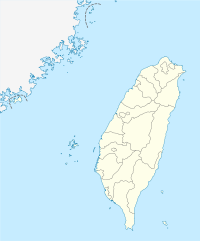
Keelung Islet (traditional Chinese: 基隆嶼; simplified Chinese: 基隆屿; Wade–Giles: Kēelόng Yǔ) is a small island located 3.35 km (2.08 mi) northeast of the northern shore of Keelung, Taiwan and 4.9 km (3.0 mi) away from the Port of Keelung. It has an area of 23.91 ha (59.08 acres). It is 910 m (2,986 ft) in length, and 410 m (1,345 ft) in width including the artificial harbor, the highest point is 182 m (597 ft) above sea level.
In ancient times, the island was seen as a sacred place by locals. It was rumoured that a female ghost named Shih-Yun lived there, to mourn over her husband who died in a shipwreck hundreds of years ago.
In the modern day, the islet is primarily used as a military training base. Since 2001, it has been opened for tourists. Ferry services to the island operate daily from the port of Keelung. There is a small port and a walkway on the island. The island is also popular with the local fishing industry, because of the quantity of fish it attracts in its surrounding sea.
The island is volcanic, part of the Chilung Volcano Group. It dates from the Pleistocene period. The eruption was explosive tholeiitic andesite and dacite. The main mineral is calcium rich plagioclase. The magma source is the western extremity of the Ryukyu Volcanic Arc formed when the subducting Philippine Sea Plate was compressed below the edge of the Eurasian Plate at about 20 to 30 km deep. The magma was contaminated with continental crust material. Geochemistry of the rock shows that iron, aluminium, titanium, potassium, rubidium and strontium are enriched, but sodium, magnesium and nickel are impoverished.[1]
References
- ^ Zhang Jinhai and He Lishi (2002). "Geology of Taiwan Province". Geology of China. Geological Publishing House. ISBN 7-116-02268-6.
Coordinates: 25°11′32″N 121°47′08″E / 25.19222°N 121.78556°E
Categories:- Islands of Taiwan
- Volcanoes of Taiwan
- Islands of the East China Sea
- Taiwan geography stubs
Wikimedia Foundation. 2010.


