- Mount Donna Buang
-
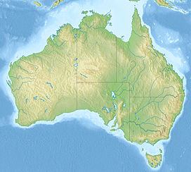
Mount Donna Buang Victoria, Australia Elevation 1,250 m (4,101 ft) AHD Location Range Donna Buang Range / Australian Alps / Great Dividing Range Coordinates 37°42′23″S 145°40′52″E / 37.70639°S 145.68111°ECoordinates: 37°42′23″S 145°40′52″E / 37.70639°S 145.68111°E Located approximately 80 km from Melbourne, Mount Donna Buang in Victoria, Australia, at 1,250 metres (4,101 ft) is the closest snowfield to Melbourne.[1]
In winter, it usually receives snow suitable for snowplay and tobogganing, and during the non winter months the area is well visited by bushwalkers. The summit of Mount Donna Buang is surrounded by Alpine ash trees and Sub alpine snow gums, and at nearby Cement Creek there is a raised walkway through Myrtle Beech (Nothofagus cunninghamii) and Mountain Ash (Eucalyptus regnans) trees known as the Mount Donna Buang Skywalk.
Mount Donna Buang is part of the Yarra Ranges National Park (formed in 1995) in which there are a number of species that have become rare or threatened, including the Slender Tree Fern, and the Geebung Tree. It contains a number of native mammals including the endangered Leadbeater's Possum, and is home to 120 different species of native birds. Some examples include the Pink Robin, Yellow-tailed Black Cockatoo and the Crimson Rosella.
The nearest serviced town to the mountain is Warburton.
Contents
Flora and fauna
The rare and possibly endangered Mount Donna Buang Wingless Stonefly (Riekoperla darlingtoni) is endemic to the area.[2]
History
In the 1860s, “Mount Acland” was the name given to the 1,250m high mountain by a Police Magistrate called Joseph Panton. The name it has today, “Mount Donna Buang”, came from the Wurundjeri Aborigines.
A walking track to the summit of Mount Donna Buang was cut during the 1890s and the much wider Donna Buang Bridle Track, which the current road from Warburton to the top of Mount Donna Buang follows, was opened in 1912.
In 1924, the Ski Club of Victoria built an 8-foot-wide (2.4 m) track for skiers on the top of Mount Donna Buang. Being the nearest location to Melbourne where you could ski, the mountain was well patronised and both the Ski Club of Victoria and the Melbourne University Ski Club built huts on the mountain to cater for their members. During the 1930s the Warburton Ski Club was officially formed as well. The first observation tower was erected shortly after the bridle track was opened.
Mount Donna Buang is a challenging cycling route, averaging 6.2% over 16.6km[3] and has also become a popular destination for recreational driving, motorcycling, and in the summer a challenging training route for endurance cyclists and triathletes.[4]
References
External links
Categories:- Mountains of Victoria (Australia)
Wikimedia Foundation. 2010.


