- Mousa Ali
-
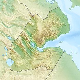
Mousa Ali Location of Mousa Ali in Djibouti (on tri-point border with Eritrea and Ethiopia) Elevation 2,021 m (6,631 ft) [1][2] Prominence 1,607 m (5,272 ft) [1][3] Listing Country high point
UltraLocation Location Tadjourah, Djibouti /
Southern Red Sea, Eritrea /
Afar, EthiopiaRange Denakil[3] Coordinates 12°28′15″N 42°24′18″E / 12.47083°N 42.405°ECoordinates: 12°28′15″N 42°24′18″E / 12.47083°N 42.405°E[1] Geology Type Stratovolcano Last eruption Holocene The Mousa Ali Volcano is a 2,021 metres (6,631 ft) stratovolcano located on the tri-point borders of Ethiopia, Eritrea and Djibouti. The volcano is the highest point in Djibouti. The volcano's summit is truncated by a caldera, which contains rhyolitic lava domes and lava flows.[2] The last known eruption occurred during the Holocene era.
Mousa Ali is situated at the tri-point of the Tadjourah Region of Djibouti; the Southern Red Sea Region of Eritrea; and the Afar Region of Ethiopia.
References
- ^ a b c Africa Ultra-Prominences, Peaklist.org, listed as "Moussa Ali Terara" Retrieved 29 September 2011
- ^ a b "Mousa Ali". Global Volcanism Program, Smithsonian Institution. http://www.volcano.si.edu/world/volcano.cfm?vnum=0201-123. Retrieved 2007-04-04.
- ^ a b "Moussa Ali" on Peakbagger Retrieved 29 September 2011
See also
- List of volcanoes in Eritrea
- List of stratovolcanoes
- List of Ultras of Africa
Categories:- Mountains of Djibouti
- Mountains of Eritrea
- Volcanoes of Eritrea
- Stratovolcanoes
- Djibouti–Eritrea border
- Djibouti–Ethiopia border
- Eritrea–Ethiopia border
- International mountains of Africa
- Highest points
- Djibouti geography stubs
- Eritrea geography stubs
- Ethiopia geography stubs
Wikimedia Foundation. 2010.

