- Cochituate Aqueduct
-
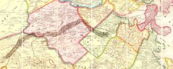 Cochituate Aqueduct map, 1852
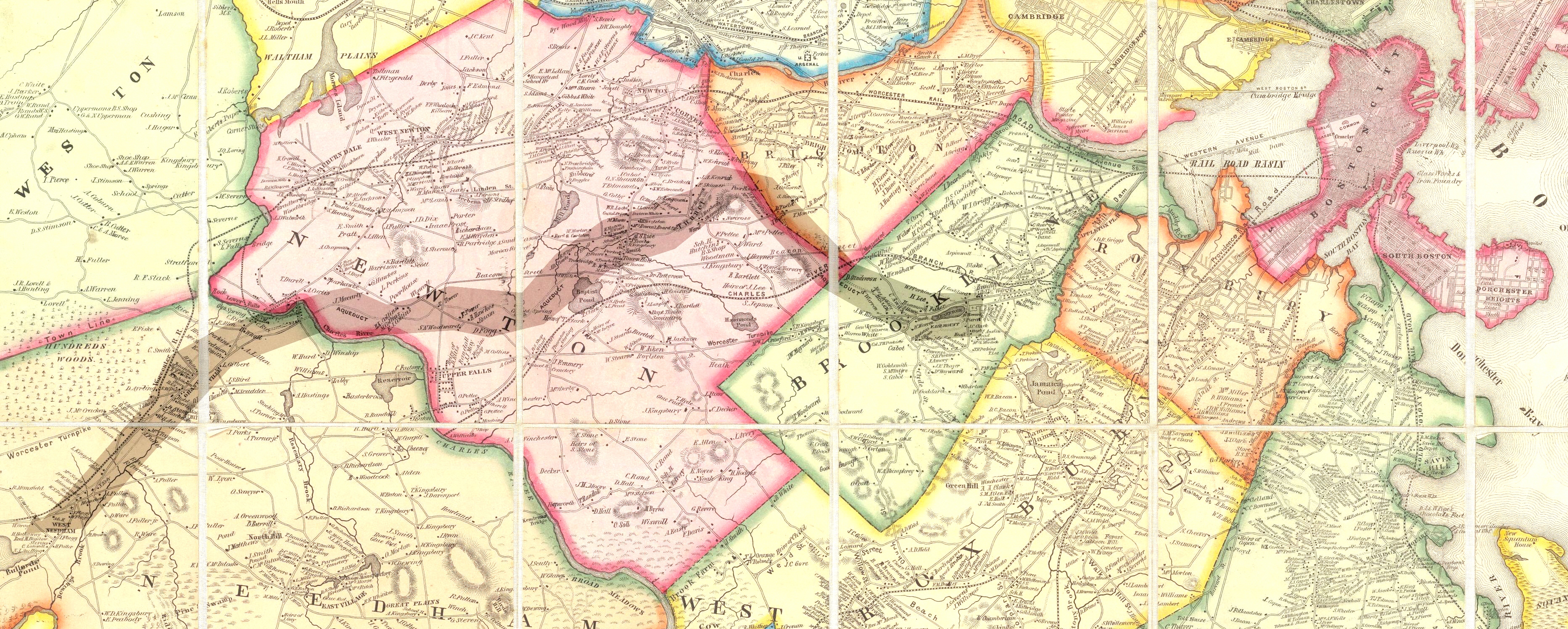
The Cochituate Aqueduct was an aqueduct bringing water to Boston, Massachusetts, during the years 1848-1951.
The aqueduct formed a key link in Boston's first major water supply system. Its genesis dates to 1845, when a Sudbury River tributary was impounded to form Lake Cochituate in Natick. This artificial lake, with 17 miles (27 km) of watershed, 2 billion US gallons (7,600,000 m3) of storage, and yield of 10 million US gallons (38,000 m3) of water per day, became the cornerstone of Boston's public water system.
The aqueduct was built in 1846-1848 to convey water from Lake Cochituate to the Brookline Reservoir. Its route was 14 miles (23 km) long, and passed through Natick, Wellesley, Newton, and Brookline. From there pipelines ran to small distribution reservoirs throughout Boston, including Beacon Hill Reservoir atop Beacon Hill. In 1848 Lake Cochituate's water first flowed into Frog Pond on Boston Common in a ceremony that drew 100,000 people.
By 1951 four major aqueducts were delivering water to Boston. The Cochituate system was unnecessary and its water declining in quality. It was thus abandoned, and portions were purchased in 1952 by the City of Newton for sewer lines. It is now part of a trail system, with granite bridges and gatehouses still intact along its route.
In 2010, the Massachusetts Water Resources Authority issued a Use Permit to the Natick Conservation Commission for 16 acres (65,000 m2) of the Natick section for future conservation and recreation purposes.
See also
- List of crossings of the Charles River
- Cochituate Standpipe
References
External links
Categories:- Aqueducts in Massachusetts
- Transportation in Middlesex County, Massachusetts
- Transportation in Norfolk County, Massachusetts
- Buildings and structures in Middlesex County, Massachusetts
- Buildings and structures in Norfolk County, Massachusetts
Wikimedia Foundation. 2010.