- Nachrodt-Wiblingwerde
-
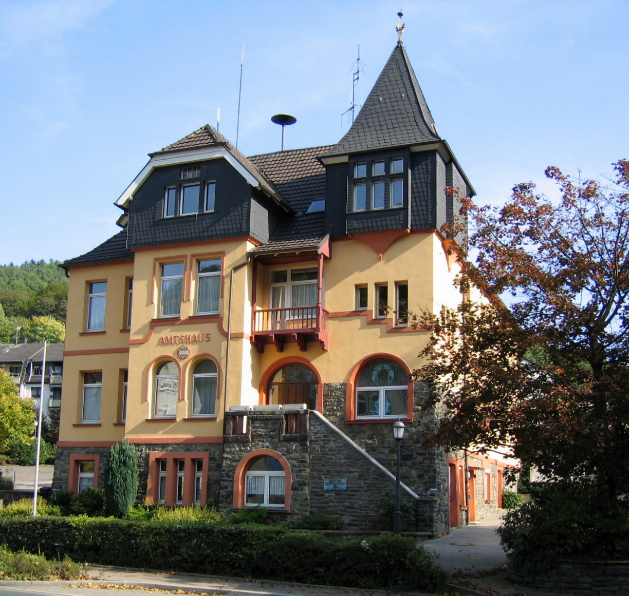
Nachrodt-Wiblingwerde Old town hall (Amtshaus)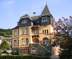


 Nachrodt-WiblingwerdeLocation of the town of Nachrodt-Wiblingwerde within Märkischer Kreis district
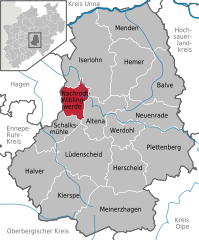

Coordinates 51°19′0″N 7°39′0″E / 51.316667°N 7.65°ECoordinates: 51°19′0″N 7°39′0″E / 51.316667°N 7.65°E Administration Country Germany State North Rhine-Westphalia Admin. region Arnsberg District Märkischer Kreis Town subdivisions 7 Mayor Friedhelm Schröder (CDU) Basic statistics Area 29.01 km2 (11.20 sq mi) Elevation 305 m (1001 ft) Population 6,724 (31 December 2010)[1] - Density 232 /km2 (600 /sq mi) Other information Time zone CET/CEST (UTC+1/+2) Licence plate MK Postal code 58769 Area codes 02352 u. 02334 Website www.nachrodt-wiblingwerde.de Nachrodt-Wiblingwerde is a municipality in the Märkischer Kreis, North Rhine-Westphalia, Germany.
Contents
Geography
The municipality is split into two main settlements. Nachrodt is located in the valley of the river Lenne at an altitude of 140 m above sea level, while Wiblingwerde is located at an altitude of 480 m on the hills of the Lennegebirge, on of the hill chains in the Sauerland mountains.
Division of the municipality
- Nachrodt:
- Obstfeld
- Einsal
- Opperhusen
- Holensiepen
- Wiblingwerde:
- Veserde
- Rennerde
- Brenscheid
- Sassenscheid
- Eilerde
- Herlsen
- Wörden
- Kaltenborn
History
The municipality was formed in 1907, when the Amt Altena was dissolved. The two municipalities Kelleramt and Wiblingwerde were merged into the new municipality Nachrodt-Wiblingwerde, which was no longer member in a Amt anymore.
Coat of arms
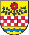
The coat of arms of the municipality shows in the top part the red and sliver rose from the church seal of the Kirchspiel Wiblingwerde. In the bottom is a wavy line representing the river Lenne and thus Nachrodt. Both symbols are separated by the red-and-silver chequered bar of the Mark. The coat of arms was designed by Otto Hupp, and was granted on October 17, 1935.
References
- ^ "Amtliche Bevölkerungszahlen" (in German). Landesbetrieb Information und Technik NRW. 31 December 2010. http://www.it.nrw.de/statistik/a/daten/amtlichebevoelkerungszahlen/index.html.
External links
 Media related to Nachrodt-Wiblingwerde at Wikimedia Commons
- Official site (German)
- Tourist information (German)
Altena | Balve | Halver | Hemer | Herscheid | Iserlohn | Kierspe | Lüdenscheid | Meinerzhagen | Menden | Nachrodt-Wiblingwerde | Neuenrade | Plettenberg | Schalksmühle | Werdohl Categories:
- Towns in North Rhine-Westphalia
- North Rhine-Westphalia geography stubs
- Märkischer Kreis
- Nachrodt:


Wikimedia Foundation. 2010.