- Mahakam River
-
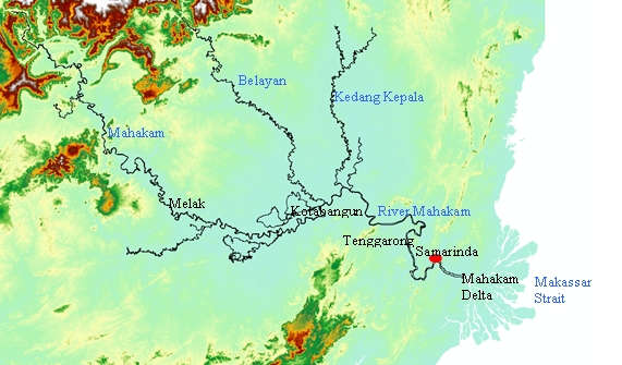
The Mahakam River is in Indonesia. It flows 980 km from the district of Long Apari in the highlands of Borneo, to its mouth at the Makassar Strait.
The city of Samarinda, the provincial capital of East Kalimantan, lies along the river 48 km (30 mi) from the river mouth.
Mahakam River 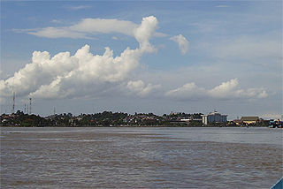 Mahakam River at Samarinda
Country Indonesia Province East Kalimantan Tributaries - left Kedang Pahu - right Kedang Rantau, Kedang Kepala, Belayan Towns/Cities Samarinda, Tenggarong, Sebulu, Muara Kaman, Kotabangun, Melak, Long Iram Source Cemaru - elevation 1,681 m (5,515 ft) Mouth Mahakam Delta, Makassar Strait - location Mahakam Delta, Sungai Mariam, Indonesia - elevation 0 m (0 ft) Length 980 km (609 mi) Basin 77,100 km2 (29,768 sq mi) Discharge for Melak[1] - average 2,500 m3/s (88,287 cu ft/s) - max 3,300 m3/s (116,538 cu ft/s) 
Contents
Summary
Mahakam River is the largest river in East Kalimantan, Indonesia, with a catchment area of approximately 77,100 km2. The catchment lies between 2˚N to 1˚S latitude and 113˚E to 118˚E longitude. The river originates in Cemaru[2] from where it flows south-eastwards, meeting the River Kedang Pahu at the city of Muara Pahu. From there, the river flows eastward through the Mahakam lakes region, which is a flat tropical lowland area surrounded by peat land. Thirty shallow lakes are situated in this area, which are connected to the Mahakam through small channels [2]. Downstream of the connection with the Semayang and Melintang lakes, the Mahakam meets three other main tributaries - the rivers Belayan, Kedang Kepala, and Kedang Rantau - and flows south-eastwards through the Mahakam delta distributaries, to the Makassar Strait.
Geology
Kalimantan, where the Mahakam lies, is part of the Sunda Continental Plate. The large island has mountain ranges between Indonesia and Malaysia, however, volcanism is absent in this island. As described by van Bemmelen (1949), River Mahakam rises in Cemaru (1,681 m) in the centre of Kalimantan, from there it cuts through the pre-tertiary axis of the island east of the Batuayan (1,652 m) and then reaches the tertiary basin of Kutai.[3] Its middle course traverses a lowland plain with many marshy lakes. This intermontane depression is separated from the neighboring basin, the Barito depression, by a broad hilly tract of less than 500m altitude. After this region, the Mahakam cuts through the Samarinda anticlinorium and reaches its alluvial delta, which spreads like a broad fan over the shelf-sea, with a base of 65 km and a radius of about 30 km.[4]
Upstream of Long Iram (upstream part of Mahakam river basin) the river is flowing in tertiary rocks (Voss, 1983).[5] Between Long Iram and Muara Kaman (middle Mahakam area) the river is flowing in quaternary alluvium, while in the downstream area between Muara Kaman and the coast including the Mahakam delta, tertiary rocks are again present. The presence of the large delta is explained by the formation and rejuvenation of the hilly region near Samarinda.[6]
Climate
The Mahakam catchment is around the equator. According to Köppen climate classification, this area belongs to type Af (tropical rainforest) that has a minimum temperature ≥18oC and precipitation of the driest month in normal year ≥60 mm[7] Transfer of mass and energy in the tropical zone occurred through general air circulation known as the Hadley cell. According to Seidel et al. (2008) the precipitation pattern in this area is largely determined by this large-scale atmospheric wind patterns, which is observable in several ways throughout the atmosphere. This circulation carries moisture into the air, generating rainfall in equatorial regions, whereas at the edges of the tropical belt are drier.[8] Within this circulation, evaporation is intensively occurred around the equator on the centre of low pressure called the Intertropical Convergence Zone (ITCZ), characterized by accumulation of cloud in the area. The ITCZ moves following the pseudo-motion of the sun within 23.5oN and 23.5oS zone, therefore its position always changes according to this motion.
The ITCZ drives the Indo-Australian monsoon phenomena which influence the regional climate including the Mahakam catchment. In December, January, February (winter in northern hemisphere) the concentration of high pressure in Asia and low pressure in Australia make the west wind blows in Indonesia (west monsoon). In June, July, August concentration of low pressure in Asia (summer in northern hemisphere) and concentration of high pressure in Australia make the east wind blows in Indonesia (east monsoon). Due to the global air circulation and the regional climate mentioned above, the Mahakam catchment which is located around the equator has a bimodal rainfall pattern with two peaks of rainfall, which are generally occurred in December and May. This is because the ITCZ passed through the equator twice a year, from the northern hemisphere in September and from the southern hemisphere in March.[9]
Mahakam Lakes
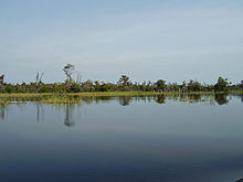 Lake Melintang at Teluk Tuk with re-growing burnt swamp forest on the background
There are about 76 lakes spread in the Mahakam river basin and about 30 lakes are located in the middle Mahakam area including the three main lakes (Lake Jempang 15,000 Ha; Lake Semayang 13,000 Ha; Lake Melintang 11,000 Ha).[10] The lakes levels are seasonally fluctuated from 0.5m – 1m during dry period to seven meters during rainy season. The Mahakam lakes and surrounding wetlands act as a trap of sediment contained in the water flowing into the lakes which are now known to become shallower, presumably as a result of an imbalance between sediment input and slow subsidence.[3]
Fishing is the primary source of livelihood in the Mahakam lakes area, most of the people around the lakes are fishermen. The middle Mahakam lake area is an area of intensive fishing activity with a productivity of 25,000 to 35,000 metric tons per year since 1970.[4]
Mahakam Delta
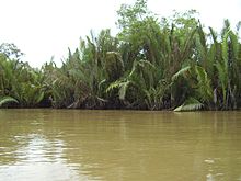 Nypha in Mahakam Delta
The Mahakam delta is a mixed fluvial-tidal dominated delta. The delta covers about 1800 km2, consisting of mangrove areas near the shore, Nypa swamps in the central areas, and lowland forest near the apex, corresponding to the first bifurcation,[5] however, recent fishery development in this area has converted a vast area of mangrove into shrimp ponds (tambak). The delta has three main distributaries system directed Northeast, Southeast and South. The area between distributaries consists of a series of tidal channels generally unconnected to the main distributaries.[11] The distributary channels are narrow and rectilinear with the depth ranging from 8 to 15 m and distributary channel bifurcations appear every 10 to 15 km.[12]
This lower Mahakam area is the second most productive hydrocarbon basin of Indonesia which contains around 3 billion barrels of oil and 30 Tcf of gas reserves.[13] Field geological investigations in this area was started in 1888 and in 1897 exploration drilling discovered oil at shallow depth of 46 m on the Louise structure. Production started in 1898 followed by expansion of exploration to the entire Mahakam.[14]Ecology
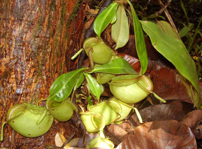
 Nepenthes, called kantong semar by the locals, is an insect-eater plant found in the Mahakam peat area
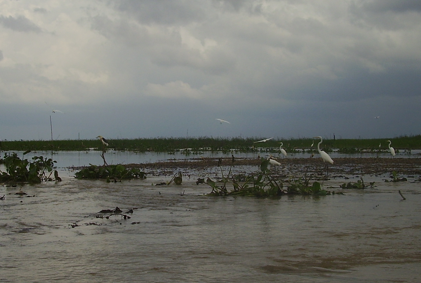
 Birds at the intermittent inlet of Lake Jempang from Mahakam River
Mahakam and its floodplain is an ecologically important region. A total of 147 indigenous freshwater fish species had been identified from the Mahakam.[15] The Mahakam hosts the freswater dolphin Irrawaddy Dolphin (Orcaella brevirostris; called Pesut by local people) a critically Endangered fish species, which is included on CITES (Convention on International Trade in Endangered Species of Wild Fauna and Flora) Appendix I.[6] The Mahakam river basin is also an important breeding and resting place for 298 bird species, among them 70 protected and five endemic species: Borneo Dusky Mannikin (Lonchura fuscans), Borneo Whistler (Pachycephala hypoxantha), Bornean Peacock-pheasant (Polyplectron schleiermacheri), Bornean Blue-flycatcher (Cyornis superbus) and Bornean Bristlehead (Pityriasis gymnocephala).[7]
A Research Cluster ([8]): "Upsetting the balance in the Mahakam Delta: past, present and future impacts of sea-level rise, climate change, upstream controls and human intervention on sediment and mangrove dynamics" extensively carry out research on the Mahakam. The cluster's objective is to study the impact of external forcing factors such as sea-level rise, climate change, upstream sediment, as well as human interference on past, present and future development of the Mahakam delta in different time scales.Social Aspect
 Samarinda grand mosque facing The Mahakam is the largest Islamic centre in Kalimantan
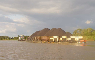
 Ponton transporting coal through the Mahakam
The River Mahakam is an economic resource for fishermen and farmers, and as freshwater source, as a waterway since ancient time until today. It is in this river basin where the Kutai kingdom evolved. The Kutai history is divided into two periods, Kutai Martadipura (around 350-400) and Kutai Kartanegara period (around 1300). Kutai Martadipura, a Hindu kingdom founded by Mulawarman at Muara Kaman, is regarded as the oldest kingdom in Indonesia.[16] Kutai Kartanegara was founded by settlers from Java at Kutai Lama near the mouth of Mahakam. In around 1565, Islam was extensively spread in Kartanegara by two Moslem preachers from Java, Tunggang Parangan and Ri Bandang.[17]
The Dayaks are the indigenous people inhabiting Kalimantan beside the Kutais and the Banjars. Since 1970s transmigration of people to East Kalimantan was organised by the Indonesian government especially in areas near River Mahakam. Transmigration aims to migrate people from overpopulated Java, Bali, and Madura islands to stimulate greater agricultural productivity in outer islands. By 1973, almost 26% of the land under cultivation in East Kalimantan was being worked by transmigrants.[18]
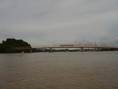
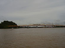 The Mahakam bridge in Samarinda
Notes
- ^ Hidayat et al., 2011. Discharge estimation in a backwater affected meandering river, HESSD, 8, 2667-2697, 2011.
- ^ van Bemmelen,R.W., 1949. The Geology of Indonesia.
- ^ van Bemmelen,R.W., 1949. The Geology of Indonesia.
- ^ van Bemmelen,R.W., 1949. The Geology of Indonesia.
- ^ Voss, F.: Kalimantan Timur, Atlas. HWWA Institute, Hamburg, 1983.
- ^ IWT Kalimantan, Contribution Delft Hydraulics, Appendix I Mahakam River
- ^ Peel, M.C., B. L. Finlayson, and T. A. McMahon, 2007. Updated world map of the Koppen-Geiger climate classification. Hydrol. Earth Syst. Sci., 11, 1633–1644.
- ^ Seidel, D.J., Qiang Fu, William J. Randel & Thomas J. Reichler, 2008. Widening of the tropical belt in a changing climateNature Geoscience 1, 21 - 24, Published online: 2 December 2007, doi:10.1038/ngeo.2007.38
- ^ Hidayat et al. (in prep.), Rainfall-runoff modelling in a poorly gauged basin – The Mahakam River
- ^ East Kalimantan provincial government, 2002. Master Plan Sungai Mahakam. Dinas Pekerjaan Umum dan Pemukiman Prasarana Wilayah (in Indonesian)
- ^ Wiweko A., 2002. The modern Mahakam delta in Modern, ancient deltaic deposits and petroleum system of Mahakam area, Totalfinaelf E&P Indonesie.
- ^ Allen, G.P., Chambers J.L.C., 1998. Sedimentation in the modern and Miocene Mahakam Delta. Indonesian Petroleum Association
- ^ Mora S., Ten Haven L., 2002. Petroleum system of lower Kutai basin in Modern, ancient deltaic deposits and petroleum system of Mahakam area, Totalfinaelf E&P Indonesie.
- ^ Homewood P, Roy D., 2002. A historical perspective on the exploration of the Mahakam in Modern, ancient deltaic deposits and petroleum system of Mahakam area, Totalfinaelf E&P Indonesie.
- ^ Christensen, M.S., 1992. Investigations on the Ecology and Fish Fauna of the Mahakam River in East Kalimantan (Borneo), Indonesia. Int. Revue ges. Hydrobiol., 77(4).
- ^ [1]
- ^ Allan J. & Muller K., 1988. The Times Travel Library: East Kalimantan, Ed. By P. Zach, Times Editions.
- ^ Babcock, 1986 as cited by Stadtmueller T., 1990. Soil erosion in East Kalimantan, Indonesia. Proceedings of the Fiji Symposium Research Needs and Applications to Reduce Erosion and Sedimentation in Tropical Steeplands, June 1990: IAHS-AISH Publ. No.192,1990.
Java Bengawan Solo River · Brantas River · Cidurian River · Cikandang River · Cilaki River · Ciliwung River · Cimandiri River · Cimanuk River · Cisadane River · Cisanggarung River · Citanduy River · Citarum River · Ciujung River · Ciwulan River · Kalimalang River · Kali Bodri River · Kali Opak River · Kali Pemali River · Kali Sanen River · Kali Serang River · Porong River · Progo River · Serayu River · Widas RiverKalimantan Arut River · Barito River · Kahayan River · Kapuas River · Kapuas (Barito) River · Katingan River · Kayan River · Lamandau River · Landak River · Lawa River · Mahakam River · Melawi River · Mendawai River · Pawan River · Sambas River · Sampit River · Sekayam River · Sesayap River · Wain RiverSulawesi Bongka River · Jeneberang River · Kalaena River · Karama River · Lalindu River · Lariang River · Lasolo River · Mamasa River · Manado River · Marisa River · Paguyaman River · Palu River · Pangkajene River · Poso River · Sadang River · Sampara River · Tallo River · Walanae RiverLesser Sunda Islands Ayung River · Benain River · Kadassa River · Kadumbul River · Melolo River · Mina River · Moyo River · Noel Besi River · Polapare River · Pono River · Sissa River · Sungi River · Wera RiverMaluku and Papua Bian River · Bien River · Bulaka River · Digul River · Kampung River · Kamundan River · Kumbe River · Lorentz River · Mamberamo River · Mapi River · Maro River · Mimika River · Momats River · Muturi River · Pulau River · Seremuk River · Sobger River · Songgato River · Tabai River · Tariku River · Taritatu River · Van Daalen River · Vriendschaps River · Wamma River · Wapoga River · Warenai River · Waruta River · Wiriagar RiverCategories:- Rivers of Kalimantan


Wikimedia Foundation. 2010.