- Ogla
-
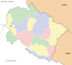
Ogla — small spot — Coordinates 29°43′N 80°23′E / 29.72°N 80.39°ECoordinates: 29°43′N 80°23′E / 29.72°N 80.39°E Country India State Uttarakhand District(s) Pithoragarh Time zone IST (UTC+05:30) Ogla (Hindi: ओगला or उगाला) is a small scenic place in the Pithoragarh district of Uttarakhand state of India in the Didihat tehsil. It lies in the crossroads of Kailash Man sarover pilgrimage highway. It is a nice place for refreshment with local cuisine. Askot Musk Deer Sanctuary is situated near this place. Charama, an army base, is also situated near this place. A place called Narayan nagar, presenting snow capped peaks of Himalaya and Swami Narayan Ashram, is situated near it. Previously it was the last motorable station for many villages and the starting point for journeys on foot. It lies among dense pine forests. It is the place where you can go to Didihat, Dharchula, Darma Valley, Bhagichaura, Jauljibi, and Kanalichhina. It is popularly called the gateway to Garkha. Majestic Himalayan peaks of India and Nepal like Panchchuli and Annapurna are visible from here. Ogla is rich in Pinus roxburghii, Rhododendron, Myrica, and Quercus forest with rich Bryophyte and Pteridophyte flora.
Categories:- Hill stations in India
- Villages in Pithoragarh district
- Uttarakhand geography stubs
Wikimedia Foundation. 2010.


