- Chapecó
-
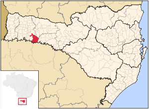
Chapecó is a major city in the western area of the state of Santa Catarina, Brazil, located 630 km west of Florianópolis, the capital of the state.
As of 2008, it has a population of around 175.000 inhabitants. The city itself has an area of 625 km².
The city was founded by Italian immigrants on August 25, 1917. Most people are descendants of Italian, German and Polish immigrants.
The city has a relatively high standard of living, with an HDI of ~0.885. The rate of illiteracy is approximately 7%.
The city has a large agro-industrial complex and is home to one of the biggest meat processing plants in South America. The city is the seat of the Roman Catholic Diocese of Chapecó.
The city is served by Serafin Enoss Bertaso Airport.
External links
Oeste Catarinense mesoregion of Santa Catarina  , Brazil
mesoregions of Santa Catarina: Grande Florianópolis • Norte Catarinense • Oeste Catarinense • Serrana • Sul Catarinense • Vale do Itajaí Chapecó Águas de Chapecó • Águas Frias • Bom Jesus do Oeste • Caibi • Campo Erê • Caxambu do Sul • Chapecó • Cordilheira Alta • Coronel Freitas • Cunha Porã • Cunhataí • Flor do Sertão • Formosa do Sul • Guatambú • Iraceminha • Irati • Jardinópolis • Maravilha • Modelo • Nova Erechim • Nova Itaberaba • Novo Horizonte • Palmitos • Pinhalzinho • Planalto Alegre • Quilombo • Saltinho • Santa Terezinha do Progresso • Santiago do Sul • São Bernardino • São Carlos • São Lourenço do Oeste • São Miguel da Boa Vista • Saudades • Serra Alta • Sul Brasil • Tigrinhos • União do OesteConcórdia Joaçaba Água Doce • Arroio Trinta • Caçador • Calmon • Capinzal • Catanduvas • Erval Velho • Fraiburgo • Herval d’Oeste • Ibiam • Ibicaré • Iomerê • Jaborá • Joaçaba • Lacerdópolis • Lebon Régis • Luzerna • Macieira • Matos Costa • Ouro • Pinheiro Preto • Rio das Antas • Salto Veloso • Tangará • Treze Tílias • Vargem Bonita • VideiraSão Miguel d'Oeste Anchieta • Bandeirante • Barra Bonita • Belmonte • Descanso • Dionísio Cerqueira • Guaraciaba • Guarujá do Sul • Iporã do Oeste • Itapiranga • Mondaí • Palma Sola • Paraíso • Princesa • Riqueza • Romelândia • Santa Helena • São João do Oeste • São José do Cedro • São Miguel do Oeste • TunápolisXanxerê Abelardo Luz • Bom Jesus • Coronel Martins • Entre Rios • Faxinal dos Guedes • Galvão • Ipuaçu • Jupiá • Lajeado Grande • Marema • Ouro Verde • Passos Maia • Ponte Serrada • São Domingos • Vargeão • Xanxerê • XaximCoordinates: 27°05′45″S 52°37′04″W / 27.09583°S 52.61778°W
Categories:- Populated places in Santa Catarina (state)
Wikimedia Foundation. 2010.

