- Daurdad
-
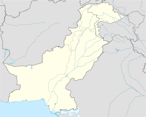
Daurdad Location in Pakistan Coordinates: 33°43′41″N 72°31′41″E / 33.72806°N 72.52806°E Country  Pakistan
Province Punjab District Attock District Tehsil Attock Tehsil Time zone PST (UTC+5) - Summer (DST) +6 (UTC) Daūrdād is a village in Golra Union Council, Attock Tehsil, Attock District in the Punjab Province of Pakistan. It is located some 23 kilometres northeast of Attock. Daurdad is an historic village with a population of roughly six thousand, all of whom are Muslim; there were also a few Hindu families before 1947, who subsequently left the village during partition. Daurdad is an agricultural area. Nala Ghaneer flows on the south side of the village, crossing the Kawah Garh mountain. The stones of this mountain were used in the construction of the historic Badshahi Mosque of Lahore, at the time of the Mughal Empire.
Facilities
Daurdad consists of a sub-branch post office, nearly one dozen shops and general stores, and three mosques. A digital telephone exchange with 400 lines services Daurdad and the surrounding areas. Daurdad has a boys higher secondary school and a girls elementary school.
Akhori Dam
Akhori Dam Project is one of the projects of Vision 25 Program, which is proposed by the former Pakistan Muslim League (Q)'s Government.
References
Categories:- Populated places in Attock District
Wikimedia Foundation. 2010.

