- Chapare Province
-
Chapare Province 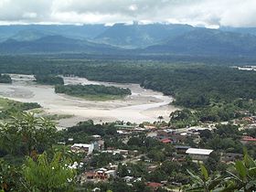
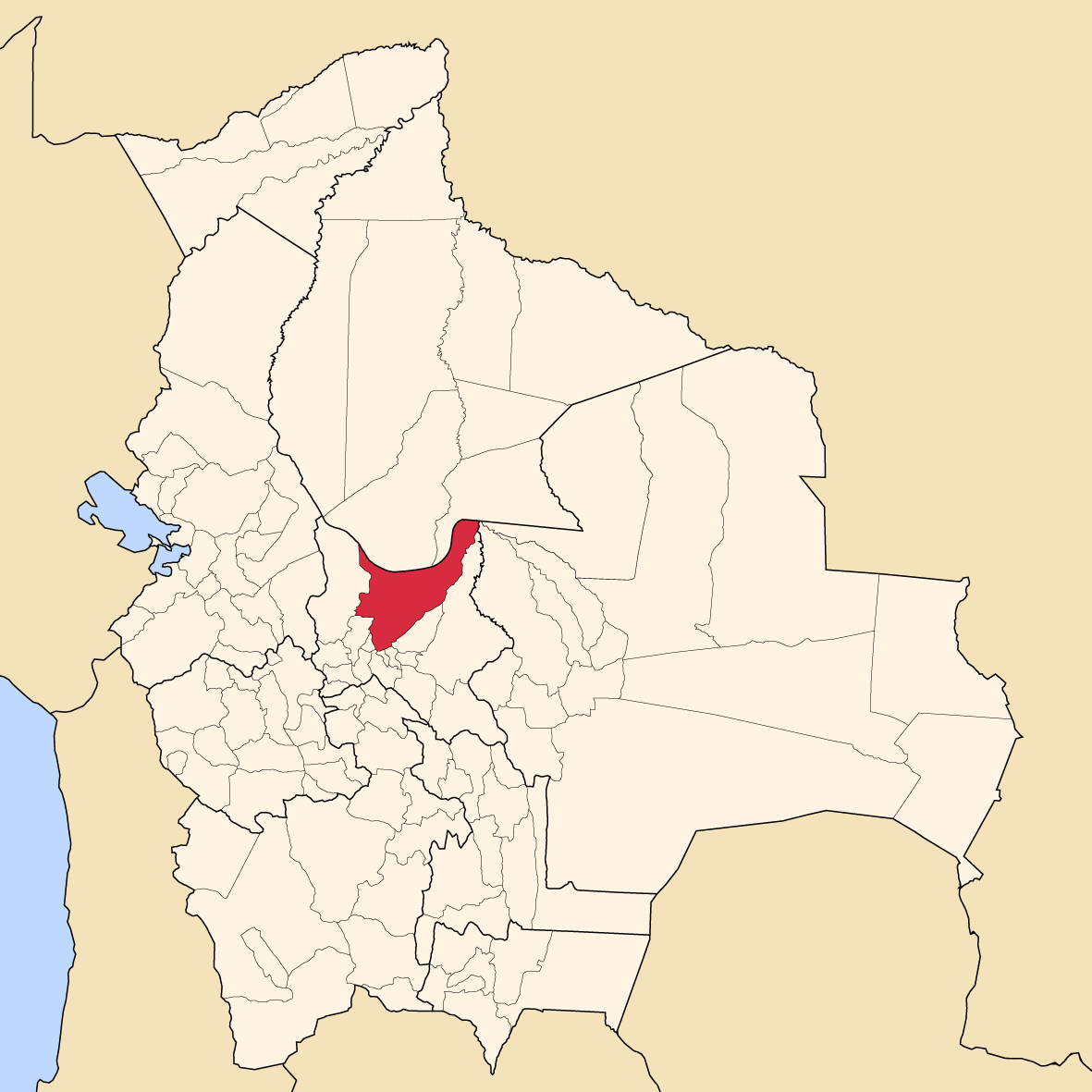
Villa Tunari on Chapare River Location of Chapare Province within Bolivia 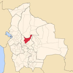
General Data Country  Bolivia
Department Cochabamba Department Capital Sacaba Municipalities 3 Cantons 13 Area 12,445 km² Elevation m Population 187,358 (2001) Density 15.1 inhabitants/km² (2001) Sub-prefect Languages Quechua, Spanish, Aymara, Yuracaré ISO 3166-2 BO.CB.CH Cochabamba Department 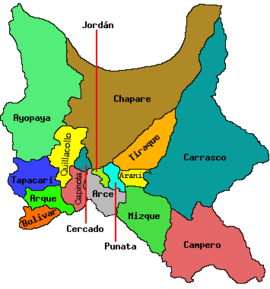
Chapare, also called The Chapare and is pronounced Cha-pa-reh, is a rural province in the northern region of Cochabamba Department in central Bolivia. The majority of the territory consists of valley rainforests that surround the area's main waterway, the Chapare River, which is also a tributary of the Amazon River. The provincial capital is Sacaba, 11 km east of Cochabamba, its principal town is Villa Tunari, a popular tourist destination.
In recent decades, the Chapare province has become a haven for illegal cultivation of the coca plant, which can be used to produce cocaine. This is due to Bolivian drug law, which until recently only permitted the Yungas region to legally grow coca, despite Chapare being a historical area for growth due to its fertility. For this reason, Chapare has been a primary target for coca eradication in recent years, with frequent and heated clashes between the U.S. Drug Enforcement Administration and Bolivian cocaleros. The law has since been changed by a deal that was struck between Evo Morales (a former coca activist and current President) and former President Carlos Mesa. This deal permits the region to grow a limited amount of coca every year .
Subdivision
Chapare Province is divided into three municipalities which are further subdivided into cantons.
Section Municipality Seat 1st Sacaba Municipality Sacaba 2nd Colomi Municipality Colomi 3rd Villa Tunari Municipality Villa Tunari Places of interest
- Carrasco National Park
- Isiboro Sécure National Park and Indigenous Territory
- Tunari National Park
External links
Coordinates: 16°50′S 66°10′W / 16.833°S 66.167°W
 Cochabamba Department
Capital: Cochabamba Provinces Arani • Arque • Ayopaya • Bolívar • Capinota • Carrasco • Cercado • Chapare • Esteban Arce •Germán Jordán • Mizque • Narciso Campero • Punata •Quillacollo • Tapacarí • Tiraque
Municipalities (and seats) Aiquile (Aiquile) • Alalay (Alalay) • Anzaldo (Anzaldo) • Arani (Arani) • Arbieto (Arbieto) • Arque (Arque) • Ayopaya (Ayopaya) • Bolívar (Bolívar) • Capinota (Capinota) • Chimoré (Chimoré) • Cliza (Cliza) • Cocapata (Cocapata) • Cochabamba (Cochabamba) • Colcapirhua (Colcapirhua) • Colomi (Colomi) • Cuchumuela (Cuchumuela) • Entre Ríos Municipality (Entre Ríos) Mizque (Mizque) • Morochata (Morochata) • Omereque (Omereque) • Pasorapa (Pasorapa) • Pocona (Pocona) • Pojo (Pojo) • Puerto Villarroel (Puerto Villarroel) • Punata (Punata) • Quillacollo (Quillacollo) • Sacaba (Sacaba) • Sacabamba (Sacabamba) • San Benito (San Benito) • Santiváñez (Santiváñez) • Shinahota (Shinahota) • Sicaya (Sicaya) • Sipe Sipe (Sipe Sipe) • Tacachi (Tacachi) • Tacopaya (Tacopaya) • Tapacarí (Tapacarí) • Tarata (Tarata) • Tiquipaya (Tiquipaya) • Tiraque (Tiraque) • Toco (Toco) • Tolata (Tolata) • Totora (Totora) • Vacas (Vacas) • Vila Vila (Vila Vila) • Villa Rivero (Villa Rivero) • Villa Tunari (Villa Tunari) • Vinto (Vinto)Categories:- Cochabamba Department
- Provinces of Bolivia
- Cochabamba Department, Bolivia geography stubs


Wikimedia Foundation. 2010.