- Darnytsia (Kiev Metro)
-
Darnytsia
Kiev Metro station
Station statistics Coordinates 50°27′20″N 30°36′48″E / 50.45556°N 30.61333°ECoordinates: 50°27′20″N 30°36′48″E / 50.45556°N 30.61333°E Lines  Sviatoshynsko-Brovarska Line
Structure surface platform Levels 1 Platforms 1 Tracks 2 Other information Opened 5 November 1965 Electrified Yes Owned by Kiev Metro Services Preceding station Kiev Metro Following station toward AkademmistechkoSviatoshynsko-Brovarska Line toward LisovaDarnytsia (Ukrainian: Дарниця) is a station on the Kiev Metro's Sviatoshynsko-Brovarska Line. The station was opened on November 5, 1965 as part of the westwards eastwards expansion of the Brovary radius and is the second one to be fully on the left bank of the Dnieper River. It takes its name from the historic neighbourhood of Kiev, Darnytsia.
Designed by architects I.Maslenkov and V.Bogdanovsky, the station presents itself as a simple surface platform with a pillar-supported concrete canopy, a design that is almost identical to the three other stations that opened along with it and typical for the 1960s public architecture. Originally a terminus, not far from the station is the "Darnytsia" depot which was the first fully operational in Kiev, and also served the Kurenivsko-Chervonoarmiyska Line from 1976 until 1982 when the "Obolon" depot opened.
The Darntsia station is located on the edge of a large park and on the Brovary Avenue. Until recently, only one passenger subway led in and out of the station, until a new western tunnel was opened on November 28, 2006.[1] This was necessary as the station is one of the busiest on the radius due to the large amount of land transport coming from the northern left-bank districts and the local shopping centre of Darnytsia.
-

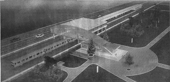
Model of the second entrance on Darnytsia
References
- ^ "A second entrance was opened on the "Darnytsia" station" (in Russian). podrobnosti.ua. http://www.podrobnosti.ua/society/2006/11/27/371514.htmlр. Retrieved December 17, 2006.
External links
- Inline
- (Ukrainian) Kyivsky Metropoliten - Station description and Photographs
- (Russian) Metropoliten.kiev.ua - Station description and Photographs
- (Czech) Zarohem.cz- Photographs
- Google maps - Satellite view centred on the vestibule
Kiev Metro Sviatoshynsko-Brovarska Line
Akademmistechko • Zhytomyrska • Sviatoshyn • Nyvky • Beresteiska • Shuliavska • Politekhnichnyi Instytut • Vokzalna • Universytet • Teatralna • Khreshchatyk
  • Arsenalna • Dnipro • Hidropark • Livoberezhna • Darnytsia • Chernihivska • Lisova
Kurenivsko-Chervonoarmiyska Line
 Heroiv Dnipra • Minska • Obolon • Petrivka • Tarasa Shevchenka • Kontraktova Ploshcha • Poshtova Ploshcha • Maidan Nezalezhnosti
 • Ploshcha Lva Tolstoho • Olimpiiska • Palats "Ukrayina" • Lybidska • Demiivska • Holosiivska • Vasylkivska • Vystavkovyi Tsentr • Ipodrom • Teremky
Syretsko-Pecherska Line
 Syrets • Dorohozhychi • Lukianivska • Lvivska Brama • Zoloti Vorota • Palats Sportu • Klovska • Pecherska • Druzhby Narodiv • Vydubychi • Slavutych • Osokorky • Pozniaky • Kharkivska • Vyrlytsia • Boryspilska • Chervony Khutir
Future lines:  Podilsko-Vyhurivska Line (under construction) •
  Livoberezhna Line (proposed) • Metro Bridge • Pivdennyi Bridge • List of stations
This Kiev Metro article is a stub. You can help Wikipedia by expanding it. This article about a Ukrainian railway station is a stub. You can help Wikipedia by expanding it. -