Cwm Penmachno

Cwm Penmachno

Coordinates: 53°00′32″N 3°51′44″W / 53.0088°N 3.8623°W / 53.0088; -3.8623

Cwm Penmachno
Cwm Penmachno is located in Conwy
Cwm Penmachno

 Cwm Penmachno shown within Conwy
Principal area Conwy
Country Wales
Sovereign state United Kingdom
Police North Wales
Fire North Wales
Ambulance Welsh
EU Parliament Wales
List of places: UK • Wales • Conwy

Cwm Penmachno is a former quarry settlement at the head of the Penmachno valley in North Wales. The slate quarry was formerly linked by narrow-gauge railway to the Ffestiniog railway at Blaenau Ffestiniog. The slopes around the village provide streams which are the source of the river Machno, which flows past the larger village of Penmachno before joining the river Conwy south of Betws-y-coed.

Situated near the end of the valley is The Latymer School's outdoor centre Ysgol Latymer which every year accommodates six year 7 trips and six year 9 as well a various geography and PE trips organised by the school. The Latymer School have bought this centre in Snowdonia National Park so its pupils can get to know each other better and to find out their individual skills in many areas

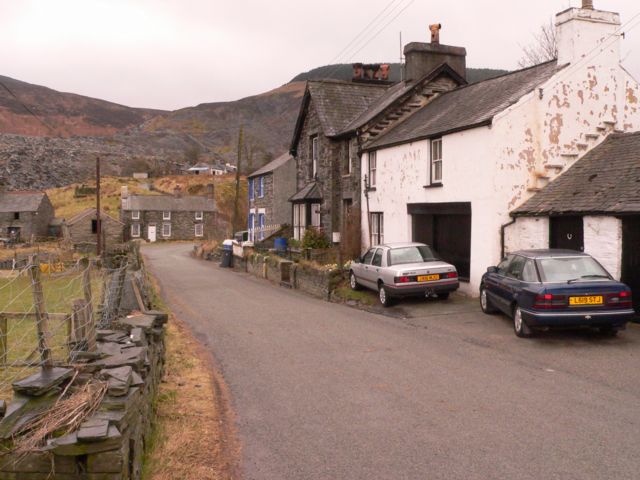
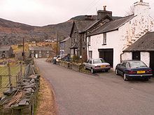
Houses in Cwm Penmachno, showing the quarry behind.
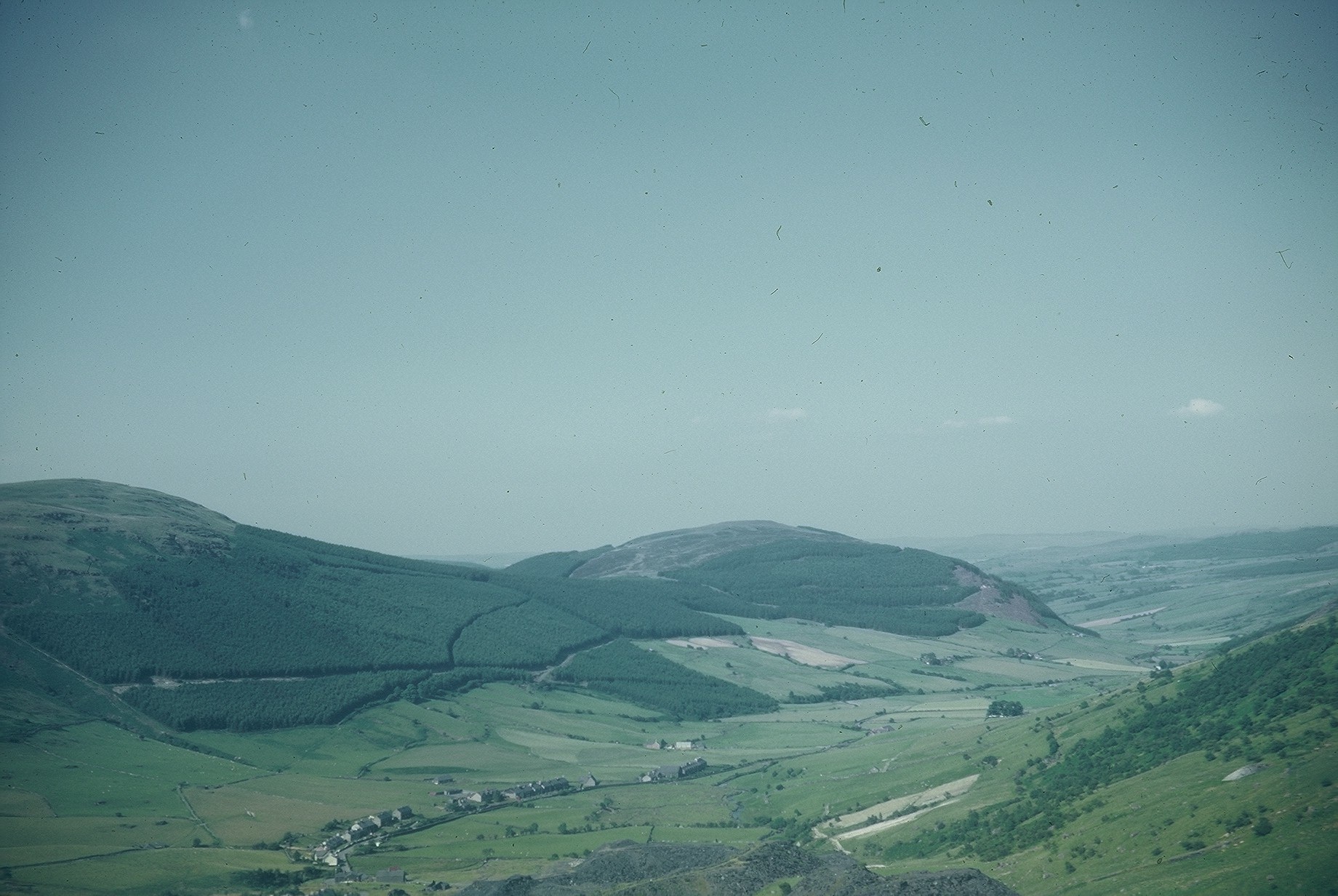
Cwm Penmachno from the south (quarry in foreground), 1969.

Coordinates: 53°00′32″N 3°51′44″W / 53.0088°N 3.8623°W / 53.0088; -3.8623


Wikimedia Foundation. 2010.

Игры ⚽ Поможем написать курсовую

Look at other dictionaries:

  • Penmachno — is a village in the isolated upland valley of Cwm Penmachno, 4 miles south of Betws y Coed in the county of Conwy, north Wales.It is renowned as the home of Bishop William Morgan (1545 1604), who lived at Tŷ Mawr, Y Wybrnant, near the village. He …   Wikipedia

  • River Machno — Geobox|River name = River Machno native name = Afon Machno other name = other name1 = image size = 250px image caption = old packhorse bridge over the river Machno etymology = country = Wales country state1 = state type = Part state region =… …   Wikipedia

  • Trefriw — infobox UK place country = Wales welsh name= constituency welsh assembly= map type= official name= Trefriw population= 1,338 (2001 census) unitary wales= Conwy lieutenancy wales= Clwyd constituency westminster= Meirionnydd Nant Conwy post town=… …   Wikipedia

  • Sarn Helen — was a Roman road in Wales, running from Aberconwy in the north to Carmarthen in the south. It was some 160 miles in length. Today some sections are modern highways, others still traceable as Roman though much degraded, and at various places there …   Wikipedia

  • The Latymer School — Infobox UK school name = The Latymer School |121px|The Latymer School Crest size = latitude = 51.6250 longitude = 0.0744 dms = yes motto = Qui patitur vincit (Latin: He who endures wins) motto pl = established = 1624 (present site 1910) approx =… …   Wikipedia

  • Wales — This article is about the country. For other uses, see Wales (disambiguation) …   Wikipedia

  • Cwt y Bugail Quarry — Map of the Rhiwbach Tramway showing the location of the Cwt y Bugail Quarry The Cwt y Bugail Quarry was a slate quarry located east of Blaenau Ffestiniog in Wales. It was first worked as a trial pit around 1840. Continuous production began in… …   Wikipedia

  • List of museums in Wales — This list of museums in Wales contains museums which are defined for this context as institutions (including nonprofit organizations, government entities, and private businesses) that collect and care for objects of cultural, artistic, scientific …   Wikipedia

  • River Conwy — Conwy (Afon Conwy) River Boats in the river estuary at Conwy …   Wikipedia

  • Dolwyddelan — Castle on its hill Part of the village of Dolwyddelan …   Wikipedia

Share the article and excerpts

Direct link
Do a right-click on the link above
and select “Copy Link”