Cheekha Dar

Cheekha Dar
Cheekah Dar
Cheekah Dar is located in Iraq
Cheekah Dar
Location of Cheekah Dar in Iraq (on the Iranian border)
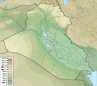
Elevation 3,611 m (11,847 ft)
Prominence 1,575 m (5,167 ft)
Listing Country high point
Ultra
Location
Location  Iraq- Iran border
Range Zagros Mountain Range
Coordinates 36°46′31″N 44°55′07″E / 36.77528°N 44.91861°E / 36.77528; 44.91861Coordinates: 36°46′31″N 44°55′07″E / 36.77528°N 44.91861°E / 36.77528; 44.91861

Cheekha Dar, or Black Tent, is the local Kurdish name for the mountain currently thought to be the highest in Iraq. It is claimed to be 3,611 metres high by the CIA. It is 6 kilometres north of the village of Gundah Zhur and is on the border with Iran.

It was climbed in November 2004 by English explorer Ginge Fullen, who recorded a GPS reading of 3,628 meters at the coordinates in the table to the right. The location is consistent with SRTM and Russian topographic mapping, although these sources are more consistent with the CIA height.

The first reported winter ascent was by Jonathan Beswick and Matthew DuPuy on March 18th, 2011. The expedition GPS confirmed 3,611m. There is a danger of land mines in the area on approach between Hamilton Road and the village of Gundah Zhur. Some fields are marked by red, triangular signs with skull and crossbones. It is possible to find Kurdish military escorts through this area in the town of Choman.

A nearby peak called Halgurd, at 36°44′N 44°52′E / 36.733°N 44.867°E / 36.733; 44.867, is thought to be 3,607 metres high, and had previously been thought to be Iraq's highest mountain.

See also

References


Wikimedia Foundation. 2010.

Игры ⚽ Поможем решить контрольную работу

Look at other dictionaries:

  • Cheekha Dar — Géographie Altitude 3 611 m[1] Massif …   Wikipédia en Français

  • Cheekha Dar — Bild gesucht  BWf1 Höhe 3.611  …   Deutsch Wikipedia

  • Irak — جمهورية العراق (arab.) Ǧumhūriyyat al Irāq کۆماری عراق (kurd.) Komara Îraqê Republik Irak …   Deutsch Wikipedia

  • Liste der höchsten Punkte nach Land — Diese Liste stellte die höchsten Punkte aller Mitgliedstaaten der Vereinten Nationen dar. Inhaltsverzeichnis 1 Punkte 2 Siehe auch 3 Weblinks 4 Einzelnachweise …   Deutsch Wikipedia

  • Geography of the Arab League — The Arab League is a political organization developing into a more economic one, it has an Area of 14 million km², making it only Second after the Russian Federation, if ranked.LandscapeThe highest point in the Arab League is in Morocco called… …   Wikipedia

  • Liste Des Pays Par Point Culminant — Cet article fait partie de la série Liste des pays du monde disparus par continent par population …   Wikipédia en Français

  • Liste des pays par point culminant — Cet article recense une liste des pays et territoires à statut spécial par point culminant. Sommaire 1 Méthodologie 2 Liste 3 Notes et références 4 Articles connexes …   Wikipédia en Français

  • Países por punto más alto — Anexo:Países por punto más alto Saltar a navegación, búsqueda Países desde el punto más alto Esta es una lista de los países por punto de mayor altitud por encima del Nivel del mar. Rank País Punto más alto Altura …   Wikipedia Español

  • Outline of Iraq — …   Wikipedia

  • Géographie du Moyen-Orient — Continent En majeure partie en Asie, extensions en Europe et en Afrique. Région Asie de l Ouest Coordonnées 50°00′N 143°24′E …   Wikipédia en Français

Share the article and excerpts

Direct link
Do a right-click on the link above
and select “Copy Link”