- Collingwood Heights, Western Australia
-
Collingwood Heights
Albany, Western Australia
Population: 691 (2006 Census)[1] Postcode: 6330 Area: 2.5 km² (1.0 sq mi) Location: 5 km (3 mi) from Albany LGA: City of Albany State District: Albany Federal Division: O'Connor Suburbs around Collingwood Heights: Lange Bayonet Head Yakamia Collingwood Heights Emu Point Spencer Park Seppings Collingwood Park Coordinates: 34°59′31″S 117°55′19″E / 34.992°S 117.922°E
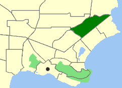
Collingwood Heights is a north-eastern suburb of Albany, Western Australia, between the Albany city centre and Emu Point. Its Local Government Area is the City of Albany.
The suburb's name was gazetted in 1981,[2] prior to which it was known as Collingwood.
Contents
Geography
Collingwood Heights is bounded by the Yakamia Creek Diversion to the north, Martin and Ulster Roads to the west and Collingwood Road to the southeast. Most of the suburb's population of 691 persons[1] are concentrated around a small residential estate at Breaksea Park.[3]
The suburb was gazetted in 1981.[2]
Facilities
Collingwood Heights is a small residential suburb located within a wider open area in the creek's catchment area. A B&B and an information bay are located in the suburb.
Collingwood Heights contains a private school, Southlands Christian College, which was established in 1999 and teaches the ACE curriculum.[4] The nearest state primary school is two suburbs away in Mount Clarence. High school students have the option of going to St Joseph's College, a private Catholic school in Spencer Park, or Albany Senior High School.
Transport
Collingwood Heights is served by Route 401 from Albany operated by Love's Bus Service.
References
- ^ a b Australian Bureau of Statistics (25 October 2007). "Community Profile Series : Collingwood Heights (State Suburb)". 2006 Census of Population and Housing. http://www.censusdata.abs.gov.au/ABSNavigation/prenav/ProductSelect?newproducttype=Community+Profiles&collection=Census&period=2006&areacode=SSC53526&breadcrumb=LP¤taction=201&action=401. Retrieved 2007-06-27.
- ^ a b "Naming of Localities - Shire of Albany (per 1962/73 v5)". Western Australia Government Gazette: pp. 1981:2775. 10 July 1981.
- ^ Department of Land Information. StreetSmart® Perth Street Directory (50 (2009) ed.). West Australian Newspapers Ltd. pp. Maps A2-A3. ISBN 978-1-921048-28-9.
- ^ School listing, Association of Independent Schools (WA), accessed 8 December 2006.
Localities in the Albany region | Great Southern | Western Australia Suburbs: Albany · Bayonet Head · Centennial Park · Collingwood Heights · Collingwood Park · Emu Point · Gledhow · Lange · Lockyer · McKail · Middleton Beach · Milpara · Mira Mar · Mount Clarence · Mount Elphinstone · Mount Melville · Orana · Port Albany · Robinson · Seppings · Spencer Park · Walmsley · Warrenup · Willyung · Yakamia
Regional: Big Grove · Elleker · Frenchman Bay · Goode Beach · Kalgan · King River · Little Grove · Lower King · Torbay · Torndirrup · Vancouver Peninsula
Categories:- Suburbs of Albany, Western Australia
Wikimedia Foundation. 2010.