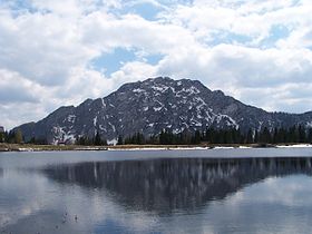
Naßfeld Pass

Naßfeld Pass
Naßfeld Pass
Elevation 1,552 m (5,092 ft)
Location
Naßfeld Pass is located in Alps
Naßfeld Pass
Location of Naßfeld Pass
Location  Austria/ Italy
Range Alps
Coordinates 46°33′36″N 13°16′32″E / 46.56°N 13.27556°E / 46.56; 13.27556Coordinates: 46°33′36″N 13°16′32″E / 46.56°N 13.27556°E / 46.56; 13.27556

Naßfeld Pass (Italian: Passo di Pramollo) is a 1552 m high mountain pass in Austria in the Carnic Alps in the Bundesland of Carinthia, leading into Italy.

It connects the Gail River valley with Italian Valcanale. The surrounding peaks are the Gartnerkofel (2195 m.), the Roßkofel (2240 m.) and the Trogkofel (2280 m.).

On the Austrian side is the largest ski resort in Carinthia.


See also

External links

References

This article incorporates information from the German Wikipedia.


Wikimedia Foundation. 2010.

Игры ⚽ Нужно решить контрольную?

Look at other dictionaries:

  • Naßfeld Pass — DMS …   Deutsch Wikipedia

  • Naßfeld — xx Naßfeld Malurch (Malvueric) von der Passhöhe …   Deutsch Wikipedia

  • Pass Grießen — Vorlage:Infobox Pass/Wartung/Bild fehltVorlage:Infobox Pass/Wartung/Profil fehlt Grießenpass West Ost Passhöhe 975 m ü. A …   Deutsch Wikipedia

  • Pass Thurn — x Pass Thurn Pass Thurn, Passhöhe, Blick nach Süden …   Deutsch Wikipedia

  • Pass Gschütt — xxx Pass Gschütt Passhöhe am Pass Gschütt …   Deutsch Wikipedia

  • Nassfeld Pass — DMS …   Deutsch Wikipedia

  • Hochtor (Pass) — Vorlage:Infobox Pass/Wartung/Profil fehlt Hochtor Blick vom Fuscher Törl nach Südwesten auf den Großen Woazkopf und die Fuscher Lacke …   Deutsch Wikipedia

  • Pyhrn-Pass — Der Pyhrnpass verbindet in 954 m ü. A. die österreichischen Bundesländer Oberösterreich im Norden und Steiermark im Süden. Er liegt zwischen Warscheneck und Bosruck (Ennstaler Alpen) in den Nördlichen Kalkalpen der Region Pyhrn Eisenwurzen. Die… …   Deutsch Wikipedia

  • Campolongo-Pass — Vorlage:Infobox Pass/Wartung/Profil fehlt Passo Campolongo Nord Süd …   Deutsch Wikipedia

  • Tenda-Pass — Passhöhe des Colle di Tenda Serpentinenreihenfolge auf der Südrampe in Frankreich, im Hintergrund die Ausfahrt aus dem Straßentunnel Der Colle di Tenda (deutsch: Te …   Deutsch Wikipedia

Share the article and excerpts

Direct link
Do a right-click on the link above
and select “Copy Link”