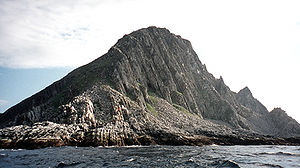
Cape Nordkinn

Cape Nordkinn
Kinnarodden

Cape Nordkinn (Norwegian: Kinnarodden, also called Nordkyn) at 71°8′2″N 27°39′0″E / 71.13389°N 27.65°E / 71.13389; 27.65 is the northernmost point on Nordkinn Peninsula in Finnmark county in northern Norway. It is notable for being the northernmost point of mainland Norway, and by extension the northernmost point of mainland Europe.

Geography

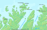
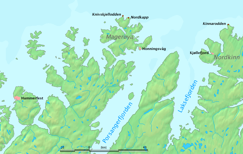
Cape Nordkinn is the northern tip of the fractal peninsula within the northernmost part of the Nordkinn Peninsula, about 14 km in a straight line from the village of Mehamn.

North Cape, more precisely Knivskjellodden, at 71°11′ 8″ N, 5.7 km further north than Cape Nordkinn is branded as Europe's "official" northernmost point, despite being located on the island of Magerøya.

Tourism

Kinnarodden (right) is on mainland, Nordkapp (center) is on an island.
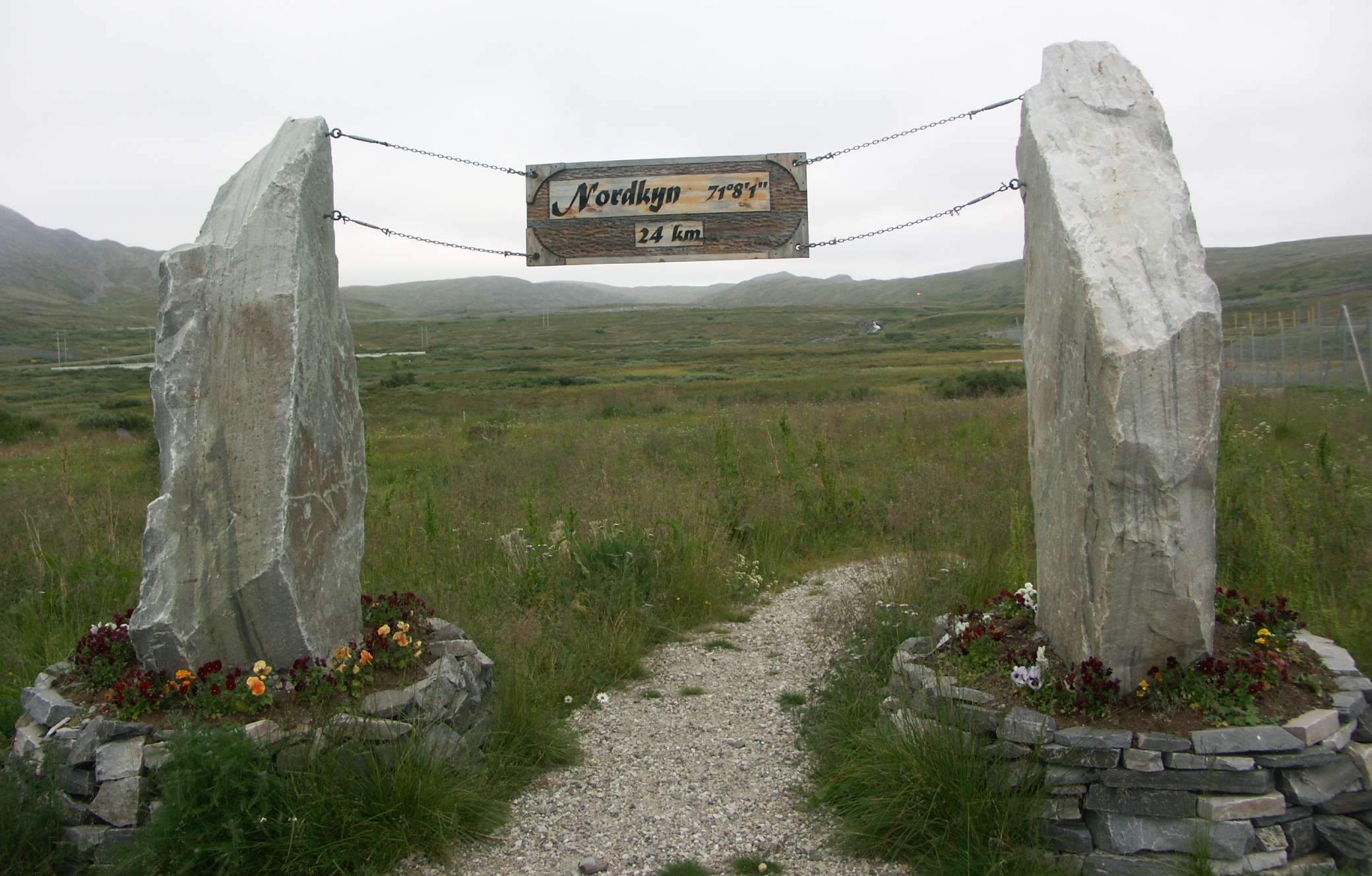
Signpost at Mehamn Airport. The trail was opened by Crown Princess Mette-Marit in 2004[1] to promote tourism in northern Finnmark.

In sharp contrast to North Cape with its extensive tourist infrastructure and busloads of visitors, Cape Nordkinn is a rather lonely place that can only be visited following at least a full-day hike from Mehamn and one day back.[2] The terrain is sufficiently difficult for hiking that more than two days is usually required for the loop, 24 km one way. On rainy weather the slippery stones make the terrain very difficult, whilst sudden fogs and associated whiteout can make orientation on the highland south of the cape impossible without a GPS.[3] There is no GSM coverage to the northwest of Mehamn Airport.

The cape can also be reached by boat tours.[4] The tourist bureau of the Gamvik municipality provides tourist information.[5] Hurtigruten ships call at Mehamn and Kjøllefjord[6] to the southwest of the cape, providing a sighting opportunity for visitors on the way.

References

Coordinates: 71°08′02″N 27°39′00″E / 71.13389°N 27.65°E / 71.13389; 27.65


Wikimedia Foundation. 2010.

Игры ⚽ Нужна курсовая?

Look at other dictionaries:

  • North Cape, Norway — For other uses, see North Cape. Coordinates: 71°10′21″N 25°47′40″E / 71.1725°N 25.79444°E / 71.1725; 25.79444 …   Wikipedia

  • Nordkapp — This article is about the municipality in Finnmark, Norway. For the North Cape (Norwegian: Nordkapp), see North Cape, Norway. Nordkapp kommune   Municipality   …   Wikipedia

  • Cabo da Roca — (Cape Roca) is a cape which forms the westernmost point of both mainland Europe and mainland Portugal. The cape is in the Portuguese municipality of Sintra, west of Lisbon district, and also forms the westernmost extent of the Serra de… …   Wikipedia

  • Extreme points of Europe — This is a list of the extreme points of Europe, the points that are farther north, south, east or west than any other location in Europe. The northernmost point of the continent is often incorrectly given as North Cape actually the second… …   Wikipedia

  • Extreme points of Norway — This is a list of the extreme points of Norway, the points that are farther north, south, east or west than any other location. Norway * Northernmost Point mdash; Rossøya, Svalbard (80° 49′44″ N) * Southernmost Point mdash; Bouvetøya, South… …   Wikipedia

  • Finnkongkeila — was a fishing village in Gamvik municipality in Finnmark county, Norway.It is located on eastern Cape Nordkinn in the outer Tanafjorden inlet, but was abandoned following the wreckage conducted by German occupants in 1944.cite encyclopedia… …   Wikipedia

  • List of peninsulas — A peninsula is a piece of land that is nearly surrounded by water but connected to mainland via an isthmus. A peninsula can also be a headland, cape, island promontory, bill, point, or spit. [ [http://www.britannica.com/ebi/article 9276348… …   Wikipedia

  • Index alphabétique maritime — Projet:Maritime/Index Projet maritime Bistro du port Participants Actualités   Agenda Outils À faire …   Wikipédia en Français

  • Cap Nord — Le cap Nord lors d un soleil de minuit. Localisation Pays …   Wikipédia en Français

  • Geography of Norway — Continent Europe Region Northern Europe Area 385,199 km2 (148,726 sq mi) Borders Total land borders …   Wikipedia

Share the article and excerpts

Direct link
Do a right-click on the link above
and select “Copy Link”