- Malungon, Sarangani
-
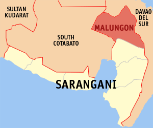
Malungon — Municipality — Map of Sarangani showing the location of Malungon. Location in the Philippines
 Malungon
Coordinates: 6°16′N 125°17′E / 6.267°N 125.283°ECoordinates: 6°16′N 125°17′E / 6.267°N 125.283°E Country  Philippines
Region SOCCSKSARGEN (Region XII) Province Sarangani District Lone district Founded Barangays 31 Government - Mayor Reynaldo F. Constantino Area - Total 750.92 km2 (289.9 sq mi) Population (2007) - Total 95,993 - Density 127.8/km2 (331.1/sq mi) Time zone PST (UTC+8) ZIP code 9517 Income class 1st class Malungon is a 1st class municipality in the province of Sarangani, Philippines. According to the latest census, it has a population of 95,993 people in 18,924 households.
Malungon is a landlocked town at the northeastern part of Sarangani. It is bounded on the west by Tupi, South Cotabato, on the north and east by the province of Davao del Sur, on the south by Alabel, Sarangani and General Santos City, and on the southwest by Polomolok, South Cotabato.
According to the last general elections, it has a total voting population of 44,536 voters.
Population Census of Malungon Census Pop. Rate 2000 93,232 — 2007 95,993 0.40% Barangays
Malungon is politically subdivided into 31 barangays.
- Alkikan
- Ampon
- Atlae
- Banahaw
- Banate
- B'Laan
- Datal Batong
- Datal Bila
- Datal Tampal
- J.P. Laurel
- Kawayan
- Kibala
- Kiblat
- Kinabalan1
- Lower Mainit
- Lutay
- Malabod
- Malalag Cogon
- Malandag
- Malungon Gamay
- Nagpan
- Panamin
- Poblacion
- San Juan
- San Miguel
- San Roque
- Talus
- Tamban
- Upper Biangan
- Upper Lumabat
- Upper Mainit
External links
- Philippine Standard Geographic Code
- 1995 Philippine Census Information
- 2000 Philippine Census Information
- 2007 Philippine Census Information
Municipalities Categories:- Municipalities of Sarangani

Wikimedia Foundation. 2010.